Items Similar to Old Map Showing Info Related to the Ottoman Wars including Conflict Dates, c1690
Want more images or videos?
Request additional images or videos from the seller
1 of 6
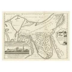
Old Map Showing Info Related to the Ottoman Wars including Conflict Dates, c1690
About the Item
"Corso del Danubio da Vienna Sui a Vicopoli, e Paesi Adiacenti - Northwestern Sheet", Coronelli, Vincenzo Maria
Subject: Central Europe, Danube River
Period: 1690 (circa)
Publication:
Color: Black & White
This is the northwestern sheet of Coronelli's six-sheet map following the course of the Danube River. It extends from Vienna east to beyond Budapest and from Silesia south to Slavonia. The map features information related to the Ottoman Wars including conflict dates and numerous places are named, often with several alternate names and spellings, reflecting the various cultures in the region.
- Dimensions:Height: 24.02 in (61 cm)Width: 17.8 in (45.2 cm)Depth: 0 in (0.02 mm)
- Materials and Techniques:Paper,Engraved
- Period:1690-1699
- Date of Manufacture:ca.1690
- Condition:A crisp impression with toning and offsetting along the centerfold. There is some minor foxing mostly along the sheet edges.
- Seller Location:Langweer, NL
- Reference Number:
About the Seller
5.0
Platinum Seller
These expertly vetted sellers are 1stDibs' most experienced sellers and are rated highest by our customers.
Established in 2009
1stDibs seller since 2017
1,965 sales on 1stDibs
Typical response time: <1 hour
- ShippingRetrieving quote...Ships From: Langweer, Netherlands
- Return PolicyA return for this item may be initiated within 14 days of delivery.
More From This SellerView All
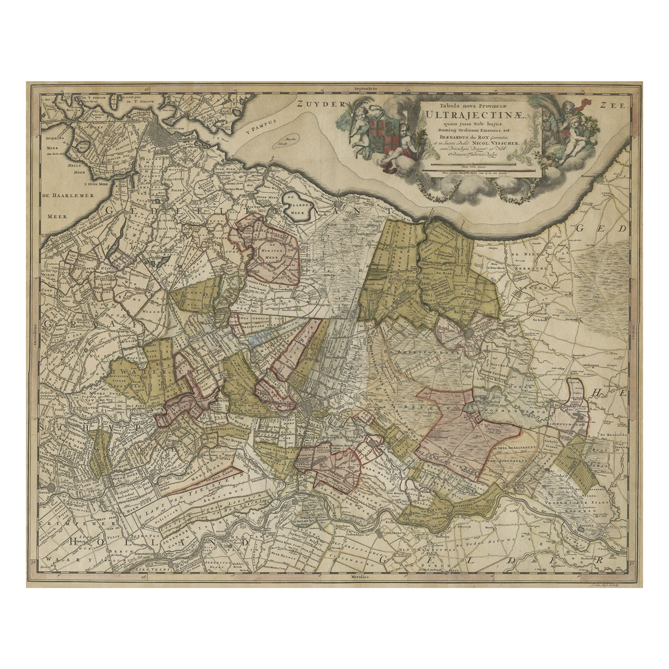
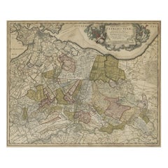
- Original Colored Antique Map of Utrecht & Surroundings, The Netherlands, c1690Located in Langweer, NLAntique map titled 'Tabula nova Provinciae Ultrajectinae quam jussu Nob: hujus Dominij Ordinum Emensus est Bernardus du Roy'. Map of the region of Utrecht, The Netherlands. This ...Category
Antique 1690s Maps
MaterialsPaper
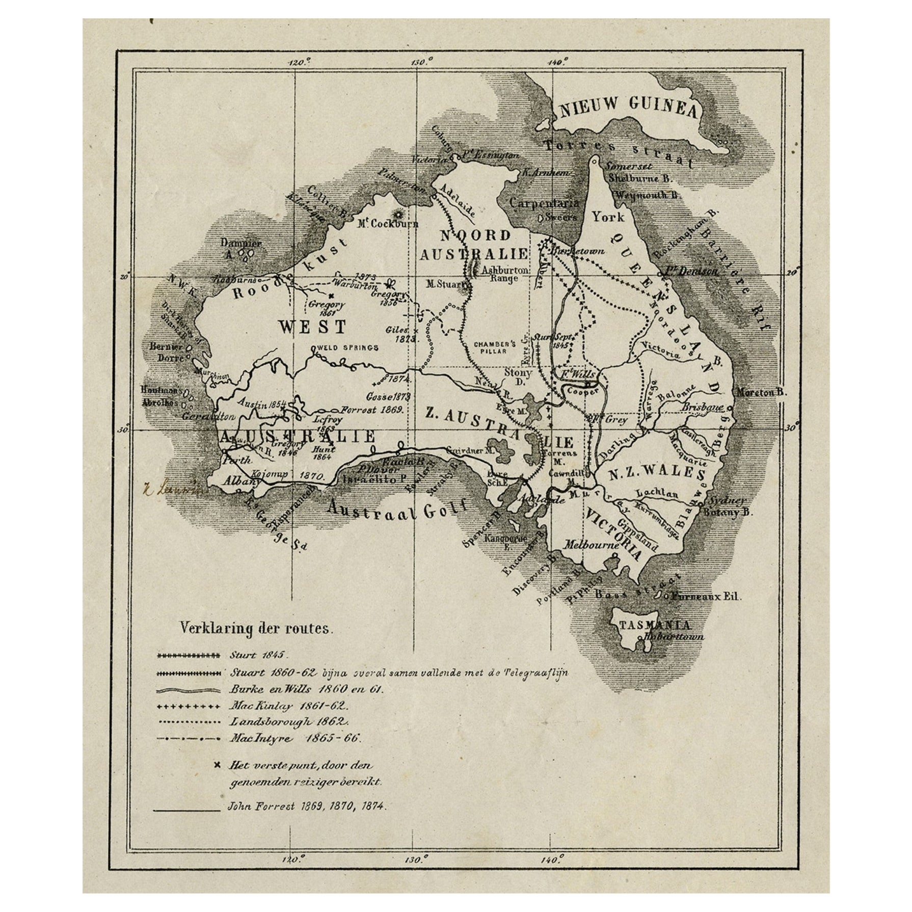
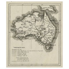
- Old Map of Australia Showing The Routes of the Main Explorers, ca.1900Located in Langweer, NLAntique print, untitled. This map shows Australia with the routes of explorers in the continent and marking the furthest point reached.. Source unknown, to be determined. Artists ...Category
Antique Early 1900s Maps
MaterialsPaper
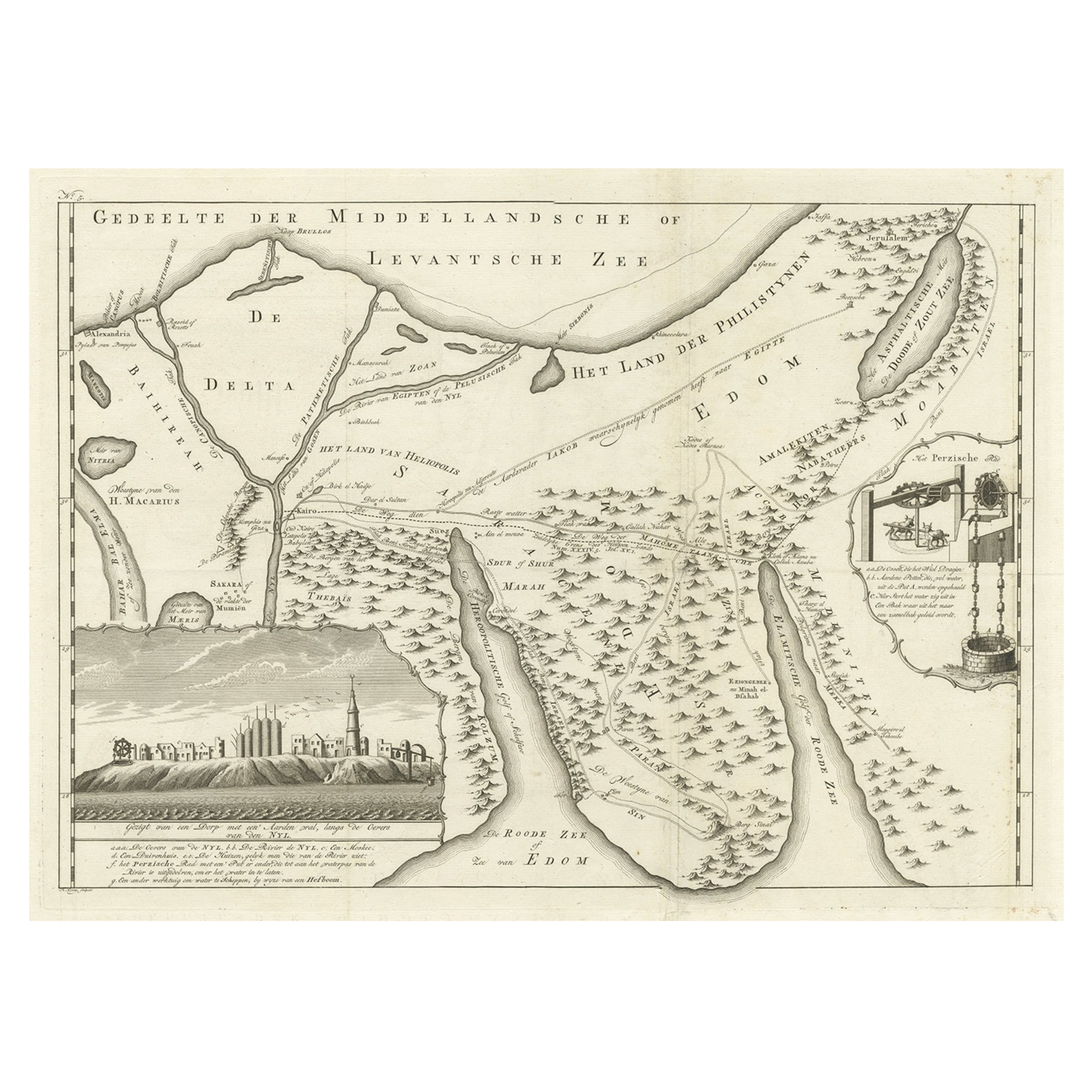
- Old Map of the Sinai Peninsula Showing the Mediterranean and the Red Sea, 1773Located in Langweer, NLAntique map of the Sinai Peninsula showing the Mediterranean Sea to the north and the Red Sea to the south. The map is decorated with images of a Persian wheel and a view of a vi...Category
Antique 1770s Maps
MaterialsPaper
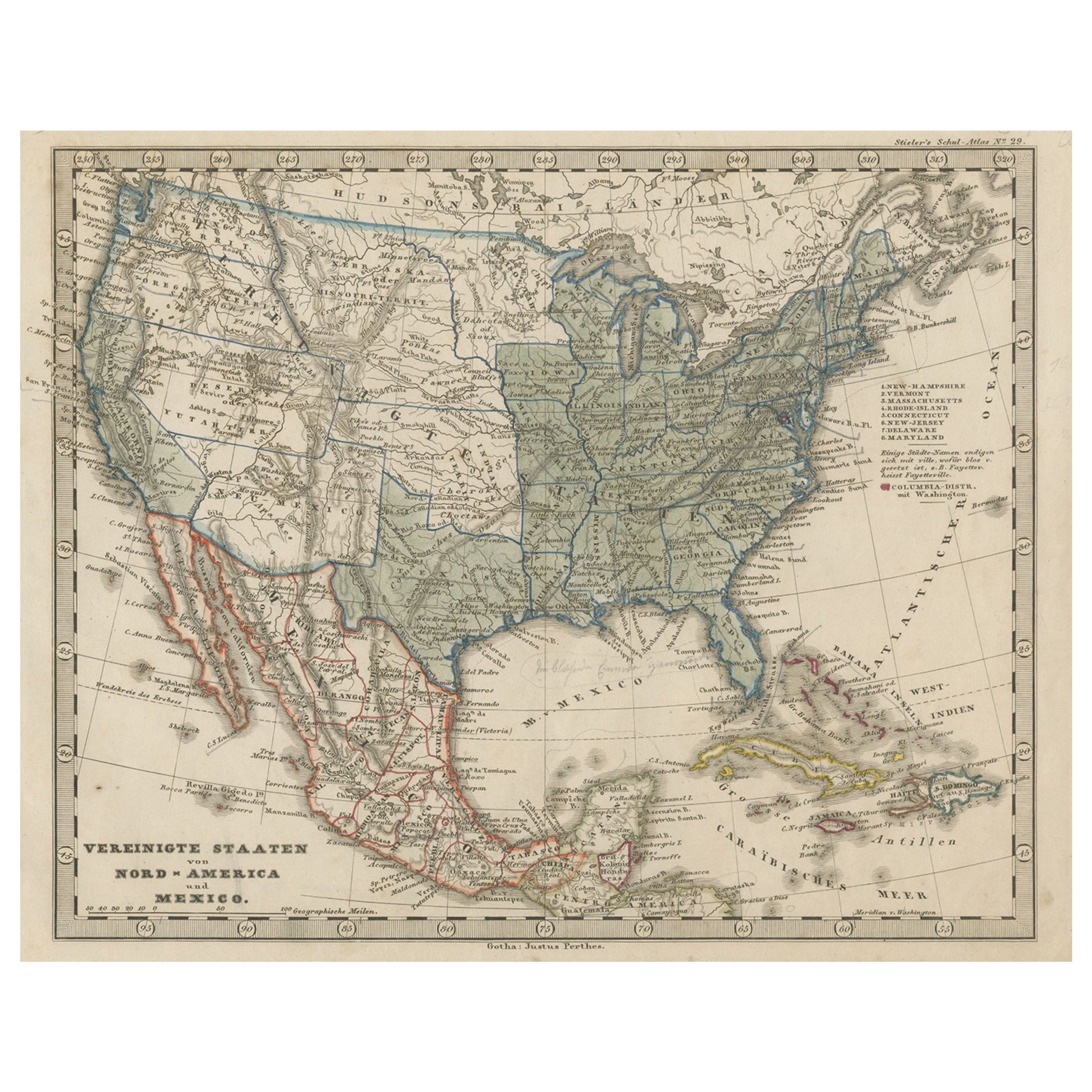
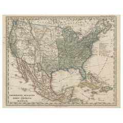
- Old Map the United States and Central America, Including Mexico, ca.1860Located in Langweer, NLAntique map titled 'Vereinigte Staaten von Nord America und Mexico'. Old map the United States and Central America, including Mexico. This print originates from 'Stieler's Schul-...Category
Antique 1860s Maps
MaterialsPaper
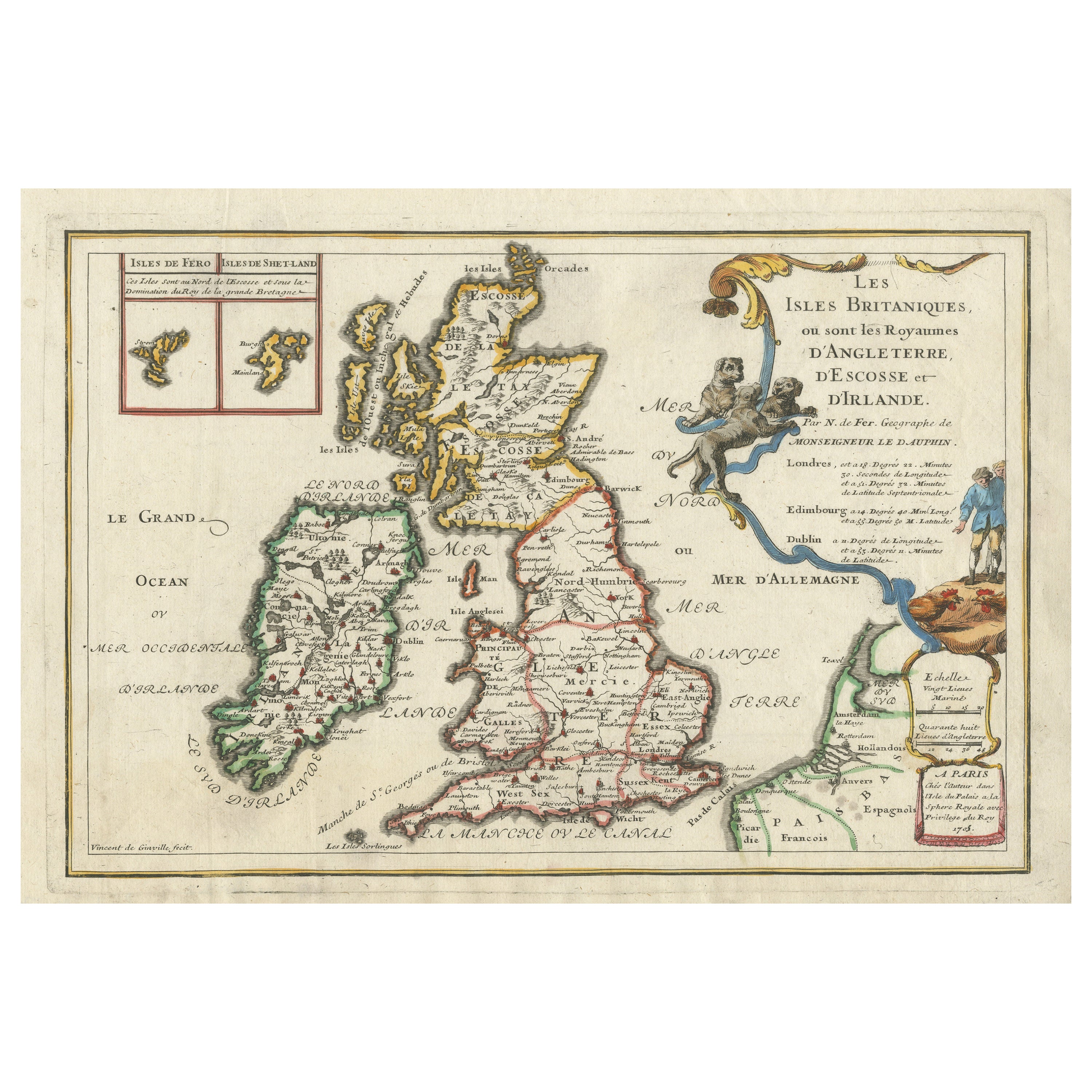
- Old Map of the British Isles with the Faroes and Shetlands, Showing Cock FightsLocated in Langweer, NLAntique map titled 'Les Isles Britaniques ou sont les Royaumes d'Angleterre (..)'. Original old map of the British Isles with inset maps of the Faroes and Shetlands. The title cartouche depicts dog...Category
Antique Early 18th Century Maps
MaterialsPaper
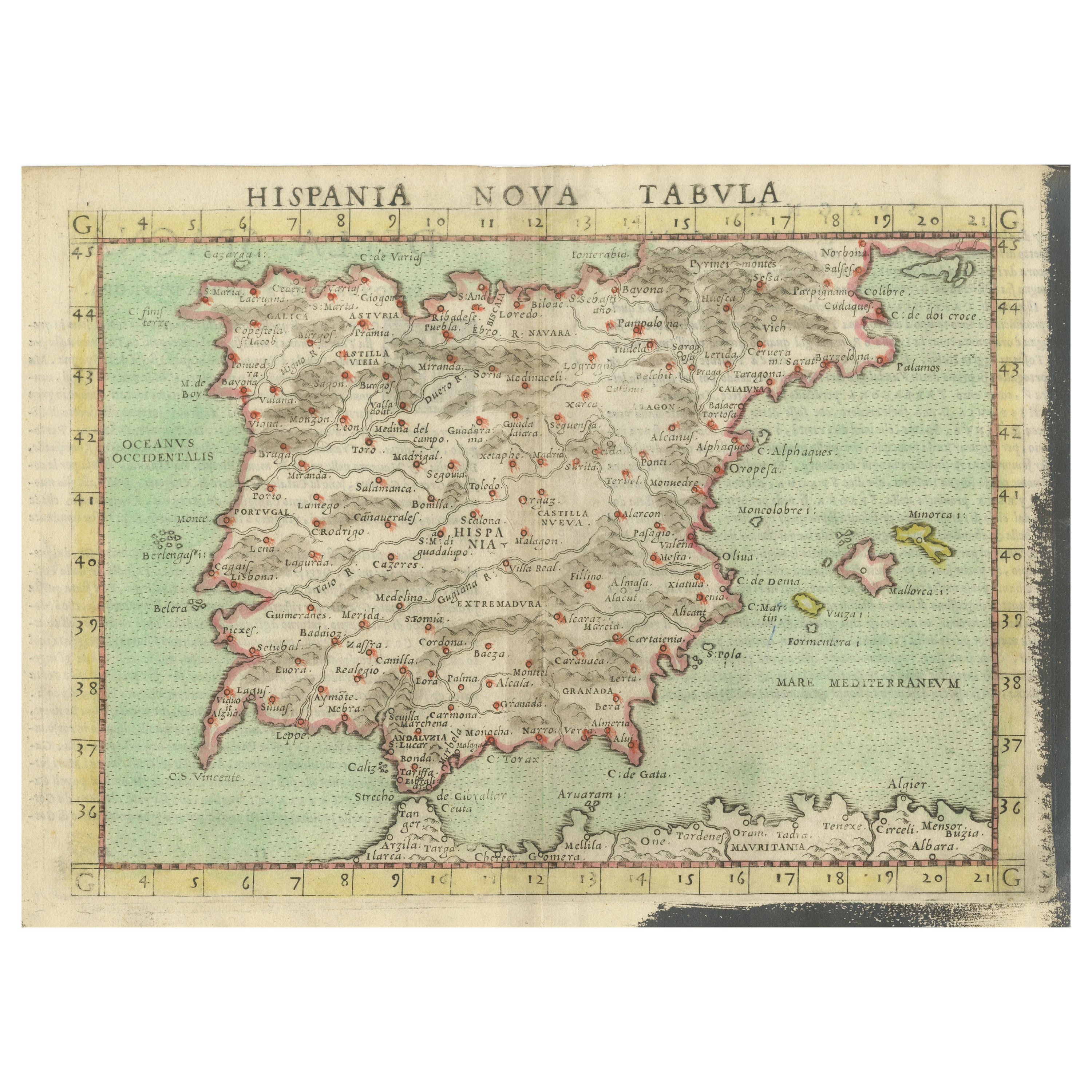
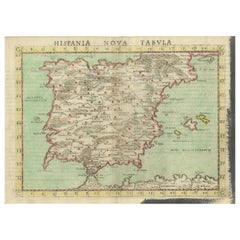
- Antique Map of Spain including the Balearic IslandsLocated in Langweer, NLAntique map titled 'Hispania Nova Tabula'. Ruscelli's map of Spain, including the Balearic Islands. This map originates from 'Espositione & introduttioni universali di Gir. Ruscelli sopra tutta la Geografia di Tolomeo (..)' published by Girolamo Ruscelli, 1561. Girolamo Ruscelli (1500-1566) was a cartographer, humanist, and scholar from Tuscany. Ruscelli was a prominent writer and editor in his time, writing about a wide variety of topics including the works of Giovanni Boccaccio and Francesco Petrarch, Italian language, Italian poetry, medicine, alchemy, and militia. One of his most notable works was a translation of Ptolemy’s Geographia...Category
Antique 16th Century Maps
MaterialsPaper

You May Also Like
- Hand Colored 18th Century Homann Map of Austria Including Vienna and the DanubeBy Johann Baptist HomannLocated in Alamo, CA"Archiducatus Austriae inferioris" is a hand colored map of Austria created by Johann Baptist Homann (1663-1724) and published in Nuremberg, Germany in 1728 shortly after his death. ...Category
Antique Early 18th Century German Maps
MaterialsPaper
- Antique 1803 Italian Map of Asia Including China Indoneseia IndiaLocated in Amsterdam, Noord HollandAntique 1803 Italian Map of Asia Including China Indoneseia India Very nice map of Asia. 1803. Additional information: Type: Map Country of Manufacturing: Europe Period: 19th centu...Category
Antique 19th Century European Maps
MaterialsPaper
- Antique French Map of Asia Including China Indoneseia India, 1783Located in Amsterdam, Noord HollandVery nice map of Asia. 1783 Dedie au Roy. Additional information: Country of Manufacturing: Europe Period: 18th century Qing (1661 - 1912) Condition: Overall Condition B (Good Used)...Category
Antique 18th Century European Maps
MaterialsPaper
- 1853 Map of "Russia in Europe Including Poland" Ric.r016Located in Norton, MADescription Russia in Europe incl. Poland by J Wyld c.1853 Hand coloured steel engraving Dimension: Paper: 25 cm W x 33 cm H ; Sight: 22 cm W x 28 cm H Condition: Good ...Category
Antique 19th Century Unknown Maps
MaterialsPaper
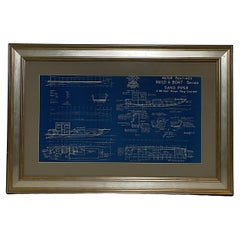
- Boat Blueprint Showing the Sand PiperLocated in Norwell, MAMotor Boating Publishing plan for a thirty foot day cruiser. Designd by William Atkin. The vessel is shown in great detail. Circa 1937 matted and framed. Weight: 7 lbs. Overall Dime...Category
Vintage 1930s North American Nautical Objects
MaterialsPaper
- Old Horizontal Map of EnglandBy TassoLocated in Alessandria, PiemonteST/520 - Old rare Italian map of England, dated 1826-1827 - by Girolamo Tasso, editor in Venise, for the atlas of M.r Le-Sage.Category
Antique Early 19th Century Italian Other Prints
MaterialsPaper


Recently Viewed
View AllMore Ways To Browse
Old Ottoman
Old Ottoman Furniture
Antique Budapest
Antique Spelling
Antique White Ottoman
Ottoman Map
Madagascar Antique Map
Map Of Prussia
Normandy Map
Prussia Map
Antique Map Of Florida
Antique Map Of Mississippi
Antique Maps Of Florida
Jamaican Antique
Louisiana Antiques
Romania Antique Map
South Arabian
Antique Hawaii Map