Items Similar to Antique Map of Southern Zeeland by Von Reilly, 1790

Want more images or videos?
Request additional images or videos from the seller
1 of 5
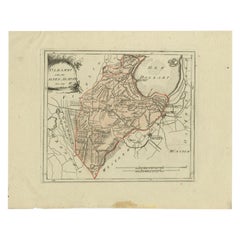
Antique Map of Southern Zeeland by Von Reilly, 1790
About the Item
"Antique map titled 'Seelands südlicher Theil oder die Inseln Süd Beverland, Tholen, Wolfersdyk und S. Philipsland'. Original antique map of the southern portion of the province of Zeeland including Zuid-Beveland, Tholen en Sint Philipsland, the Netherlands. From 'Schauplatz Der Funf Theile der Welt' (Wien: Reilly, 1791-1806), a world atlas in 830 maps by Franz Joseph Johann von Reilly. Artists and Engravers: Franz Joseph Johann von Reilly (1766-1820) was a Vienna based art dealer. He is also known as the author of two atlases.
Artist: Franz Joseph Johann von Reilly (1766-1820) was a Vienna based art dealer. He is also known as the author of two atlases.
Condition: Good, general age-related toning. Frame included, minor wear. Please study image carefully.
Date: 1790
Overall size: 46.2 x 42.8 cm.
Image size: 0.001 x 26.5 x 21.5 cm.
Antique prints have long been appreciated for both their aesthetic and investment value. They were the product of engraved, etched or lithographed plates. These plates were handmade out of wood or metal, which required an incredible level of skill, patience and craftsmanship. Whether you have a house with Victorian furniture or more contemporary decor an old engraving can enhance your living space. We offer a wide range of authentic antique prints for any budget.".
- Dimensions:Height: 16.86 in (42.8 cm)Width: 18.19 in (46.2 cm)Depth: 0 in (0.01 mm)
- Materials and Techniques:
- Period:
- Date of Manufacture:1790
- Condition:
- Seller Location:Langweer, NL
- Reference Number:
About the Seller
5.0
Platinum Seller
These expertly vetted sellers are 1stDibs' most experienced sellers and are rated highest by our customers.
Established in 2009
1stDibs seller since 2017
1,965 sales on 1stDibs
Typical response time: <1 hour
- ShippingRetrieving quote...Ships From: Langweer, Netherlands
- Return PolicyA return for this item may be initiated within 14 days of delivery.
More From This SellerView All
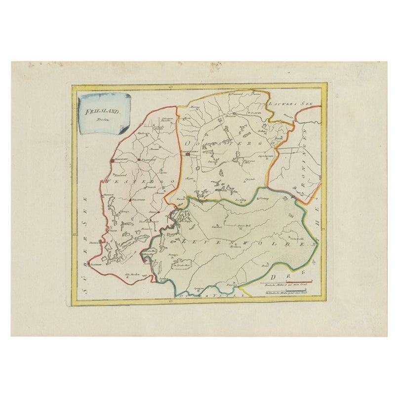
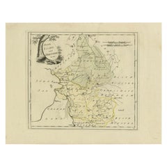
- Antique Map of Friesland by Von Reilly, 1791Located in Langweer, NLAntique map titled 'Friesland'. Map of the province of Friesland, the Netherlands. This map orginates from 'Schauplatz der fünf Theile der Welt'. Artists and Engravers: Franz Joseph ...Category
Antique 18th Century Maps
MaterialsPaper
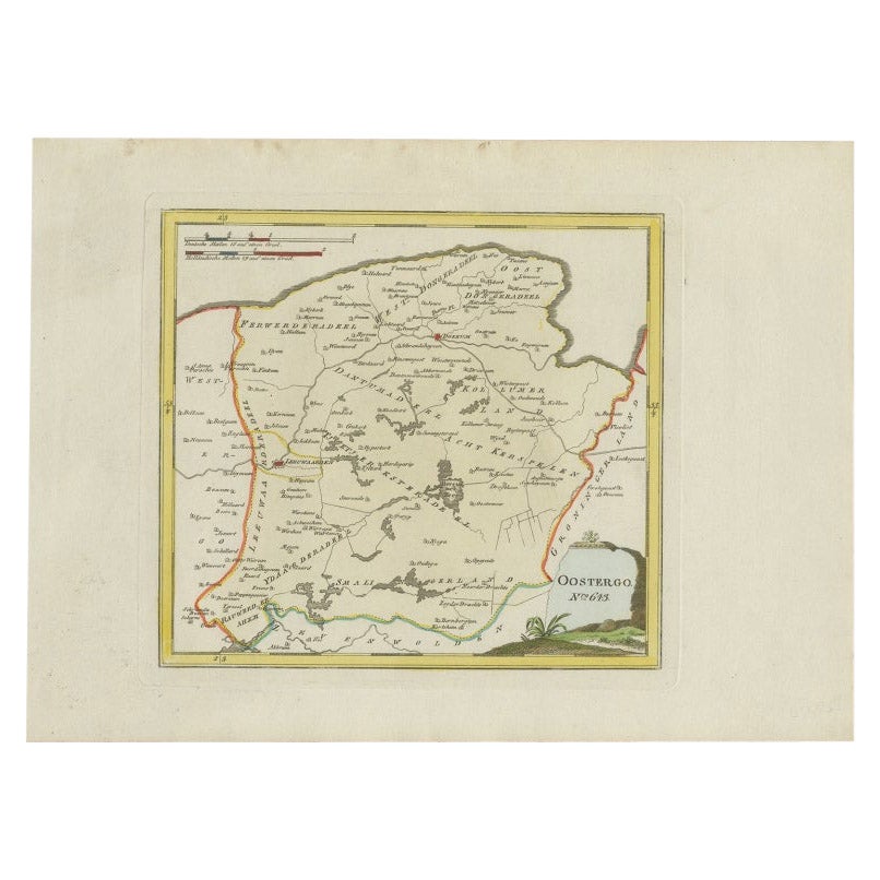
- Antique Map of Oostergo by Von Reilly, 1791Located in Langweer, NLAntique map titled 'Der Provinz Oostergo sechs südliche Grietenyen'. Map of the Oostergo region, Friesland, the Netherlands. This map orginates from 'Schauplatz der fünf Theile der W...Category
Antique 18th Century Maps
MaterialsPaper
- Antique Map of Oostergo by Von Reilly, 1791Located in Langweer, NLAntique map titled 'Oostergo'. Map of the Oostergo region, Friesland, the Netherlands. This map orginates from 'Schauplatz der fünf Theile der Welt'. Artists and Engravers: Franz Jos...Category
Antique 18th Century Maps
MaterialsPaper
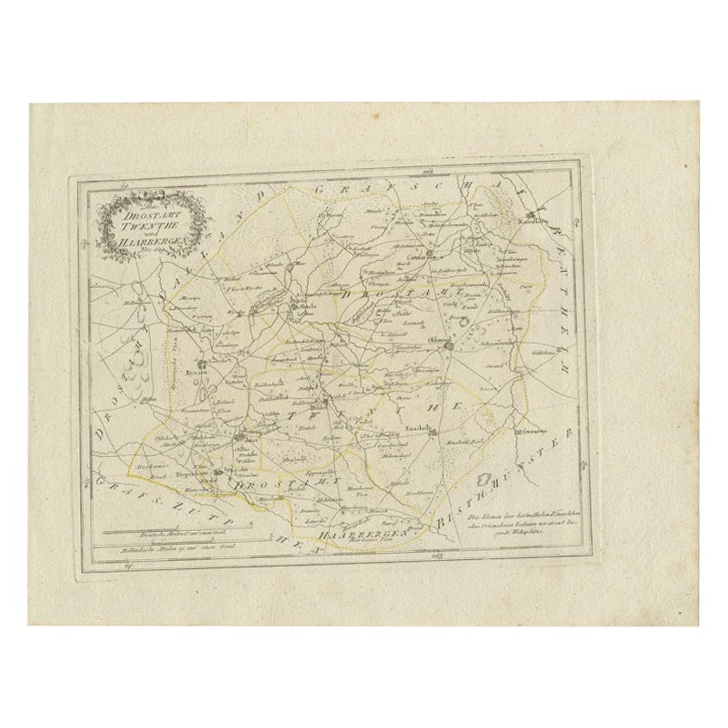
- Antique Map of Part of Overijssel by Von Reilly, 1792Located in Langweer, NLAntique map titled 'Das Drostamt Twenthe und Haarbergen'. This map depicts part of The Netherlands (Overijssel). This map originates from 'Schauplatz der fünf Theile der Welt' publis...Category
Antique 18th Century Maps
MaterialsPaper
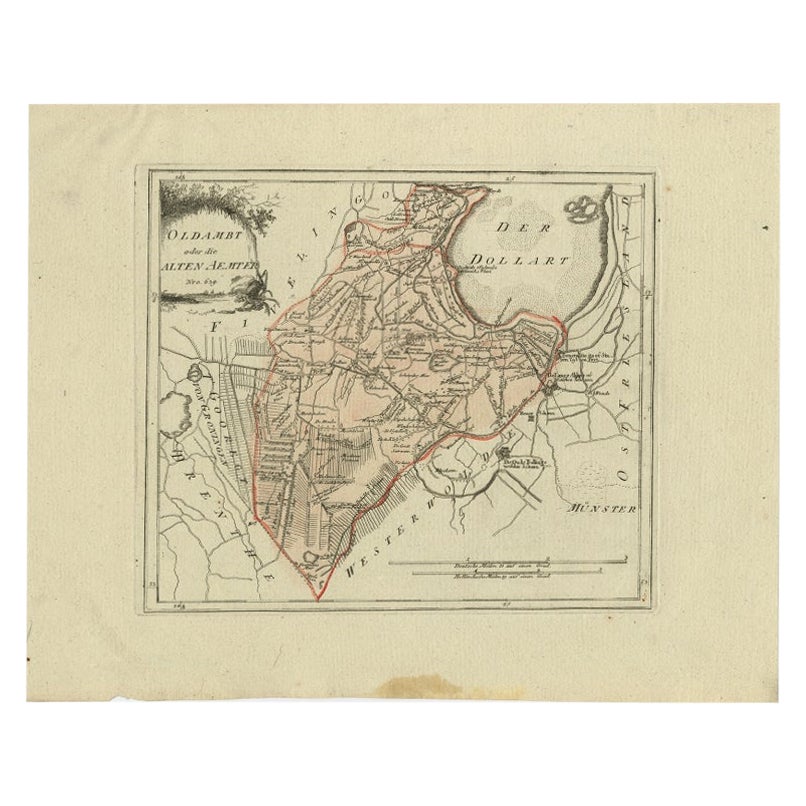
- Antique Map of Part of Groningen by Von Reilly, 1792Located in Langweer, NLAntique map titled 'Oldambt oder die Alten Aemter'. This map depicts part of the Dutch province Groningen. This map originates from 'Schauplatz der fünf Theile der Welt' published in...Category
Antique 18th Century Maps
MaterialsPaper
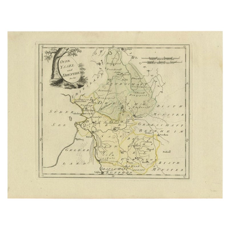
- Antique Map of Overijssel and Drenthe by Von Reilly, c.1795Located in Langweer, NLAntique map titled 'Overyssel und Drenthe'. Decorative map of Overijssel and Drenthe, The Netherlands. From 'Schauplatz Der Funf Theile der Welt' (Wien: Reilly, 1791-1806), a world a...Category
Antique 18th Century Maps
MaterialsPaper

You May Also Like
- Original Antique Map of Spain and Portugal, circa 1790Located in St Annes, LancashireSuper map of Spain and Portugal Copper plate engraving by A. Bell Published, circa 1790. Unframed.Category
Antique 1790s English Other Maps
MaterialsPaper
- 18th Century Map of the Southern Balkans by Giovanni Maria CassiniBy Giovanni Maria CassiniLocated in Hamilton, Ontario18th century map by Italian engraver Giovanni Maria Cassini (Italy 1745-1824). Map of the Southern Balkans: Rome. Hand colored and copper engraved print done in the year 1788. It in...Category
Antique 18th Century Italian Maps
MaterialsPaper
- 1907 Map of Colorado, Antique Topographical Map, by Louis NellLocated in Colorado Springs, COThis highly detailed pocket map is a topographical map of the state of Colorado by Louis Nell from 1907. The map "has been complied from all availabl...Category
Antique Early 1900s American Maps
MaterialsPaper
- Map Southern Scotland Thomas Conder Alex Hogg 1795Located in BUNGAY, SUFFOLKA new map of the southern part of Scotland containing the counties of Stirling, Lanerk, Renfrew, Linlithgow, Edinburgh, Peebles, Haddingtoun, Berwick, Selkirk, Roxburgh, Dumfries, Wigtoun, Kirkudbright & Air Published by Alex Hogg at the Kings Arms...Category
Antique 18th Century English Georgian Maps
MaterialsPaper
- 1861 Topographical Map of the District of Columbia, by Boschke, Antique MapLocated in Colorado Springs, COPresented is an original map of Albert Boschke's extremely sought-after "Topographical Map of the District of Columbia Surveyed in the Years 1856 ...Category
Antique 1860s American Historical Memorabilia
MaterialsPaper
- Southern Greece: A Large 17th C. Hand-colored Map by Sanson and JaillotBy Nicolas SansonLocated in Alamo, CAThis large original hand-colored copperplate engraved map of southern Greece and the Pelopponese Peninsula entitled "La Moree Et Les Isles De Zante, Cefalonie, Ste. Marie, Cerigo & C...Category
Antique 1690s French Maps
MaterialsPaper


Recently Viewed
View AllMore Ways To Browse
Antique World Map Print
Furniture From 1790
Antiques Art And Collectables Antique
18th Century Southern Antiques
Vienna 18th
Antique Curiosities Framed Art
Southern Antiques
Franz Joseph
Framed World Map
Antique Framed Map Engravings
1820 World Map
Large Framed Antique Maps
Map Of Mexico
Antique Map Of Mexico
Antique Maps Of Mexico
Antique Navigator
Antique Map California
Antique Map Of California