Items Similar to Antique Coastal Map of West Sumatra 'Indonesia' by J. Mannevillette, 1745


Want more images or videos?
Request additional images or videos from the seller
1 of 5
Antique Coastal Map of West Sumatra 'Indonesia' by J. Mannevillette, 1745
About the Item
Antique map titled 'Carte de la côte occidentale de l'isle Sumatra depuis la ligne équinoctiale jusqu'au détroit de la Sonde'. Beautiful coastal map of West Sumatra, an island in Western Indonesia. This map originates from 'Le Neptune Oriental'.
- Dimensions:Height: 30.32 in (77 cm)Width: 21.86 in (55.5 cm)Depth: 0.02 in (0.5 mm)
- Materials and Techniques:
- Period:
- Date of Manufacture:1745
- Condition:Please study images carefully.
- Seller Location:Langweer, NL
- Reference Number:
About the Seller
5.0
Platinum Seller
These expertly vetted sellers are 1stDibs' most experienced sellers and are rated highest by our customers.
Established in 2009
1stDibs seller since 2017
1,965 sales on 1stDibs
Typical response time: <1 hour
- ShippingRetrieving quote...Ships From: Langweer, Netherlands
- Return PolicyA return for this item may be initiated within 14 days of delivery.
More From This SellerView All
- Antique Map of West Sumatra, Indonesia, 1900Located in Langweer, NLAntique map titled 'Sumatra, Bangka, Blitoeng en de Riouw-Archipel'. Old map of West Sumatra depicting the various islands and the Strait of Malacca. This map originates from 'Atlas ...Category
20th Century Maps
MaterialsPaper
- Antique Map of Sumatra, Indonesia 'c.1780'Located in Langweer, NLAntique map titled 'Neue Karte von der Insel Sumatra'. Extremely rare map of Sumatra, Indonesia. Published circa 1780.Category
Antique Late 18th Century Maps
MaterialsPaper
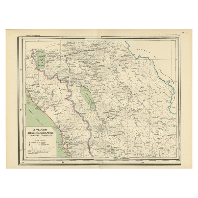
- Antique Map of Padang, Sumatra, Indonesia, 1900Located in Langweer, NLAntique map titled 'De Padangsche Beneden-en Bovenlanden van de Koninginnedbaai tot Fort de Kock'. Old map of Padang, Sumatra. This map originates from 'Atlas van Nederlandsch Oost- ...Category
20th Century Maps
MaterialsPaper
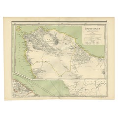
- Antique Map of Aceh in Sumatra, Indonesia, 1900Located in Langweer, NLAntique map titled 'Groot-Atjeh en aangrenzende Kuststaten'. Old map of Aceh, with surrounding coastal regions. This map originates from 'Atlas van Nederlandsch Oost- en West-Indië' ...Category
20th Century Maps
MaterialsPaper
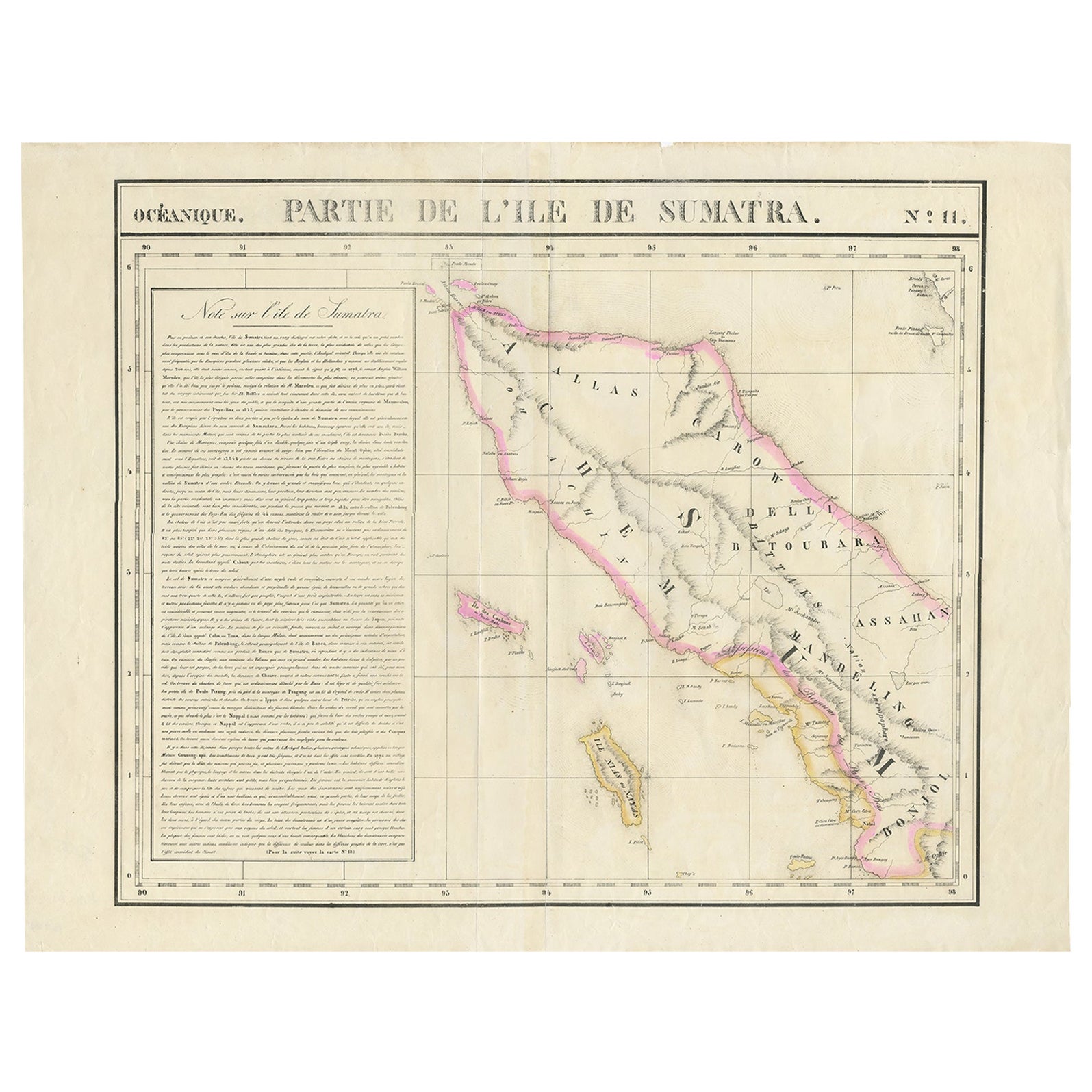
- Antique Map of West Sumatra by P.M.G. Vandermaelen, 1827Located in Langweer, NLA chart showing the western part of Sumatra, published in the "Atlas Universel de Géographie".Category
Antique Early 19th Century Maps
MaterialsPaper
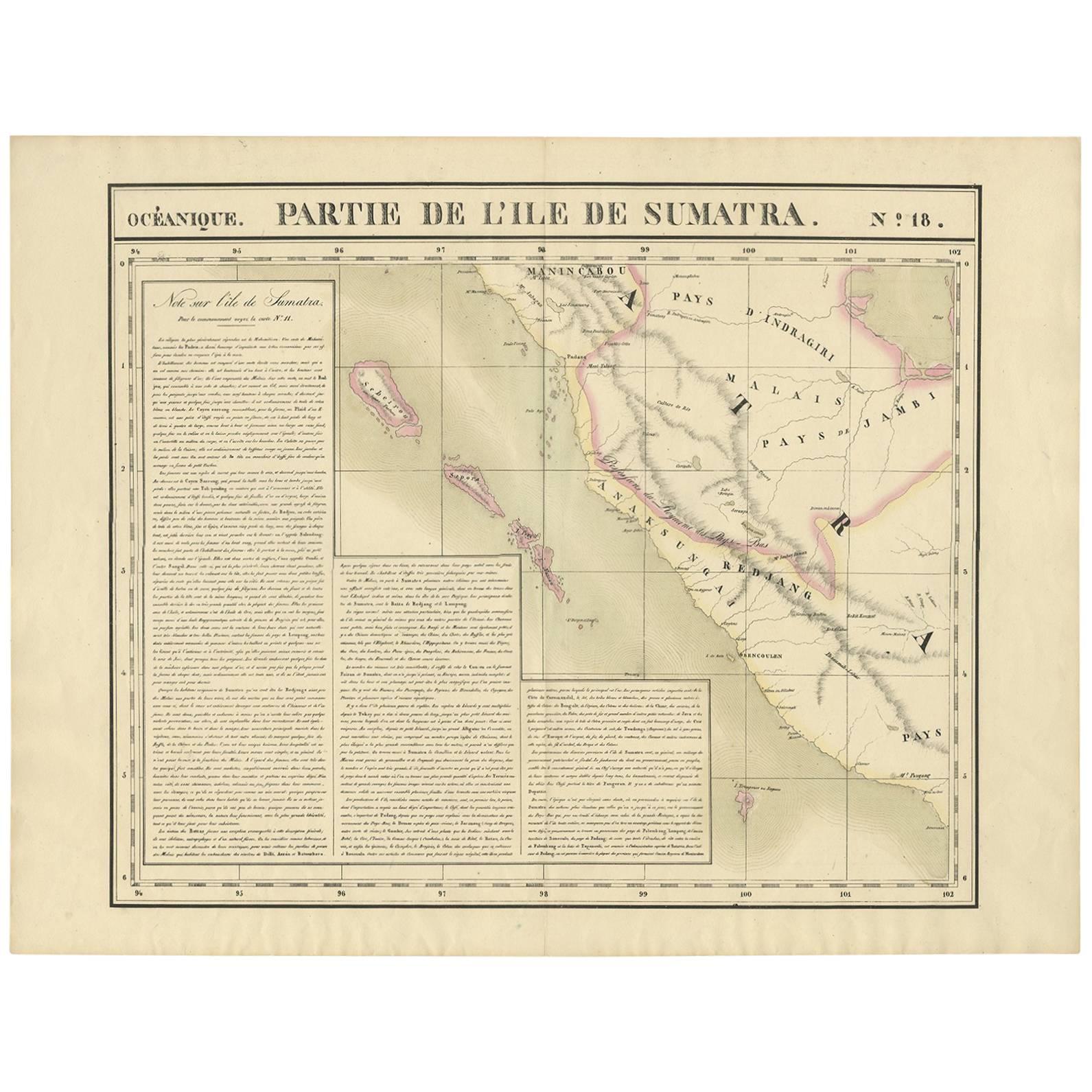
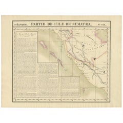
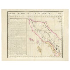
- Detailed Antique Map of Northern Sumatra, Indonesia, circa 1825Located in Langweer, NLAntique map titled 'Partie de l'Ile de Sumatra'. Chart showing the northern part of Sumatra. Originates from 'Atlas Universel' by P.M. Vandermaelen. Artists and Engravers: Philip...Category
Antique 19th Century Maps
MaterialsPaper


You May Also Like
- Original Antique English County Map - West Yorkshire. J & C Walker. 1851Located in St Annes, LancashireGreat map of The West Riding of Yorkshire Original colour By J & C Walker Published by Longman, Rees, Orme, Brown & Co. 1851 Unframed.Category
Antique 1850s English Other Maps
MaterialsPaper
- 17th Century Hand-Colored Map of West Africa by Mercator/HondiusLocated in Alamo, CAA 17th century hand-colored map entitled "Guineae Nova Descriptio" by Gerard Mercator and Jodocus Hondius, published in their 'Atlas Minor' in Amsterdam in 1635. It is focused on the...Category
Antique Mid-17th Century Dutch Maps
MaterialsPaper
- 17th Century Hand-Colored Map of a Region in West Germany by JanssoniusBy Johannes JanssoniusLocated in Alamo, CAThis attractive highly detailed 17th century original hand-colored map is entitled "Archiepiscopatus Maghdeburgensis et Anhaltinus Ducatus cum terris adjacentibus". It was published ...Category
Antique Mid-17th Century Dutch Maps
MaterialsPaper
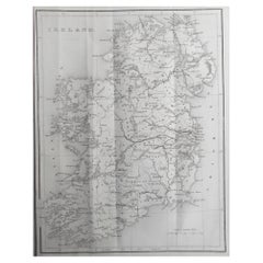
- Original Antique Map of Ireland by Hughes. C.1850Located in St Annes, LancashireGreat map of Ireland Engraved by W.Hughes Published by Virtue, C.1850 Unframed.Category
Antique 1850s Scottish Other Maps
MaterialsPaper
- Original Antique Map of Scotland by Becker. C.1850Located in St Annes, LancashireGreat map of Scotland Engraved by F.P Becker Published by Virtue, C.1850 Unframed.Category
Antique 1850s Scottish Other Maps
MaterialsPaper
- Original Antique Map of Russia By Arrowsmith. 1820Located in St Annes, LancashireGreat map of Russia Drawn under the direction of Arrowsmith Copper-plate engraving Published by Longman, Hurst, Rees, Orme and Brown, 1820 Unframed.Category
Antique 1820s English Maps
MaterialsPaper


Recently Viewed
View AllMore Ways To Browse
La Ligne
Antique Furniture Detroit
Antique Furniture Dundee
Antique Map Chicago
Antique Map Copenhagen
Antique Map Malta
Antique Map Of Malta
Antique Maps Of Malta
Antique Maps Of Pennsylvania
Antique Queensland
Mitchell Antique Maps
North Carolina Map
Otto Petri
Ottoman Map
Alexandria Map
Antique Bassett Furniture
Antique Furniture Furniture Nova Scotia
Antique Furniture Nova Scotia Furniture