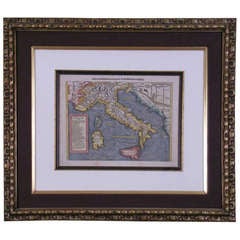
Sardinia Map

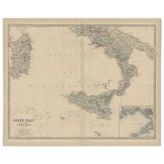
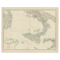
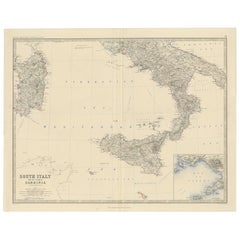
Antique Map of Southern Italy and Sardinia by Johnston, 1882
Located in Langweer, NL
"Antique map titled 'South Italy and the Island of Sardinia'. Old map of Southern Italy and the
Category

Antique 19th Century Maps

Materials

Paper

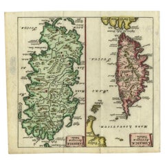
Antique Map of the Islands of Corsica and Sardinia, 1685
Located in Langweer, NL
maps on one sheet, showing the islands Corsica and Sardinia from the pocket atlas 'Introductionis in
Category

Antique 17th Century Maps

Materials

Paper

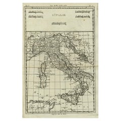
Antique Map of Italy, Corsica, Sardinia and Sicily, ca.1780
Located in Langweer, NL
Description: Antique map titled 'L'Italie.' Map of Italy, Corsica, Sardinia and Sicily. Highly
Category

Antique 1780s Maps

Materials

Paper

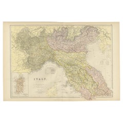
Original Antique Map of Italy with an Inset of Sardinia, 1882
Located in Langweer, NL
Embark on a historical odyssey with an original Antique Map of Italy from the esteemed
Category

Antique 1880s Maps

Materials

Paper

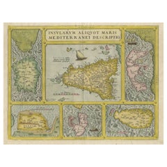
Coloured Antique Map of Sicily, Sardinia, Corfu, Elba, Malta and Zerbi (Jerba)
By Abraham Ortelius
Located in Langweer, NL
Ortelius' map combining, on one page, maps of the islands of Sicily, Sardinia, Corfu, Elba, Malta and Zerbi
Category

Antique 16th Century Maps

Materials

Paper

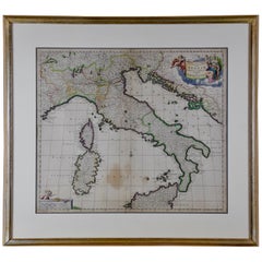
Italy, Sicily, Sardinia, Corsica and Dalmatian Coast: A 17th Century Dutch Map
By Theodorus Danckerts
Located in Alamo, CA
islands of Corsica and Sardinia and part of Sicily are also represented. At the time this map was made
Category

Antique Late 17th Century Dutch Maps

Materials

Paper

Antique Map of South Italy and the Island of Sardinia by Johnston (1909)
Located in Langweer, NL
Antique map titled 'South Italy and the Island of Sardinia'. Original antique map of South Italy
Category

Early 20th Century Maps

Materials

Paper

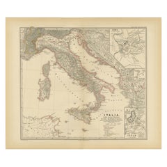
Map of The Italian Peninsula with the islands of Sicily, Sardinia, Corsica, 1880
Located in Langweer, NL
This map, titled "ITALIA, Sicilia, Sardinia, Corsica," represents the Italian Peninsula along with
Category

Antique 1880s Maps

Materials

Paper

Antique Map of Italy, Showing Corsica, Sardinia, Croatia, Malta and More, C.1740
Located in Langweer, NL
.' Attractive detailed map showing Italy as well as Corsica, Sardinia, Minorca, Croatia, Albania, Dalmatia, a
Category

Antique 18th Century Maps

Materials

Paper

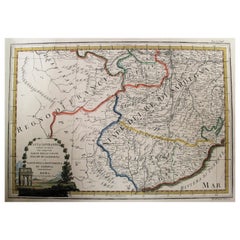
Map of the Kingdom of Sardinia and Part of the Kingdom of Genoa, Rome
By Giovanni Maria Cassini
Located in Hamilton, Ontario
18th century map by Italian engraver Giovanni Maria Cassini (Italy 1745-1824). Map of Part of the
Category

Antique 18th Century Italian Maps

Materials

Paper

Map of Southern Italy inlcluding Sardinia and Inset of the Bay of Naples, c.1860
Located in Langweer, NL
Antique map titled 'South Italy and the Island of Sardinia'. Old map of Southern Italy and the
Category

Antique 1860s Maps

Materials

Paper

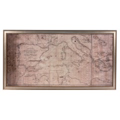
Large Framed Map of the Mediterranean
Located in New York, NY
Large map/chart chart of The Mediterranean and the Grecian Archipelago showing Italy, Sardinia
Category

20th Century French Mid-Century Modern Maps

Large Framed Map of the Mediterranean
H 36 in W 67 in D 0.75 in
Antique Map of Corsica and Sardini, 1729
Located in Langweer, NL
Detailed map of the Islands of Corsica and Sardinia, showing towns, rivers, lakes, mountains, bays
Category

Antique Early 18th Century Maps

Materials

Paper

Antique Map of Corsica and Sardini,  1729
H 11.46 in W 5.4 in D 0.02 in
Detailed Antique Map of Italy and surrounding Islands
Located in Langweer, NL
antique map, based on D'Anville's important map of Italy. The map extends to Sicily, Corsica, Sardinia
Category

Antique Mid-18th Century Maps

Materials

Paper

Antique Map of Italy by R. Bonne, circa 1780
Located in Langweer, NL
Beautiful map of Italy, Corsica, Sardinia and Sicily. Highly detailed, showing towns, rivers, some
Category

Antique Late 18th Century Maps

Materials

Paper

Antique Map of Italy by R. Bonne, circa 1780
H 17.13 in W 11.23 in D 0.02 in
Large Decorative Antique Map of the Mediterranean, ca.1770
Located in Langweer, NL
Antique map titled 'Carte de la Mer Mediterranee en Douze Feuilles'. First map out of twelve
Category

Antique 1770s Maps

Materials

Paper

Antique Map of North Africa by Ortelius, c.1580
Located in Langweer, NL
Antique map titled 'Barbariae et Biledulgerid Nova Descriptio'. Original antique map of North
Category

Antique 16th Century Maps

Materials

Paper

Antique Map of North Africa by Ortelius, c.1600
Located in Langweer, NL
Antique map titled 'Barbariae et Biledulgerid nova descriptio'. Old map of coastal North Africa
Category

Antique 17th Century Maps

Materials

Paper

Antique Engraved Map of Italy in Roman Times, ca.1730
Located in Langweer, NL
Observationes Astromicas Exacte" The map shows Italy, Corsica, Sardinia and parts of the Mediterrean, including
Category

Antique 1730s Maps

Materials

Paper

Antique Map of Italy and Other Regions Near the Adriatic Sea
Located in Langweer, NL
Antique map titled 'Italie et Provinces Autrichnes sur l'Adriatique'. Original old map of Italy and
Category

Antique Mid-19th Century Maps

Materials

Paper

Antique Map of Italy, North Part, by W. G. Blackie, 1859
Located in Langweer, NL
The "Antique Map of Italy, North Part" by W. G. Blackie, dated 1859, is a historically significant
Category

Antique Mid-19th Century Maps

Materials

Paper

Antique Map of the Northern Coast of Africa and Southern Europe, circa 1745
By Covens & Mortier
Located in Langweer, NL
Antique map titled 'In Notitiam Ecclesiasticam Africae Tabula Geographica'. Very decorative hand
Category

Antique Mid-18th Century Maps

Materials

Paper

Antique Map of The Regions of Italy and Sicily during the Roman Empire, 1880
Located in Langweer, NL
buried by the eruption of Mount Vesuvius in 79 AD. - **Corsica and Sardinia**: Smaller maps of the
Category

Antique 1880s Maps

Materials

Paper

Roman Italy and Provinces: A Cartographic Snapshot, 1880
Located in Langweer, NL
The map titled "ITALIA, Gallia Cisalpina, Sicilia, Sardinia, Corsica" focuses on Italy and its
Category

Antique 1880s Maps

Materials

Paper

Roman Italy and Provinces: A Cartographic Snapshot, 1880
Free Shipping
H 15.56 in W 18.51 in D 0 in
17th Century Dutch Map of Italy, Sicily, Sardinia, Corsica and Dalmatian Coast
By Theodorus Danckerts
Located in Alamo, CA
islands of Corsica and Sardinia and part of Sicily are also represented. At the time this map was made
Category

1690s Prints and Multiples

Materials

Engraving

Italia mit Corsica Sardinia und Sicilla
By Sebastian Münster
Located in Florham Park, NJ
Italia mit…Corsica, Sardinia und Sicilia. Geographia Universalis, Vetus et Nova, complectens
Category

18th Century and Earlier Academic Prints and Multiples

Materials

Engraving

Mediterranean and Adriatic Seas: Original 18th Century Hand-colored Map by Bowen
Located in Alamo, CA
This is an original 18th century hand-colored map entitled "An Accurate Chart of The Mediterranean
Category

Mid-18th Century Old Masters Landscape Prints

Materials

Engraving

People Also Browsed

18th century Set Hand Colored Nautical Engravings
By M. Ogier
Located in Savannah, GA
Signed M. Ogier (Fecit:by), this set of four hand colored engravings is part of a larger edition of plates. These plates are numbered PL 16, 347, 365 and 386. The subject is probably...
Category

Antique 18th Century Unknown Elizabethan Prints

Materials

Glass, Wood, Paper

Antique Spanish Old Master Oil on Wood Panel, Head Portrait of Christ
Located in Cirencester, Gloucestershire
Artist/ School: 18/19th Century Spanish School Title :Head study of Christ Medium: oil painting on wood panel, period gilt framed panel : 6 x 5 inches Provenance: private collect...
Category

18th Century Old Masters Figurative Paintings

Materials

Oil

18th century Spanish ebonised and guilt mirror
Located in Brecht, BE
wonderful patina on this Spanish ebonised and guilt pearwood framed mirror, lovely foxed mirror glass ... chic, elegant, timeless ...
Category

Antique Late 18th Century Spanish Mantel Mirrors and Fireplace Mirrors

Materials

Mirror, Pearwood

Antique Italian Giltwood Trumeau Mirror with Harbor Scene Oil Painting, C. 1780
Located in Dallas, TX
This Italian trumeau mirror, hand-carved circa 1780, features a 20 ½” H x 38” W mirror set beneath a maritime oil painting. The giltwood frame has angular protrusions in the upper co...
Category

Antique Late 18th Century Italian Trumeau Mirrors

Materials

Canvas, Wood, Giltwood, Paint

Large 18th century Spanish Colonial Religious Painting
Located in San Francisco, CA
Large oil painting of the holy family on hand woven canvas. Peruvian or Bolivian. Acquired from an estate in the San Francisco Bay Area from a gentleman who had been in the first w...
Category

Antique 18th Century Peruvian Spanish Colonial Paintings

Materials

Canvas

18th Century Spanish Walnut Table
Located in Faversham, GB
A superb 18th-century rustic walnut table from Catalonia. The generous weathered three-plank top is supported by an X-frame support to one side of the table and a central stretcher ...
Category

Antique Mid-18th Century Spanish Spanish Colonial Tables

Materials

Walnut

18th Century Spanish Walnut Table
H 30.71 in W 68.31 in D 27.17 in
Antique Map of the Languedoc Region 'France' by D. Weege, 1753
Located in Langweer, NL
Antique map titled 'Caart van Languedoc'. Map of the Languedoc-Rousillion region in Southern France. Flanked by miniature plans and views of cities of the region like Montpellier, N...
Category

Antique Mid-18th Century Maps

Materials

Paper

Antique Royal Crown Derby Chinoiserie Styled Teapot, Cream & Sugar Set
By Royal Crown Derby Porcelain
Located in Hamilton, Ontario
This teapot and cream and sugar set were made by the well known Royal Crown Derby maker of England and dates to approximately 1850 and done in the period Chinoiserie style. The set i...
Category

Antique Mid-19th Century English Chinoiserie Tea Sets

Materials

Porcelain

19th-century Carved, Painted and Gilt tortoise shell, 'the Cosmic Turtle'
Located in Amsterdam, NL
A highly unusual carved painted, gilt and gem-set tortoise carapace resembling the mythical Cosmic or World-bearing Turtle Probably Germany, late 19th century L. 32 x W. 26 x H. 20...
Category

Antique Late 19th Century Natural Specimens

Materials

Multi-gemstone, Gold Leaf

Miniature Antique Furniture, First Edition
By Herbert F. Schiffer, Peter B. Schiffer
Located in valatie, NY
Miniature Antique Furniture by Herbert F. and Peter B. Schiffer. Wynnewood: Livingston Publishing Company, 1972. First edition hardcover with dust jacket. 264 pp. A study of handcraf...
Category

20th Century American Books

Materials

Paper

XVIII Century Pair of Touchers in Gilt Woodwork converted in lighting appliqués
Located in Lisboa, PT
XVIII Century Pair of Touchers in Gilt Woodwork Converted in Lighting Appliqués Carved and gilded wood touchers from XVIII century Spain are exquisite examples of craftsmanship and ...
Category

Antique Late 18th Century Spanish Wall Lights and Sconces

Materials

Wood

An Original 1825 Illustration of the Large Hairy Armadillo by G.B. Whittaker
Located in Langweer, NL
An original hand-coloured engraving of "The Hairy Armadillo or Fourth Tatou of d'Azara." This is a depiction of the species known scientifically as Chaetophractus villosus, more com...
Category

Antique Mid-19th Century Prints

Materials

Paper

The Economic Balancing Act: A Satirical View of 1780 Britain
Located in Langweer, NL
Title: "The Economic Balancing Act: A Satirical View of 1780 Britain" This original etching and engraving, circa 1780, is a satirical commentary on the precarious state of the Briti...
Category

Antique 1780s Prints

Materials

Paper

Charming 18th Century Miniature Map of Greece, 1685
Located in Langweer, NL
Antique map titled 'Graeciae Descriptio.' Charming miniature map of Greece from the pocket atlas 'Introductionis in Universam Geographiam tam Veterem quam novam .. Acessit P. Bertii ...
Category

Antique 17th Century Maps

Materials

Paper

18th Century Oil on Canvas Spanish Religious Painting Saints with Christ, 1730
Located in Vicoforte, Piedmont
Antique Spanish painting from the 18th century. Artwork oil on canvas depicting a religious subject, Adoration of Saints with Christ and the Virgin Mary, of good pictorial quality. T...
Category

Antique 1730s Spanish Paintings

Materials

Canvas

Miniature Cast Iron Linen Press with Schildkröt Doll, 1890-1900
Located in Delft, NL
A miniature cast iron linen press with Schildkröt doll, 1890-1900 An antique miniature mangle linen press, circa 1890-1900, made of cast iron with 2 wooden shelves and wooden roll...
Category

Antique Late 19th Century European Toys and Dolls

Materials

Iron

Recent Sales

Italia mit...Corsica, Sardinia und Sicilia.
By Sebastian Münster
Located in Florham Park, NJ
Sebastian Munster. Italia mit…Corsica, Sardinia und Sicilia. Woodcut with Hand-Color
Category

Antique 19th Century German Maps

Early 19th Century Map of Revolutionary France with 13 Belgian and Six Piedmont
By Kirkwood
Located in Pataskala, OH
This framed, hand colored map of France illustrates the departments during the Revolutionary period
Category

Antique 1810s English Louis XVI Maps

Map of Sardinia, Sicily and part of Corsica by Mercator - Engraving - 17th c.
By Gerard Mercator
Located in Zeeland, Noord-Brabant
(…)' - Very decorative map of Sardinia, Sicily and part of Corsica. With two war ships, and sea monsters in
Category

1690s Old Masters More Prints

Materials

Engraving

The Sea Coast of Barbary from Cape de Tenes to Cape de Rosa.
By James Bennett
Located in Zeeland, Noord-Brabant
a part of Sardinia is shown. Two inset maps show detailed coastal maps of Algiers, and Bona (Annaba
Category

Early 18th Century More Prints

Materials

Engraving

Antique Map of Italy, Sicily and Sardinia Based on Ancient Sources, 1848
Located in Langweer, NL
Antique map titled 'Italia Inferior, Sicilia et Sardinia'. Old map of Italy, Sicily and Sardinia
Category

Antique 19th Century Maps

Materials

Paper

Decorative Map of Sicily, Malta and a Bit of Naples and Sardinia 'Italy', c.1680
Located in Langweer, NL
Antique map titled 'Regnum Siciliae cum circumjacentribus Regnis et Insulis'. Decorative map of
Category

Antique 1680s Maps

Materials

Paper

1730 Dutch Map of the Italian Pennisula and Mediterranean
Located in Colorado Springs, CO
Exceptional 1730 Dutch map, entitled: L'Italie Dressee sur les Observations de Mrs. de l'Academie
Category

Antique 1730s European Maps

Antique Map of Elba in Tuscany, Italy, Site of Napoleon's First Exile, c.1620
Located in Langweer, NL
Antique map titled 'Elba Isola olim Ilua'. Old map of Elba, a Mediterranean island in Tuscany
Category

Antique 17th Century Maps

Materials

Paper

Antique Print of a Lady from Sassari 'Sardinia' in Italy, 1850
Located in Langweer, NL
Overall size: 20.8 x 28 cm. Image size: 12.1 x 21.8 cm. We sell original antique maps to collectors
Category

Antique 19th Century Prints

Materials

Paper

Antique Print of a Lady from Gallura in Sardinia, Italy, 1850
Located in Langweer, NL
: 1850 Overall size: 20.7 x 28 cm. Image size: 11.5 x 19.2 cm. We sell original antique maps to
Category

Antique 19th Century Prints

Materials

Paper

Antique Print of a Lady from Ploaghe in Sassari 'Sardinia' in Italy, 1850
Located in Langweer, NL
Antique costume print titled 'Femme de Ploaghe'. Old print depicting a lady from Ploaghe, Sardinia
Category

Antique 19th Century Prints

Materials

Paper

Antique Print of a Lady from Sinnai, Cagliari 'region of Sardinia', Italy, 1850
Located in Langweer, NL
Overall size: 20.9 x 27.2 cm. Image size: 13.2 x 21 cm. We sell original antique maps to collectors
Category

Antique 19th Century Prints

Materials

Paper

Antique Map of Italy, with Sardinia and Corsica
Located in Langweer, NL
. Also includes the islands of Sardinia and Corsica. This map originates from Maison Basset's 1852
Category

Antique Mid-19th Century Maps

Materials

Paper

Antique Map of Italy, Sardinia and Corsica by Lowry, '1852'
Located in Langweer, NL
Antique map titled 'Italy, Sardinia and Corsica'. Four individual sheets of Italy, Sardinia and
Category

Antique Mid-19th Century Maps

Materials

Paper

Antique Map of Switzerland, Italy, Sardinia and Corsica by Lowry, '1852'
Located in Langweer, NL
Antique map titled 'Switzerland, Italy, Sardinia & Corsica'. Original map of Switzerland, Italy
Category

Antique Mid-19th Century Maps

Materials

Paper

Antique Map of Italy Depicting Sardinia, Sicily and Corse, c.1873
Located in Langweer, NL
Antique map titled 'Italië'. Old map depicting Italy and the islands of Sardinia, Sicily and Corse
Category

Antique 19th Century Maps

Materials

Paper

Large Antique Map of Italy with Corsica, Sardinia, Sicily & Malta, 1854
Located in Langweer, NL
Antique map titled 'The States of Italy, with their islands, Corsica, Sardinia, Sicily & Malta
Category

Antique 19th Century Maps

Materials

Paper

Antique Map of Italy 'Sardinia and Corsica' by P. Cluverus, circa 1672
Located in Langweer, NL
Antique map titled 'Italiae Antiquae novissima tabula auctore P. Cluvero'. Very decorative map of
Category

Antique Late 17th Century Maps

Materials

Paper

Antique Map of the Kingdom of Sardinia by Keizer & de Lat, 1788
Located in Langweer, NL
Sardinia, Italy. This map originates from 'Nieuwe Natuur- Geschied- en Handelkundige Zak- en Reisatlas' by
Category

Antique Late 18th Century Maps

Materials

Paper

Antique Map of Italy by F. de Aefferden, 1725
Located in Langweer, NL
Rare and decorative map of Italy with Sicily, Sardinia and Corsica. Decorative border on the
Category

Antique Early 18th Century Maps

Materials

Paper

Antique Map of Northern Africa by Ortelius 'circa 1590'
Located in Langweer, NL
Beautiful antique map titled 'Barbariae et Biledvlgerid nova descriptio'. Original double-page
Category

Antique 16th Century Maps

Materials

Paper

Antique Map of South Italy by A.K. Johnston, 1865
Located in Langweer, NL
Antique map titled 'South Italy and the Island of Sardinia'. With an inset map of the Bay of Naples
Category

Antique Mid-19th Century Maps

Materials

Paper

Antique Wall Map of the Empire of Charlemagne by Bertius 'circa 1620'
Located in Langweer, NL
Antique map titled 'Imperii Caroli Magni et vicinarum regionum descriptio'. Rare, large four-sheet
Category

Antique Early 17th Century Maps

Materials

Paper

Map of Italy, Hand-Colored Copper Engraving by Matthaus Seutter, circa 1725
Located in Colorado Springs, CO
1725 hand-colored map of Italy by Matthaus Seutter, titled "Nova Et Exactissima Totius Italiae
Category

Antique 1720s Maps

Antique Map of the Region Around Italy, Sicily and Greece by H. Heirs, 1766
Located in Langweer, NL
Gorgeous full color example of Homann's map of the region bounded by the Danube in the North, Italy
Category

Antique Mid-18th Century Maps

Materials

Paper

Sardinia - Original Etching - 16th Century
Located in Roma, IT
. The etching represents the map of Sardinia, through aesthetic features and visual codes. Sardinia is
Category

16th Century Old Masters Figurative Prints

Materials

Etching

Antique Print of a Lady Selling Soap in Tempio, Sardinia, Italy, 1850
Located in Langweer, NL
in Tempio, Sardinia, Italy. This print originates from 'Costumes Moderne (Musée de Costumes
Category

Antique 19th Century Prints

Materials

Paper

Antique Print of a Lady from Osilo in the Sassari Region 'Sardinia', Italy, 1850
Located in Langweer, NL
Overall size: 21.2 x 27.8 cm. Image size: 11.5 x 21 cm. We sell original antique maps to collectors
Category

Antique 19th Century Prints

Materials

Paper

Gastronomic Italy. Map of the Principal Gastronomic Specialties of The Regions
Located in New York, NY
This fascist-era map of famous Italian foods and drinks including Ostriche, Orvieto, Pizza
Category

1930s Cubist Prints and Multiples

Materials

Paper

Antique Map of Ancient Italy and the Islands Corsica, Sicily and Sardinia
Located in Langweer, NL
Antique map titled 'Italia Antiqua of Oud Italje (..)'. Very decorative map of ancient Italy and
Category

Antique Early 18th Century Maps

Materials

Paper

Get Updated with New Arrivals
Save "Sardinia Map", and we’ll notify you when there are new listings in this category.

Sardinia Map For Sale on 1stDibs

At 1stDibs, there are many versions of the ideal sardinia map for your home. Frequently made of paper, every sardinia map was constructed with great care. Your living room may not be complete without a sardinia map — find older editions for sale from the 18th Century and newer versions made as recently as the 20th Century. Giovanni Maria Cassini, Sebastian Münster and Theodorus Danckerts each produced at least one beautiful sardinia map that is worth considering.

How Much is a Sardinia Map?

Prices for a sardinia map can differ depending upon size, time period and other attributes — at 1stDibs, they begin at $111 and can go as high as $1,646, while the average can fetch as much as $651.

Read More

Pamela Shamshiri Shares the Secrets behind Her First-Ever Book and Its Effortlessly Cool Interiors

The sought-after designer worked with the team at Hoffman Creative to produce a monograph that beautifully showcases some of Studio Shamshiri's most inspiring projects.

Moroccan Artworks and Objects Take Center Stage in an Extraordinary Villa in Tangier

Italian writer and collector Umberto Pasti opens the doors to his remarkable cave of wonders in North Africa.

Montecito Has Drawn Royalty and Celebrities, and These Homes Are Proof of Its Allure

Hollywood A-listers, ex-pat aristocrats and art collectors and style setters of all stripes appreciate the allure of the coastal California hamlet — much on our minds after recent winter floods.

Whaam! Blam! Pow! — a New Book on Pop Art Packs a Punch

Publishing house Assouline and writer Julie Belcove have teamed up to trace the history of the genre, from Roy Lichtenstein, Andy Warhol and Yayoi Kusama to Mickalene Thomas and Jeff Koons.

The Sparkling Legacy of Tiffany & Co. Explained, One Jewel at a Time

A gorgeous new book celebrates — and memorializes — the iconic jeweler’s rich heritage.

What Makes a Gem-Encrusted Chess Set Worth $4 Million?

The world’s most opulent chess set, weighing in at 513 carats, is literally fit for a king and queen.

Tauba Auerbach’s Geometric Pop-Up Book Is Mighty Rare, Thanks to a Hurricane

This sculptural art book has an epic backstory of its own.

Step inside the Storied Mansions of Palm Beach’s Most Effervescent Architect

From Spanish-style courtyards to fanciful fountains, these acclaimed structures abound in surprising and elegant details.