Items Similar to Antique Chart of the Friendly Islands or Nowadays Tonga, by Cook, 1784


Want more images or videos?
Request additional images or videos from the seller
1 of 6
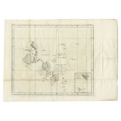
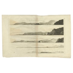
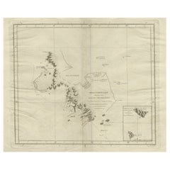
Antique Chart of the Friendly Islands or Nowadays Tonga, by Cook, 1784
About the Item
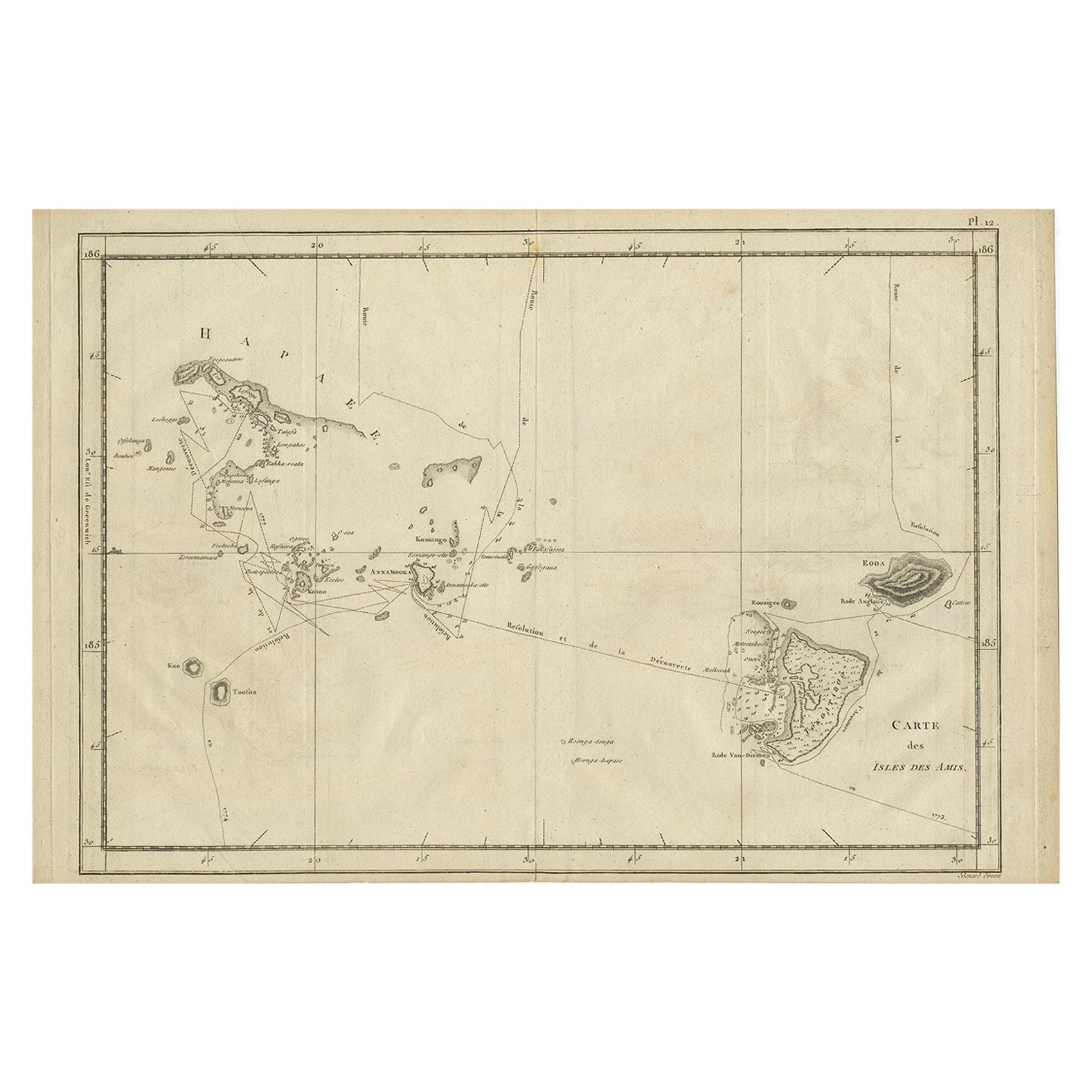
Antique print titled 'Chart of the Friendly Islands'. Antique map of the Friendly Islands depicting Rotterdam or Anamocka, Middelburg or Eaoowe and Amsterdam or Tongatabu. Originates from 'A Voyage to the Pacific Ocean: Undertaken, by the Command of His Majesty, for Making Discoveries in the Northern Hemisphere (..)' published in Dublin.
Artists and Engravers: James Cook (Author, 1728-1779) was a British captain, explorer and cartographer.
Condition: Good, general age-related toning. Defect lower left margin. Please study image carefully.
Date: 1784
Overall size: 42.5 x 29 cm.
Image size: 34.5 x 24 cm.
Antique prints have long been appreciated for both their aesthetic and investment value. They were the product of engraved, etched or lithographed plates. These plates were handmade out of wood or metal, which required an incredible level of skill, patience and craftsmanship. Whether you have a house with Victorian furniture or more contemporary decor an old engraving can enhance your living space. We offer a wide range of authentic antique prints for any budget.
- Creator:James Cook (Author)
- Dimensions:Height: 11.42 in (29 cm)Width: 16.74 in (42.5 cm)Depth: 0 in (0.01 mm)
- Materials and Techniques:
- Period:
- Date of Manufacture:1784
- Condition:Condition: Good, general age-related toning. Defect lower left margin. Please study image carefully.
- Seller Location:Langweer, NL
- Reference Number:
About the Seller
5.0
Platinum Seller
These expertly vetted sellers are 1stDibs' most experienced sellers and are rated highest by our customers.
Established in 2009
1stDibs seller since 2017
1,966 sales on 1stDibs
Typical response time: <1 hour
- ShippingRetrieving quote...Ships From: Langweer, Netherlands
- Return PolicyA return for this item may be initiated within 14 days of delivery.
More From This SellerView All
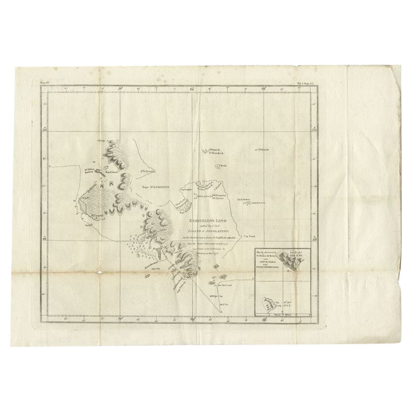
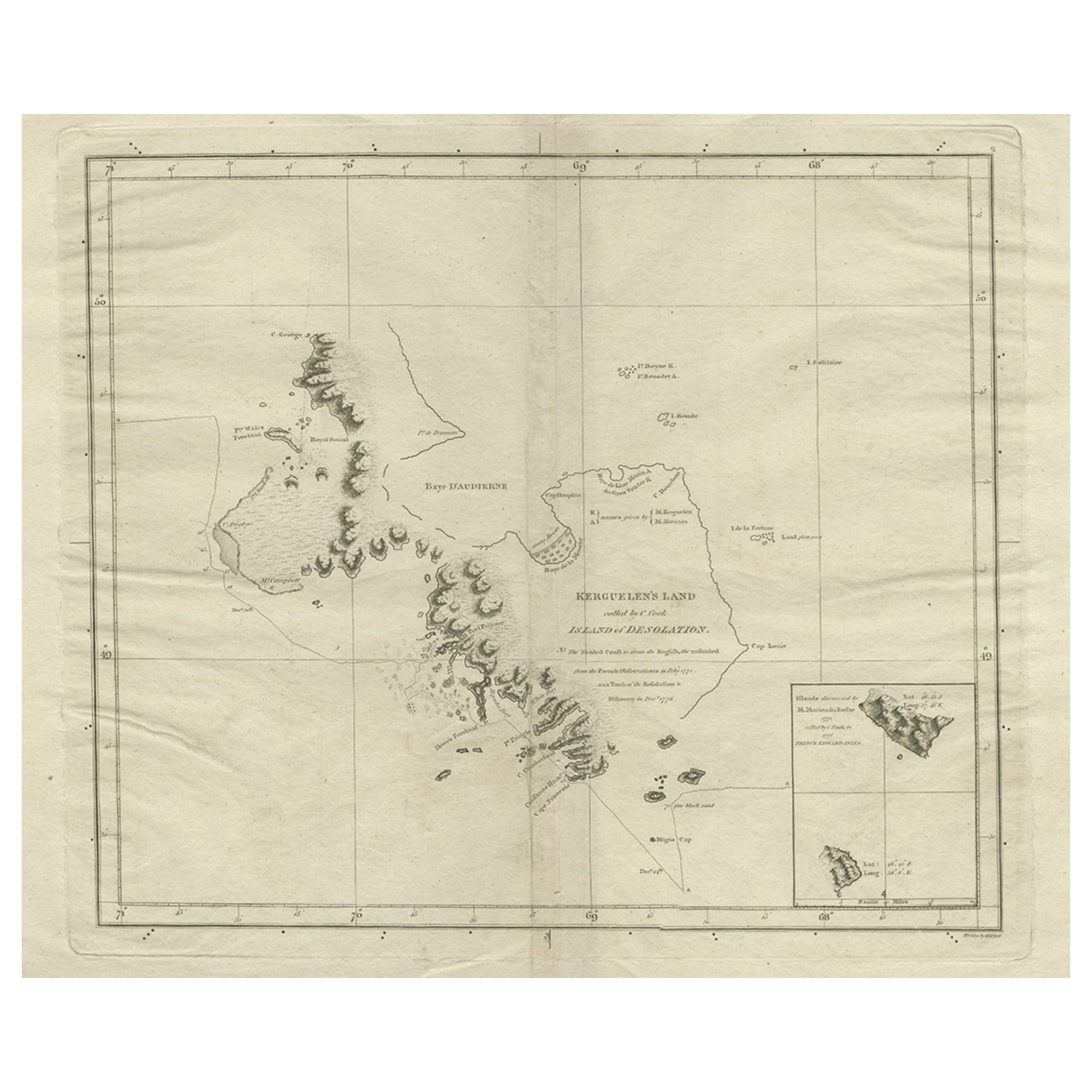
- Antique Map of Kerguelens Island Coast by Cook, 1784By James CookLocated in Langweer, NLAntique print titled 'Kerguelen's Land (..)'. Antique map of Kerguelens island coast, known today as the Desolation islands. Originates from 'A Voyage to the Pacific Ocean: Undertaken, by the Command of His Majesty, for Making Discoveries in the Northern Hemisphere (..)' published in Dublin. Artists and Engravers: James Cook...Category
Antique 18th Century Prints
MaterialsPaper
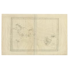
- Antique Chart of the Friendly Islands or Tonga in the Pacific Ocean, 1785By James CookLocated in Langweer, NLAntique print titled 'Chart of the Friendly Islands'. Antique map of the Friendly Islands depicting Rotterdam or Anamocka, Middelburg or Eaoowe and Amsterdam or Tongatabu. Originates...Category
Antique 18th Century Prints
MaterialsPaper
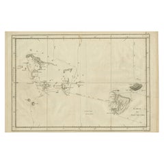
- Antique Engraved Map of the Friendly Islands or Tonga, ca.1785Located in Langweer, NLAntique map titled 'Carte des Isles des Amis'. Map of the Friendly Islands / Tonga. The Tongan people first encountered Europeans in 1616 when the Dutch vessel Eendracht, captain...Category
Antique 1780s Maps
MaterialsPaper
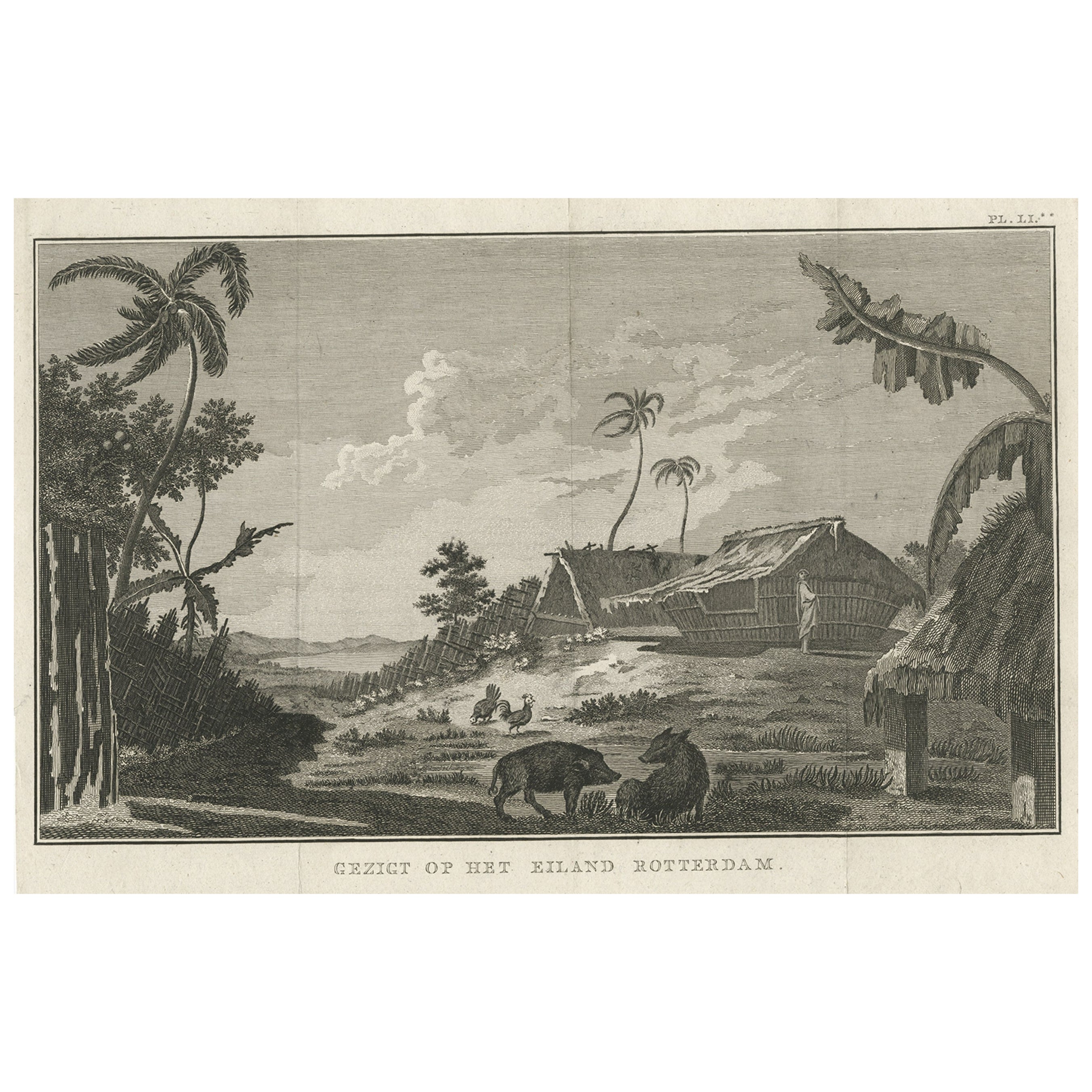
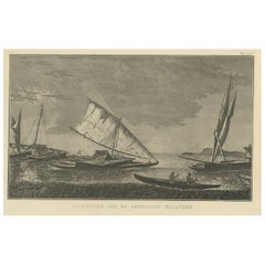
- Antique Print of Boats of the Friendly Islands or Tonga, by Cook, c.1801Located in Langweer, NLAntique print titled 'Vaartuigen van de Vrienden-Eilanden'. This print depicts various boats. Originates from 'Reizen rondom de Waereld' by J. Cook. Artists and Engravers: Author:...Category
Antique 19th Century Prints
MaterialsPaper
- Antique Print of Kerguelens Island by Cook, C.1784By James CookLocated in Langweer, NLAntique print titled 'Three views of Arched Point (..)'. Four views of Kerguelens Island/Desolation Islands, discovered by the Frenchman Marion du Fresne in 1772 and visited by Cook ...Category
Antique 18th Century Prints
MaterialsPaper
- Antique Map of Kerguelens Island Coast in the Indian Ocean by Cook, 1785By James CookLocated in Langweer, NLAntique print titled 'Kerguelen's Land (..)'. Antique map of Kerguelens island coast, known today as the Desolation islands. Originates from 'Voyage to the Pacific Ocean, undertaken ...Category
Antique 18th Century Prints
MaterialsPaper
You May Also Like
- Antique Anatomical Wall Chart Depicting the Human SkeletonLocated in Berghuelen, DEA rare 19th century anatomical wall chart depicting the human skeleton. On the sides On the sides are detailed description in German language. The wall...Category
Early 20th Century German Victorian Prints
MaterialsPaper
- 1865 Chart of the Islands of MadeiraLocated in Norwell, MARare James Imray chart from 1865 titled "Chart of the Islands of Madeira, Porto Santo and Dezerea" drawn from the survey made by Captain Ate Vidal Royal Navy, London. Published by Ja...Category
Antique 1860s European Maps
MaterialsPaper
- Antique Foldable Anatomical Wall Chart Depicting Human MusculatureLocated in Berghuelen, DEAntique Foldable Anatomical Wall Chart Depicting Human Musculature The rare 19th century anatomical wall chart depicts the human musculature and inter...Category
Early 20th Century German Victorian Prints
MaterialsWood, Paper
- Captain Cook's Exploration of Tahiti 18th C. Hand-Colored Map by BellinBy Jacques-Nicolas BellinLocated in Alamo, CAThis beautiful 18th century hand-colored copper plate engraved map is entitled "Carte de l'Isle de Taiti, par le Lieutenant J. Cook" was created by Jacques Nicolas Bellin and publish...Category
Antique Mid-18th Century French Maps
MaterialsPaper
- “On the Moors” or "Dogging" Signed by Heywood Hardy, Antique Print, 1894By Heywood HardyLocated in Colorado Springs, COPresented is an 1894 signed first edition goupil-gravure print by Heywood Hardy (1842-1933). The engraving was printed in Paris and published by Boussod Valadon & Co. Publishers, the successors to Goupil & Co. Designed as a companion to After the Drive, Hardy’s On the Moors (Dogging) depicts three hunters and their two dogs hunting ducks. The youngest of the three men is shooting his gun as the dogs excitedly wait to chase after the bird. This print is one of only 75 artist’s proofs and has been signed by the artist in pencil at the lower left corner of the print’s margin. Hunting has a long history in England and is considered a very traditional activity even today. One of the most popular forms of hunting is called “wildfowling” and targets wild geese and ducks. Often conducted on coastal marshes, wildfowling is typically a solitary or small group sport unlike the grand group fox and pheasant hunts...Category
Antique 1890s French Prints
MaterialsPaper
- Anatomical Wall Chart Depicting the Human Lymphatic and Blood VesselsLocated in Berghuelen, DEA rare 19-carat anatomical wall chart depicting the human lymphatic and blood vessels. On the sides with detailed description in German language. Print...Category
Early 20th Century German Victorian Prints
MaterialsPaper


Recently Viewed
View AllMore Ways To Browse
Antique Prints Dublin
Antique Tall Cabinet Doors
Used Metal Bed Frames
Vintage Metal And Glass Bar Cart
Wood Jewelry Display
18th Mahogany Chest On Chest
18th Century Mahogany Chest On Chest
Antique American Flag
Antique American Flags
Antique Casement Window
Antique Casement Windows
Antique Folding Doors
Antique Victorian Interior Doors
Brass Breakfront
Buffet Cabinet Pair
Butterfly Cabinet
French Mahogany Display Cabinet
French Serpentine Chest Commode