Items Similar to Ornate Cartography of Colonial Grandeur: The West India Islands around 1851

Want more images or videos?
Request additional images or videos from the seller
1 of 6
Ornate Cartography of Colonial Grandeur: The West India Islands around 1851
About the Item
This map is a part of John Tallis's series of maps, known for their detailed and ornamental style. John Tallis & Company, mentioned in the caption, was an English cartographic publisher active during the 19th century. The company was renowned for its detailed maps of countries and regions around the world, often including intricate border decorations, vignettes, and historically informative illustrations.
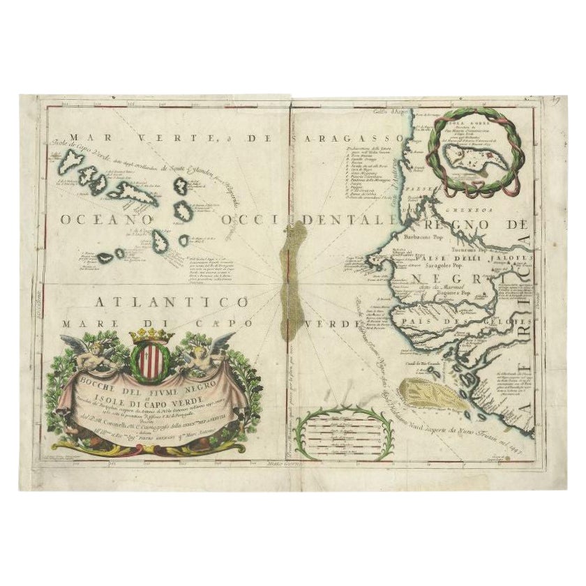
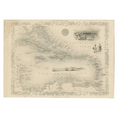
The map itself is a mid-19th-century depiction of the West Indies, which is a region of the North Atlantic Ocean in the Caribbean that consists of the island countries and surrounding waters of three major archipelagos: the Greater Antilles, the Lesser Antilles, and the Lucayan Archipelago. The detail on the map is quite accurate for its time, showing not only the geography but also marking important cities and ports, which would have been vital information during the era of British colonialism.
Robert Montgomery Martin, whose work is cited here, was a British author and colonial administrator, and his writings included comprehensive descriptions of the British colonies during the peak of the British Empire. His work was often used as the textual accompaniment to the maps produced by John Tallis.
The Tallis maps are characterized by their vignettes that illustrate local scenes, notable features, or important figures, which can be seen in the margins of the map. These vignettes are valuable for giving cultural and social context to the geographical information presented. It's not just a map but a piece of historical documentation that reflects the interests and perspectives of the British during the time it was made. The presence of these artistic elements makes Tallis maps not just navigational tools but also historical artifacts and works of art.
The map includes islands such as Cuba, Jamaica, Hispaniola (containing Haiti and the Dominican Republic), Puerto Rico, and various smaller islands of the Lesser Antilles, amongst others. The economic, geopolitical, and social conditions of these countries during the era when this map was made were heavily influenced by colonial powers, primarily by the empires of Europe, including the British Empire.
The screenshots from the map show various detailed sections of the West India Islands and surrounding areas, which include artistic elements and cartographic details typical of John Tallis maps:
1. The first image shows the northern part of the Caribbean, including the southern tip of Florida, the Bahamas, and the northwestern part of the Caribbean Sea. It features intricate border decorations that are a hallmark of Tallis's work. The map detail is quite meticulous, highlighting the geographical features and names of the islands, banks, and keys in the region.
2. The second image is focused on the central portion of the Caribbean Sea, showcasing islands and parts of the South American coast. It includes depictions of ships, indicating the region's maritime significance during the time the map was made. Again, this section displays a wealth of detail, naming even small islands and geographical features.
3. The third image zooms in on the top banner of the map, featuring the title "WEST INDIA ISLANDS" and an illustrative vignette showing a view of "Kingston, Jamaica, from the Commercial Rooms." There's also an inset showing the "Seal of Jamaica." These elements provide a historical and cultural context to the map and also serve as decorative embellishments that add to the aesthetic appeal of the document.
Each section of the map also includes a compass rose, and the map's scale is noted at the bottom, demonstrating its use as a navigational tool as well as an artistic object. The map would have served both as an informative guide to the islands in the Caribbean during the era of British colonial influence and as a decorative piece demonstrating the British interest in and connection to these regions.
- Dimensions:Height: 10.71 in (27.2 cm)Width: 14.26 in (36.2 cm)Depth: 0 in (0.02 mm)
- Materials and Techniques:
- Period:
- Date of Manufacture:1851
- Condition:Good given age. Original fold in middle as published. General age-related toning, please study scan carefully.
- Seller Location:Langweer, NL
- Reference Number:Seller: BG-13736-181stDibs: LU3054339299012
About the Seller
5.0
Platinum Seller
These expertly vetted sellers are 1stDibs' most experienced sellers and are rated highest by our customers.
Established in 2009
1stDibs seller since 2017
1,967 sales on 1stDibs
Typical response time: <1 hour
- ShippingRetrieving quote...Ships From: Langweer, Netherlands
- Return PolicyA return for this item may be initiated within 14 days of delivery.
Auctions on 1stDibs
Our timed auctions are an opportunity to bid on extraordinary design. We do not charge a Buyer's Premium and shipping is facilitated by 1stDibs and/or the seller. Plus, all auction purchases are covered by our comprehensive Buyer Protection. Learn More
More From This SellerView All
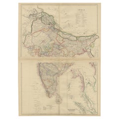
- Vintage Cartographic Collection Set of India Explored - W. G. Blackie's 1859Located in Langweer, NLAntique map titled 'India'. Original antique map of India with inset maps of Pegu, the Tenasserim Provinces, straits settlements. This map originate...Category
Antique Mid-19th Century Maps
MaterialsPaper
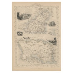
- Original Antique Map of the Channel Islands, Incl. Decorative Vignettes, 1851Located in Langweer, NLAntique map titled ‘Channel Islands’. Includes decorative vignettes titled St. Peters Port, Castle Cornet, Druidical altar near Lancresse, Mont Orgueil Castle and Jersey. Originates from 'The Illustrated Atlas, And Modern History Of The World Geographical, Political, Commercial & Statistical, Edited By R. Montgomery Martin'. Published; John Tallis London, New York, Edinburgh & Dublin. 1851. Drawn and Engraved by J. Rapkin. Artists and engravers: John Tallis (1817-1876) was a British map...Category
Antique 1850s Maps
MaterialsPaper
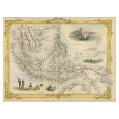
- Decorative Antique Map of the Malay Archipelago or East Indies Island, 1851Located in Langweer, NLAntique map Indonesia titled 'Malay Archipelago, or East India Islands'. With vignettes of Victoria Mount, New Guinea, Nativaes of New Guinea an...Category
Antique 1850s Maps
MaterialsPaper
- Engraving by Tallis and Rapkin of Map of the West Indies in The Caribbean, 1851Located in Langweer, NLJohn Tallis' 1851 map of the West Indies stands as a striking example of his renowned cartographic work. With meticulous detail and artistic embellishments, this map offers a compreh...Category
Antique Mid-19th Century Maps
MaterialsPaper
- Cartographic Elegance: The British Raj's India, 1882 Atlas by Blackie and SonLocated in Langweer, NLThese two maps are part of an 1882 atlas published by Blackie and Son, a notable publishing company in the 19th century known for their educational books and detailed atlases. The ma...Category
Antique 1880s Maps
MaterialsPaper
- 18th Century Cartographic Depiction of Upper India and Ceylon, 1835Located in Langweer, NLAn exquisite set of two maps, 'Carte de la Partie Superieure De L'Inde en de Cadu Gange,' masterfully crafted by the renowned 18th-century French cartographer, Charles Marie Rigobert...Category
Antique 1830s Maps
MaterialsPaper
You May Also Like
- Antique Lithography Map, West Africa, English, Framed, Cartography, VictorianLocated in Hele, Devon, GBThis is an antique lithography map of Western Africa. An English, framed atlas engraving of cartographic interest by John Rapkin, dating to the early Victorian period and later, circ...Category
Antique Mid-19th Century British Early Victorian Maps
MaterialsWood
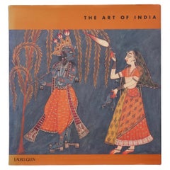
- The Art of IndiaLocated in Bradenton, FLThe Art of India. Hardcover book with dustjacket. First edition, published in 1997 by Laurel Glen Publishing. Illustrated, 97 pages.Category
Late 20th Century Books
MaterialsPaper
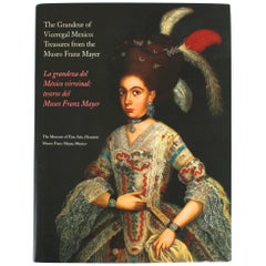
- The Grandeur of Viceregal Mexico; Treasures from the Museo Franz MayerLocated in valatie, NYThe Grandeur of Viceregal Mexico; Treasures from the Museo Franz Mayer. Houston: The Museum of Fine Arts, 2002. First edition hardcover with dust jacket. Spanish and English text. 36...Category
21st Century and Contemporary American Books
MaterialsPaper
- Colonial Silver VOC 'East-India Company' IngotLocated in Amsterdam, NLA silver 'V.O.C. AMSTERDAM' ingot circa 1738, with monogram and the assay mark of the Amsterdam Grill family With V.O.C. monogram and the A for Amsterdam. L. approx. 15.5 cm Weight approx. 2000 grams Note: The ingots were salvaged in 2004 from the wreck of the VOC indiaman Rooswijk, equipped by the Amsterdam VOC Chamber. The Rooswijk sank on its second voyage to the Dutch East Indies off the English coast on the Goodwin Sands...Category
Antique 18th Century Dutch Historical Memorabilia
MaterialsSterling Silver
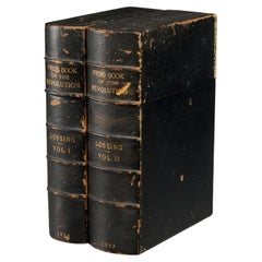
- The Pictorial Field-Book of the Revolution, 1851, (2) vols., Benson J. LossingBy S. Harper BrothersLocated in Morristown, NJ(2) vols., by Benson J. Lossing. ...Illustrations, by Pen and Pencil, of the History, Biography, Scenery, Relics, and Traditions of the War for Independence. Two volumes, the first i...Category
Antique 1850s American Victorian Books
MaterialsLeather, Paper
- Antique Oarsman's Map of the River Thames, English, Cartography, Published 1912Located in Hele, Devon, GBThis is an antique copy of The Oarsman's and Angler's Map of the River Thames - New Edition. An English, bound map book, published in English by Edward Stanford, London, this new edi...Category
Early 20th Century British Other Books
MaterialsPaper


Recently Viewed
View AllMore Ways To Browse
English Colonial Furniture
English Colonial
Southern Colonial
Colonial India
Furniture From British India
Ornate Keys
Antique British Hallmarks
Antique Ornate Key
Colonial Furniture Company
Furniture West Indies
West Indies Furniture
Antique Ship Parts
Art Of British India
West Indies Antique Furniture
Key West Furniture
Used Furniture Key West
Colonial British India Furniture
Colonial British India