Items Similar to Original Antique Map of North and South America in Attractive Old Coloring

Want more images or videos?
Request additional images or videos from the seller
1 of 6
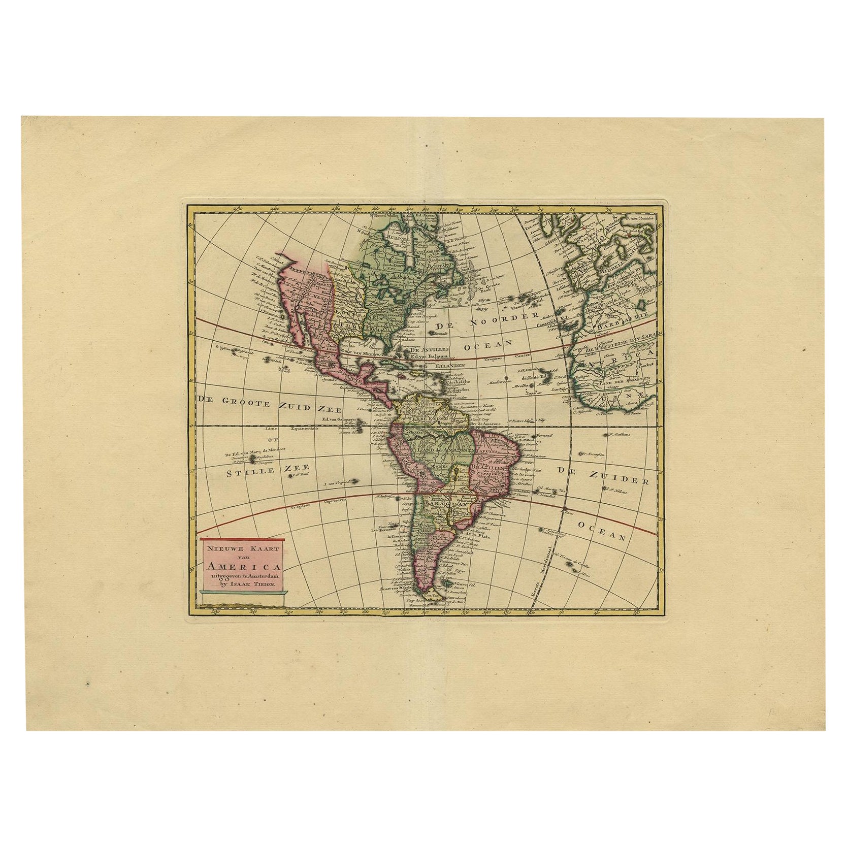
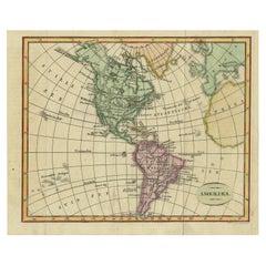
Original Antique Map of North and South America in Attractive Old Coloring
About the Item
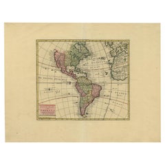
Antique map titled 'Nieuwe Kaart van America'. Beautiful map of America. The fabled Quivira is used to name a large mountain range placed just north of Mexico. Published by I. Tirion, circa 1750.
- Creator:Isaak Tirion (Artist)
- Dimensions:Height: 16.15 in (41 cm)Width: 19.69 in (50 cm)Depth: 0.02 in (0.5 mm)
- Materials and Techniques:
- Period:
- Date of Manufacture:c.1750
- Condition:Wear consistent with age and use. Beautiful original/contemporary hand coloring. Original folding line. General age-related toning, minor wear. Blank verso. Please study images carefully.
- Seller Location:Langweer, NL
- Reference Number:
About the Seller
5.0
Platinum Seller
These expertly vetted sellers are 1stDibs' most experienced sellers and are rated highest by our customers.
Established in 2009
1stDibs seller since 2017
1,965 sales on 1stDibs
Typical response time: <1 hour
- ShippingRetrieving quote...Ships From: Langweer, Netherlands
- Return PolicyA return for this item may be initiated within 14 days of delivery.
More From This SellerView All
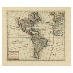
- Very Attractive Map of North and South America and Western Part of Africa, 1744Located in Langweer, NLAntique map titled 'Nieuwe Kaart van America.' Very attractive map of North and South America, the western part of Africa and south west Europe. With full contemporary hand colouring...Category
Antique 18th Century Maps
MaterialsPaper
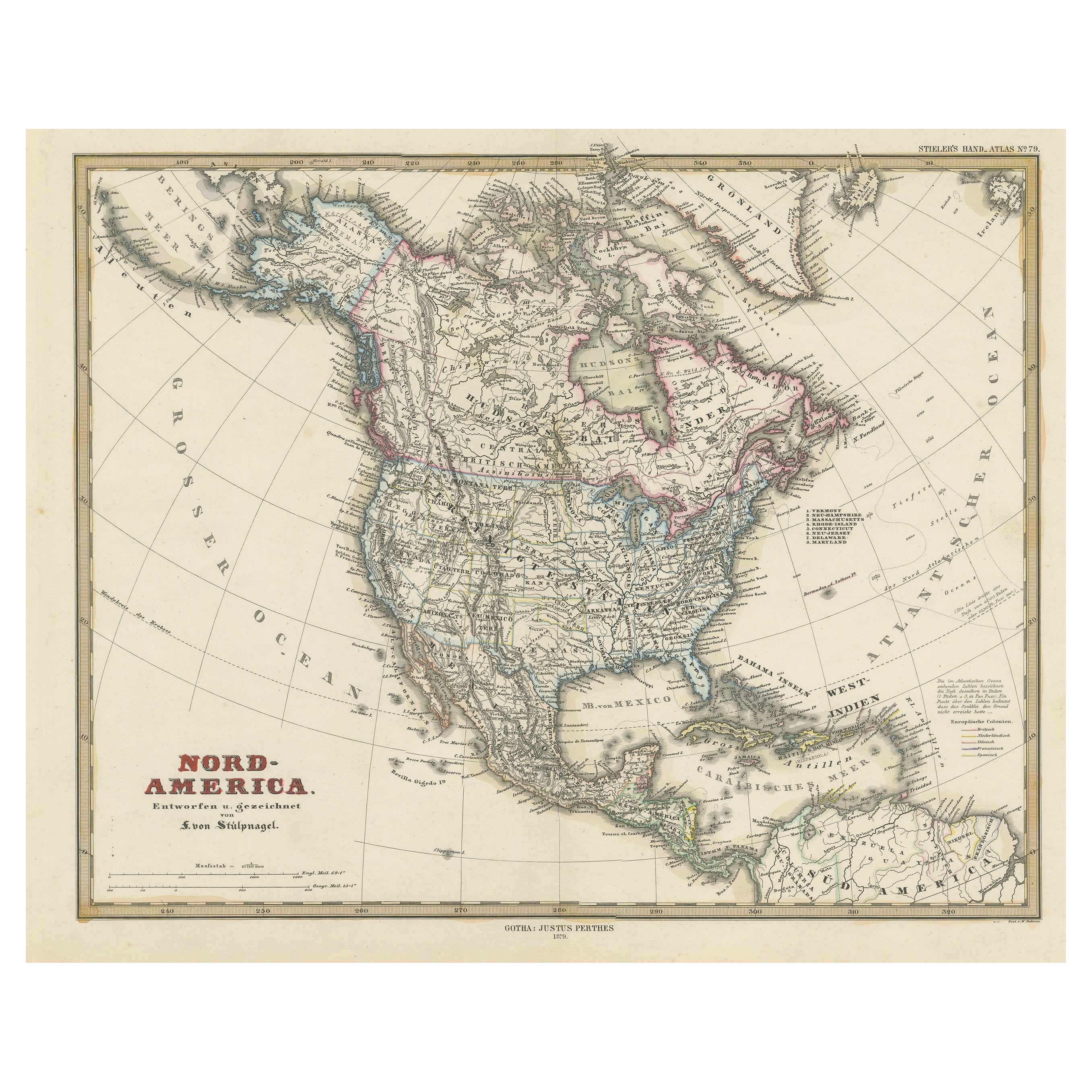
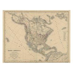
- Antique Map with Hand Coloring of North America and the West IndiesLocated in Langweer, NLOriginal antique map titled 'Nord-America'. Old map of North America and the West Indies. This map originates from Stielers Handatlas, published circa 1879. Stielers Handatlas (a...Category
Antique Late 19th Century Maps
MaterialsPaper
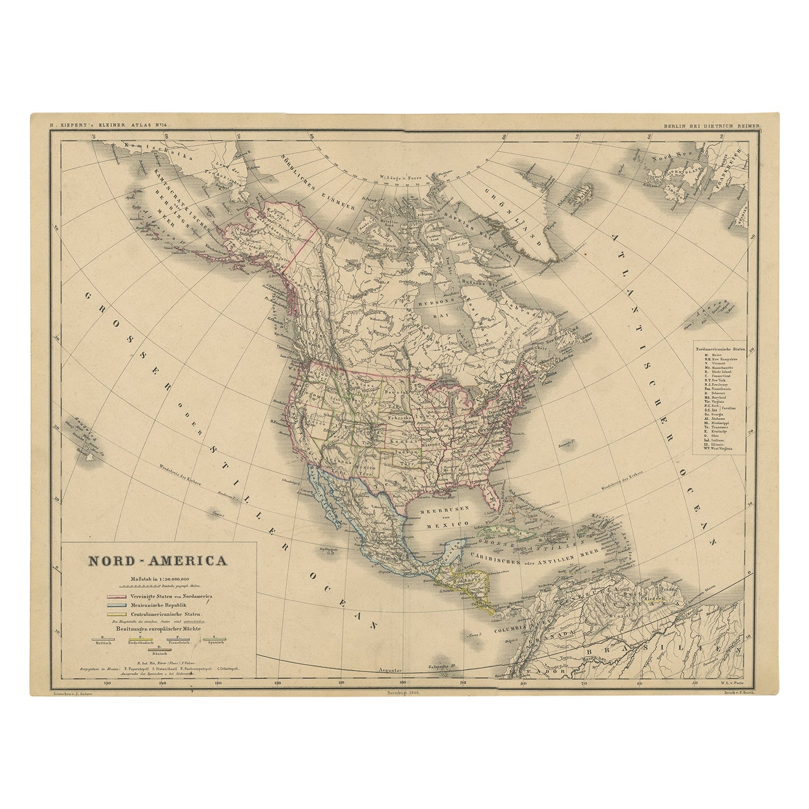
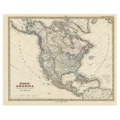
- Old Original Antique German Map of North America, ca.1870Located in Langweer, NLAntique map titled 'Nord-America'. Old map of North America. This map originates from 'H. Kiepert's Kleiner Atlas der Neueren Geographie für Schule und Haus'. Artists and Engrave...Category
Antique 1870s Maps
MaterialsPaper
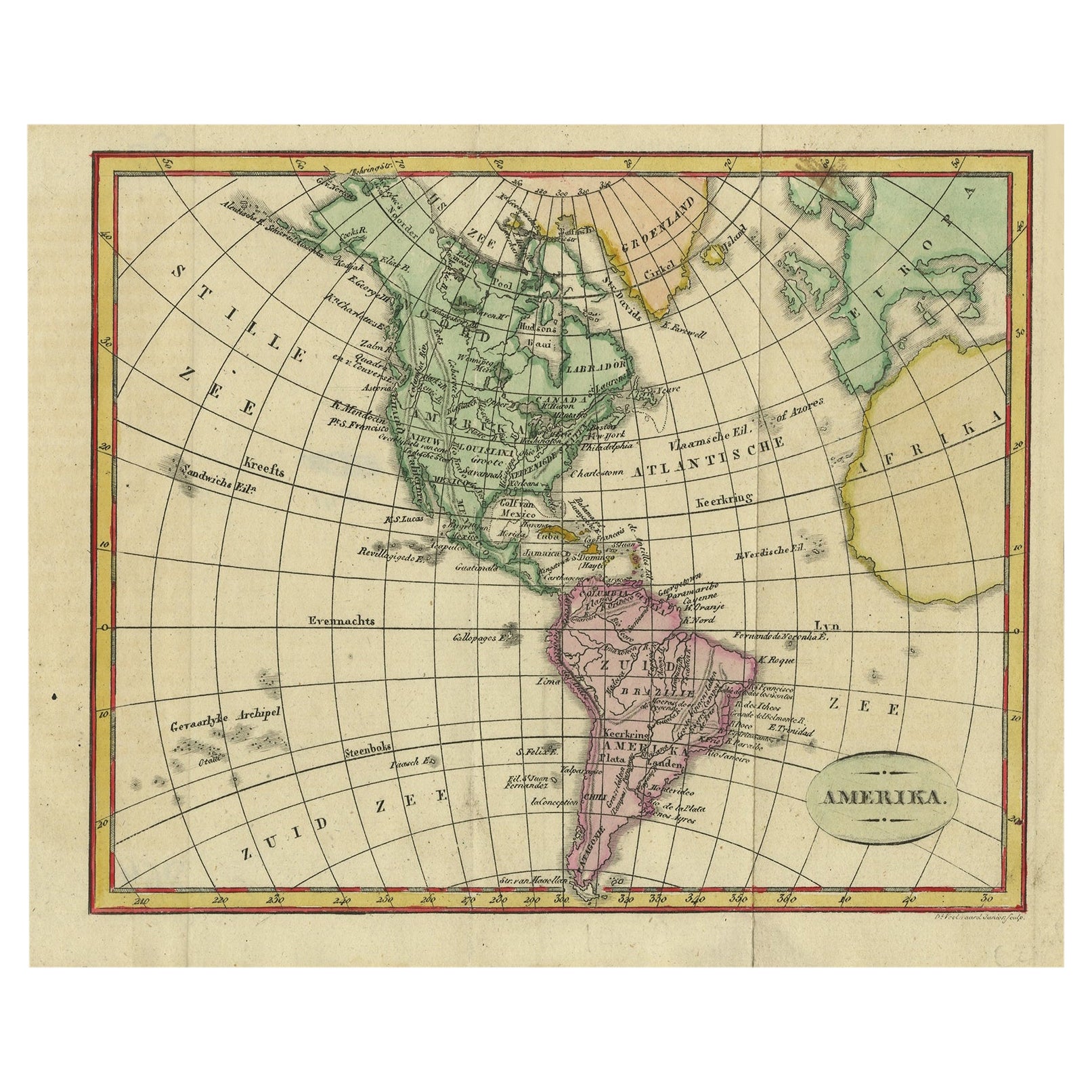
- Decorative Dutch Antique Map of North and South America, 1841Located in Langweer, NLDescription: Antique map titled 'Amerika'. Small map of North and South America. This map originates from the Dutch publication 'De Aarde, beschouwd in haren Natuurlijken Toestan...Category
Antique 1840s Maps
MaterialsPaper
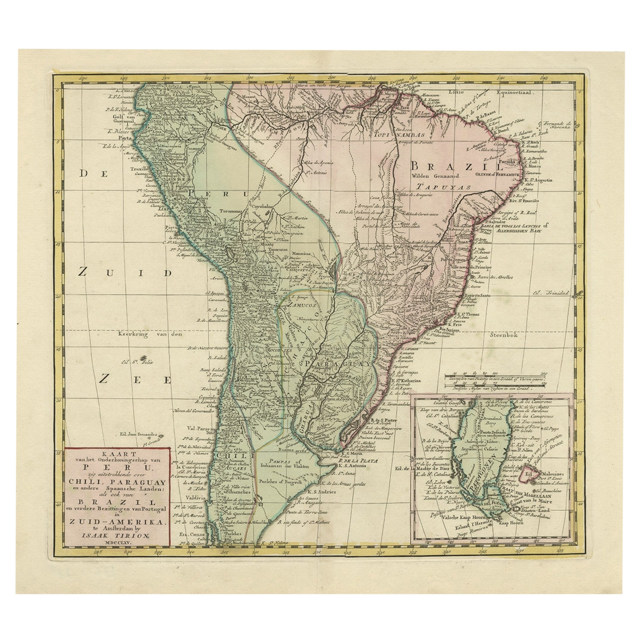
- Attractive Antique Hand-Coloured Map of South America, ca.1765Located in Langweer, NLAntique map titled 'Kaart van het Onderkoningschap van Peru zig uitstrekkende: over Chile, Paraguay en andere Spaansche Landen als ook van Brazil en verdere Bezittingen van Portugal ...Category
Antique 1760s Maps
MaterialsPaper
- Antique Hand-Coloured Map of North and South America, ca.1765Located in Langweer, NLDescription: Antique map titled 'Nieuwe Kaart van Amerika.' Attractive map of North and South America, the western part of Africa and south west Europe. Source unknown, to be determi...Category
Antique 1760s Maps
MaterialsPaper

You May Also Like
- Original Antique Map of South America. C.1780Located in St Annes, LancashireGreat map of South America Copper-plate engraving Published C.1780 Two small worm holes to left side of map Unframed.Category
Antique Early 1800s English Georgian Maps
MaterialsPaper
- Original Antique Map of South America, circa 1830Located in St Annes, LancashireGreat map of South America Copper plate engraving Published by Butterworth, Livesey & Co., circa 1830 Unframed.Category
Antique Early 1800s English Other Maps
MaterialsPaper
- Large Antique 1859 Map of North AmericaLocated in Sag Harbor, NYThis Map was made by Augustus Mitchell in 1859 It is in amazing condition for being 163 years old. This price is for the rolled up easy to ship version of this piece. I will be Frami...Category
Antique Mid-19th Century American Maps
MaterialsCanvas, Paper

- Original Antique Map of South America by Thomas Clerk, 1817Located in St Annes, LancashireGreat map of South America Copper-plate engraving Drawn and engraved by Thomas Clerk, Edinburgh. Published by Mackenzie And Dent, 1817 Unframed.Category
Antique 1810s English Maps
MaterialsPaper
- Original Antique Map of South Africa, Arrowsmith, 1820Located in St Annes, LancashireGreat map of South Africa. Drawn under the direction of Arrowsmith. Copper-plate engraving. Published by Longman, Hurst, Rees, Orme and Br...Category
Antique 1820s English Maps
MaterialsPaper
- Original Antique Map of South East Asia, Arrowsmith, 1820Located in St Annes, LancashireGreat map of South East Asia Drawn under the direction of Arrowsmith Copper-plate engraving Published by Longman, Hurst, Rees, Orme and Brown, 1820 Unframed.Category
Antique 1820s English Maps
MaterialsPaper


Recently Viewed
View AllMore Ways To Browse
Mexican 18th Century
Mexican 18th Century Furniture
Mexico Old Map
South Pacific Map
Antique Maps Of Philadelphia
Antique Navigation Tools
Antique Navigational Tools
John Speed Map
John Speed Maps
Malaysia Map
Sailing Charts
1820 World Map
Antique Amazon
Antique Map Israel
Antique Map Of Israel
Antique Maps Dublin
Antique Maps Of Israel
Antique Maps Of Russian Empire