Items Similar to Original Antique Map of the Area of Bremen and Lower Saxony

Want more images or videos?
Request additional images or videos from the seller
1 of 6
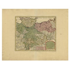
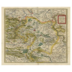
Original Antique Map of the Area of Bremen and Lower Saxony
About the Item
Antique map titled 'Ducatus olim Episcopatus Bremensis et ostiorum Albis et Visurgis Fluviorum novissima Descriptio'. Original old map of the area of ??Bremen and Lower Saxony. Uncommon edition by Janssonius, published circa 1644.
Johannes Janssonius (1588, Arnhem – buried July 11, 1664, Amsterdam) was a Dutch cartographer and publisher who lived and worked in Amsterdam.
- Creator:Johannes Janssonius (Artist)
- Dimensions:Height: 19.41 in (49.3 cm)Width: 22.56 in (57.3 cm)Depth: 0.02 in (0.5 mm)
- Materials and Techniques:
- Period:Mid-17th Century
- Date of Manufacture:circa 1644
- Condition:Wear consistent with age and use. Original/contemporary hand coloring. Original folding line, with splits. Defect in right margin. Few closed tears along outline coloring, few small defects still affecting image and margins. Blank verso. Please study image carefully.
- Seller Location:Langweer, NL
- Reference Number:
About the Seller
5.0
Platinum Seller
These expertly vetted sellers are 1stDibs' most experienced sellers and are rated highest by our customers.
Established in 2009
1stDibs seller since 2017
1,966 sales on 1stDibs
Typical response time: <1 hour
- ShippingRetrieving quote...Ships From: Langweer, Netherlands
- Return PolicyA return for this item may be initiated within 14 days of delivery.
More From This SellerView All
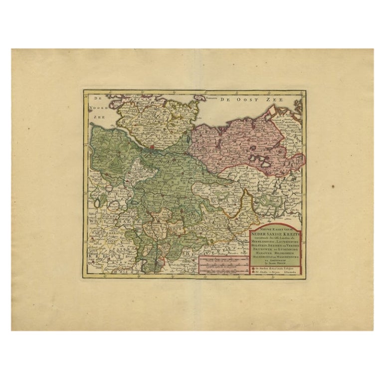
- Antique Map of Lower Saxony in Germany, c.1740Located in Langweer, NLAntique map titled 'Nieuwe Kaart van de Neder Saxise Kreits (..).' Attractive detailed map showing Lower Saxony, Germany, including Mekelenburg, Lauwenburg, Holstein, Bremen, Verden ...Category
Antique 18th Century Maps
MaterialsPaper
- Antique Map of Lower Saxony by Clouet, 1787Located in Langweer, NLAntique map titled 'Basse Saxe'. Antique map of Lower Saxony, Germany. Originates from 'Geographie moderne avec une introduction' by J.B.L. Clouet.Category
Antique Late 18th Century Maps
MaterialsPaper
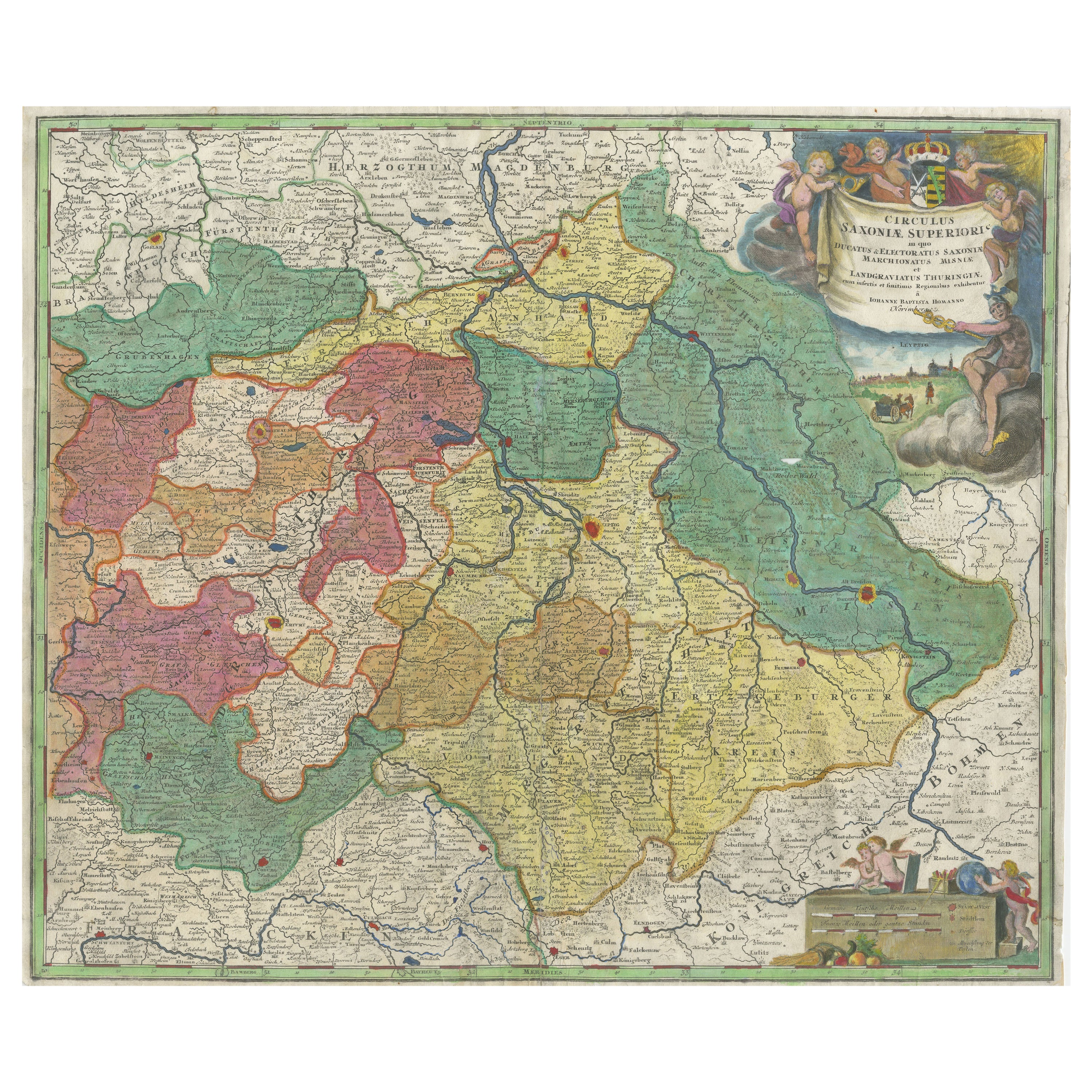
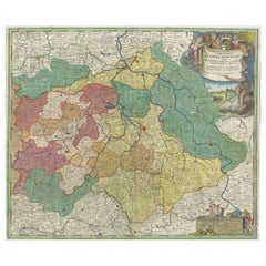
- Antique Map of Saxony, GermanyLocated in Langweer, NLOriginal antique map titled 'Circulus Saxoniae Superioris'. Original antique map of Saxony, Germany. The cities of Leipzig, Freiburg and many others are highlighted in gold. This map originates from 'Atlas Novus Terrarum Orbis...Category
Antique Early 18th Century Maps
MaterialsPaper
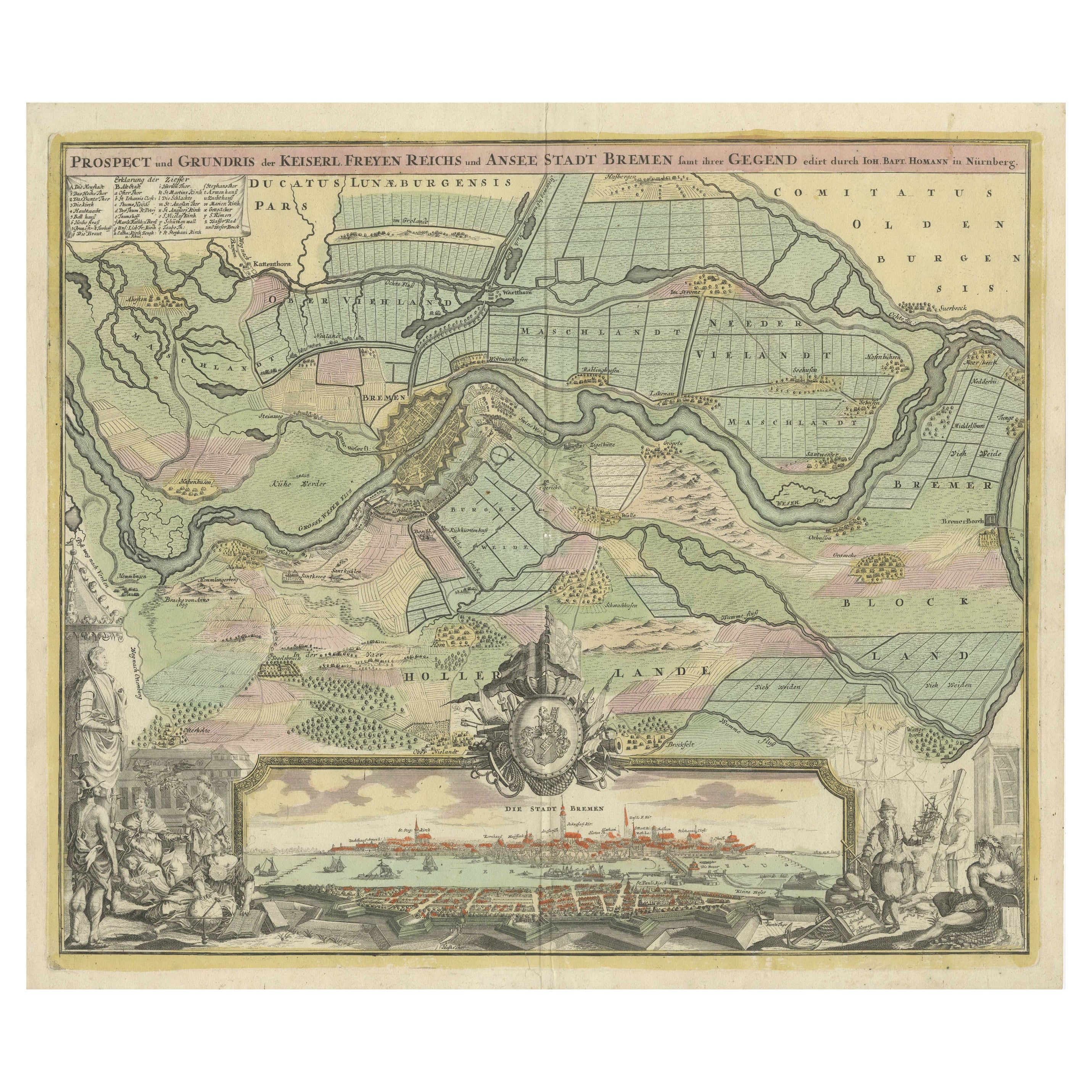
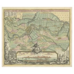
- Large Antique Map of the City of Bremen and Surroundings, GermanyLocated in Langweer, NLOriginal antique map titled 'Prospect und Grundris der Keiserl Freyen Reichs und Ansee Stadt Bremen (..)'. This is a superb chart of the city of Bremen and the surrounding small vill...Category
Antique Early 18th Century Maps
MaterialsPaper
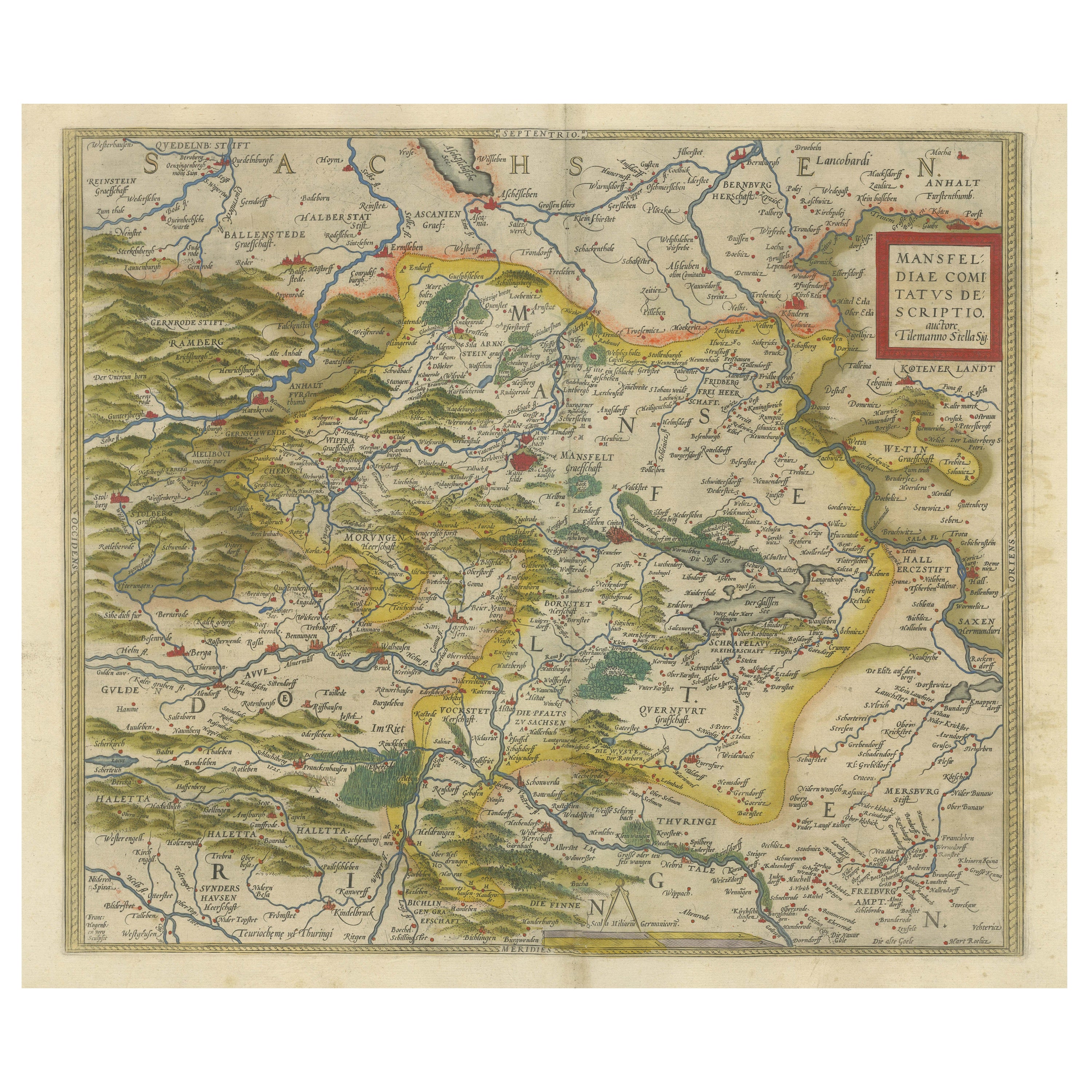
- Antique Map of the Region of Mansfeld, Saxony-Anhalt, GermanyBy Abraham OrteliusLocated in Langweer, NLAntique map titled 'Mansfeldiae Comitatus Descriptio'. Original antique map of the region of Mansfeld, Saxony-Anhalt, Germany. Shows the area between Halle a. d. Saale, Aschersleben,...Category
Antique Early 17th Century Maps
MaterialsPaper
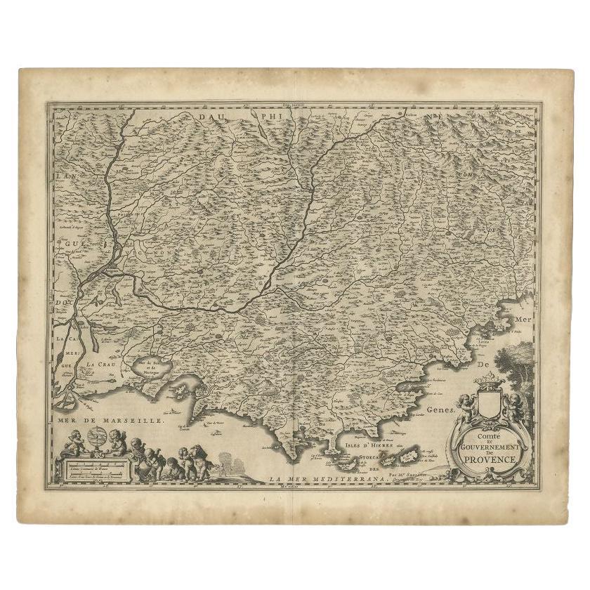
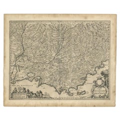
- Original Antique Map of the Southern Coast of France by Janssonius, 1657By Johannes JanssoniusLocated in Langweer, NLAntique map of France titled 'Comté et Gouvernement de Provence'. Decorative map of the southern coast of France. This map originates from 'Atlas Novus,...Category
Antique 17th Century Maps
MaterialsPaper

You May Also Like
- Original Antique Map of India. C.1780Located in St Annes, LancashireGreat map of India Copper-plate engraving Published C.1780 Three small worm holes to right side of map and one bottom left corner Unframed.Category
Antique Early 1800s English Georgian Maps
MaterialsPaper

- Original Antique Map of Asia. C.1780Located in St Annes, LancashireGreat map of Asia Copper-plate engraving Published C.1780 Two small worm holes to right side of map Unframed.Category
Antique Early 1800s English Georgian Maps
MaterialsPaper

- Original Antique Map of Italy. C.1780Located in St Annes, LancashireGreat map of Italy Copper-plate engraving Published C.1780 Unframed.Category
Antique Early 1800s English Georgian Maps
MaterialsPaper

- Original Antique Map of The World by Thomas Clerk, 1817Located in St Annes, LancashireGreat map of The Eastern and Western Hemispheres On 2 sheets Copper-plate engraving Drawn and engraved by Thomas Clerk, Edinburgh. Published by Mackenzie And Dent, 1817 ...Category
Antique 1810s English Maps
MaterialsPaper
- Original Antique Map of Ireland- Tipperary and Waterford. C.1840Located in St Annes, LancashireGreat map of Tipperary and Waterford Steel engraving Drawn under the direction of A.Adlard Published by How and Parsons, C.1840 Unframed.Category
Antique 1840s English Maps
MaterialsPaper
- Original Antique Map of Ireland- Kerry. C.1840Located in St Annes, LancashireGreat map of Kerry Steel engraving Drawn under the direction of A.Adlard Published by How and Parsons, C.1840 Unframed.Category
Antique 1840s English Maps
MaterialsPaper


Recently Viewed
View AllMore Ways To Browse
Used Furniture In The Area
Antique Map Bremen
Antique Maps Of Virginia
Framed Africa Maps
G Plan Antique Furniture
G Plan Furniture Antique Furniture
Map Hawaii
Napoleon Map
Rand Mcnally Antique Maps
Victorian Staircase
Alsace Map
Antique Great Lakes Map
Antique Map Chile
Antique Map Of Jerusalem
Antique Ohio Maps
Burgundy Map
Macedonia Map
Map Of Hungary