Items Similar to Italian Parchment Map of the City of Pisa Dated, 1640


Want more images or videos?
Request additional images or videos from the seller
1 of 10
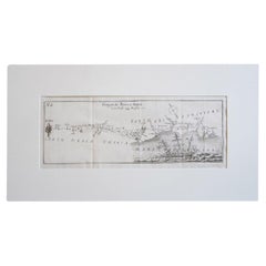
Italian Parchment Map of the City of Pisa Dated, 1640
About the Item
An antique map of the Tuscan city of Pisa engraved for The 'Itinerarium Italiæ Nov-antiquæ' by Matthäus Merian the Elder and printed in 1640. The original paper from 1640 is well preserved. We have expertly mounted the map here in Florence to protect it.
The city is depicted from a bird's eye view using extraordinarily beautiful detailed engraving which captures every detail within the ancient cities walls.
In Pisa: Detail of Piazza del Duomo with the Leaning Tower, the Arsenale built where the Arno leaves the city and the large vegetable garden areas that surround the city's medieval walls. This ancient print of Pisa includes a legend and the coat of arms of the maritime city.
Matthäus Merian the Elder (1593-1650) was a Swiss engraver born in Basel who worked in Frankfurt and illustrated many publications from the late sixteenth century.
We also have a map of Lucca by Matthäus Merian the Elder and printed in 1640 available for sale. We recommend framing these pieces under glass to preserve them for another 400 years.
Dimensions:
Uniform Mount: H43cm X W55cm
Map Pisa: H26cm X W34cm.
- Creator:Matthäus Merian the Elder (Author)
- Dimensions:Height: 10.63 in (27 cm)Width: 15.36 in (39 cm)Depth: 0.4 in (1 cm)
- Materials and Techniques:
- Place of Origin:
- Period:1640-1649
- Date of Manufacture:1640
- Condition:
- Seller Location:Roma, IT
- Reference Number:1stDibs: LU8425233750062
Matthäus Merian the Elder
Matthäus Merian is one of the most respected Swiss/German artists and engravers of the 17th century. In addition to creating a large number of illustrations and maps, he passed his knowledge and skill to his children, who followed in the family tradition. His son Matthäus Merian, the Younger was an accomplished engraver. His daughter Maria Sybella Merian in addition to becoming a prominent artist, became one of the greatest woman scientists of the 18th century as an entomologist. Her engravings of insects in their natural habitats are as sought after by collectors as are her father's illustrations.
About the Seller
5.0
Gold Seller
These expertly vetted sellers are highly rated and consistently exceed customer expectations.
Established in 2019
1stDibs seller since 2023
24 sales on 1stDibs
Typical response time: 5 hours
- ShippingRetrieving quote...Ships From: Amelia, Italy
- Return PolicyA return for this item may be initiated within 3 days of delivery.
More From This SellerView All
- 1880s Map of The Italian Alps from Milan to Lake GardaLocated in Roma, ITGeographical Map of the Profile and Elevation of the Italian Alps from Milano to Lake Garda. The map features the name of each peak and key cities including Monza, Brescia and Bergam...Category
Antique 1880s Italian Maps
MaterialsParchment Paper
- Antique Italian Map of Viaggio da Roma a Napoli 1775Located in Roma, ITAn original print from 1775 showing an early route map of the journey from Rome to Naples. This route map was part of a collection of travellers routes published in a book translated...Category
Antique 1770s Italian Maps
MaterialsParchment Paper
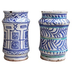
- Pair of Italian Hand-Painted Ceramic Pots / Albarelli made in the late 1800sLocated in Roma, ITA beautiful and rare pair of maiolica patterned Italian albarelli, late 1800s early 1900s. Found in Palazzo Torlogna in Rome. Alberelli were ancient storage containers often used in...Category
Antique Early 19th Century Italian Urns
MaterialsCeramic
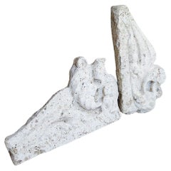
- Pair of 17th Century Italian Travertine MantlesLocated in Roma, ITA pair of 300 year old travertine mantles salvaged from a 17th century church in Le Marche. The stone is absolutely beautiful and the pieces have aged allowing for us still to see th...Category
Antique 17th Century Italian Abstract Sculptures
MaterialsTravertine
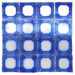
- Set of 32 Blue and White French ceramic tiles made in the 1930sLocated in Roma, ITA set of 32 individual French ceramic tiles in blue and white. Each tile is 11cm x 11cm and the set can be used extrenally or internally to decorate a kicthen or terrace space. The ...Category
Vintage 1920s French Flooring
MaterialsCeramic
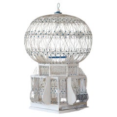
- Early 1900s Vintage Italian BirdcageLocated in Roma, ITI have been on the lookout for the ideal vintage birdcage for some time and recently came across this wonderful specimen in Rome. It is made of wood and metal wire in cream and blue....Category
Early 20th Century Italian Country Bird Cages
MaterialsMetal

You May Also Like
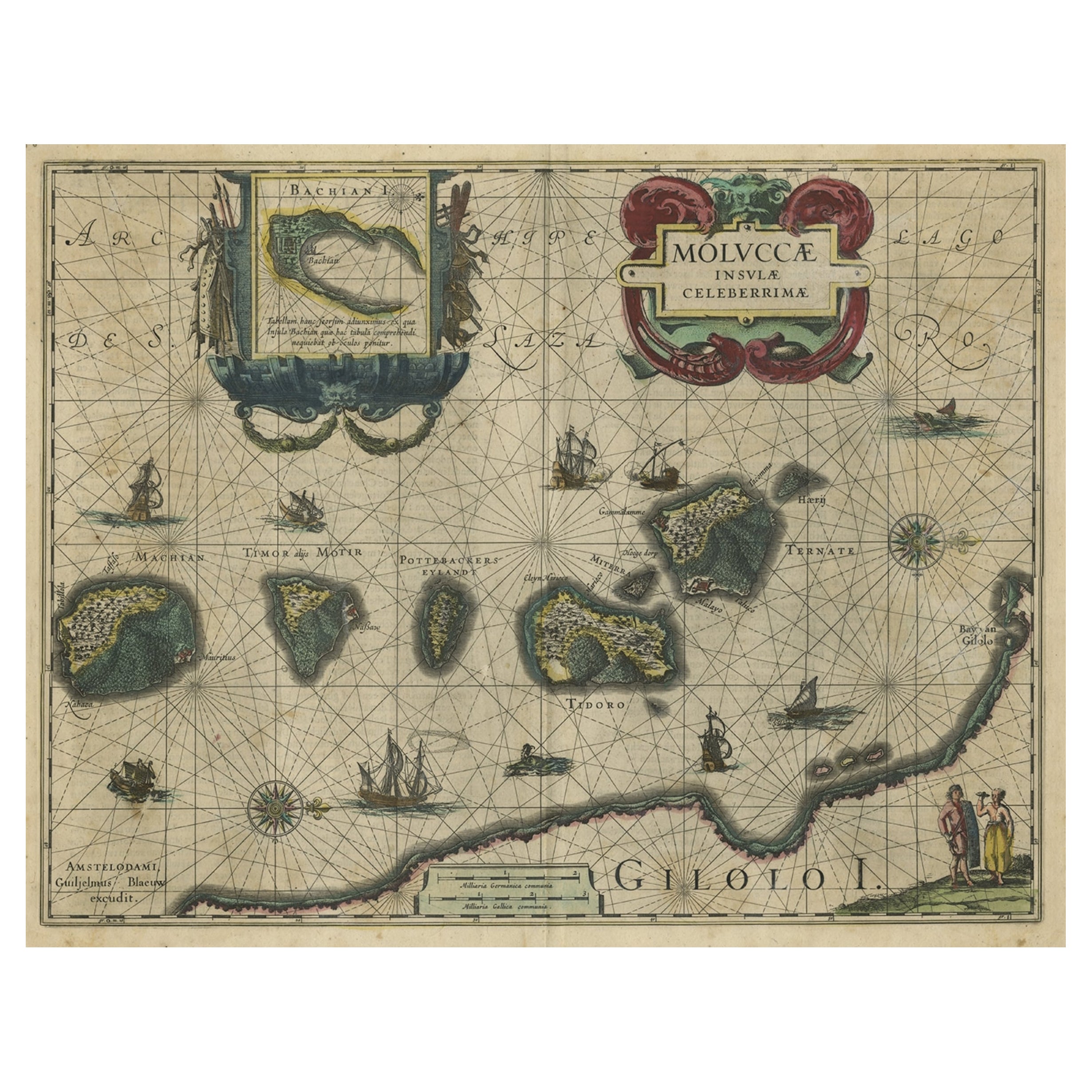
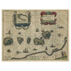
- Antique Map of the Maluku Islands by Blaeu, c.1640Located in Langweer, NLAntique map titled 'Moluccae Insulae Celeberrimae'. Decorative map of the Maluku Islands, also known as the Moluccas or the Spice Islands. Inset of the island of Bachian (Batjan) in ...Category
Antique 17th Century Maps
MaterialsPaper
- Antique Map of the Region of Bourbonnais by Janssonius, circa 1640Located in Langweer, NLAntique map titled 'Bourbonois - Borbonium Ducatus'. Old map of the former region of Bourbonnais, France. It includes the cities of Bourbon, Moulins, Charenton, Brulles, Varennes and...Category
Antique Mid-17th Century Maps
MaterialsPaper
- Antique Map of the Region of Blois by Janssonius, 'circa 1640'By Johannes JanssoniusLocated in Langweer, NLAntique map titled 'Description du Blaisois'. Old map of the region of Blois, France. It shows the city of Blois, Amboise, the Loire River and more. Published by J. Janssonius, circa...Category
Antique Mid-17th Century Maps
MaterialsPaper
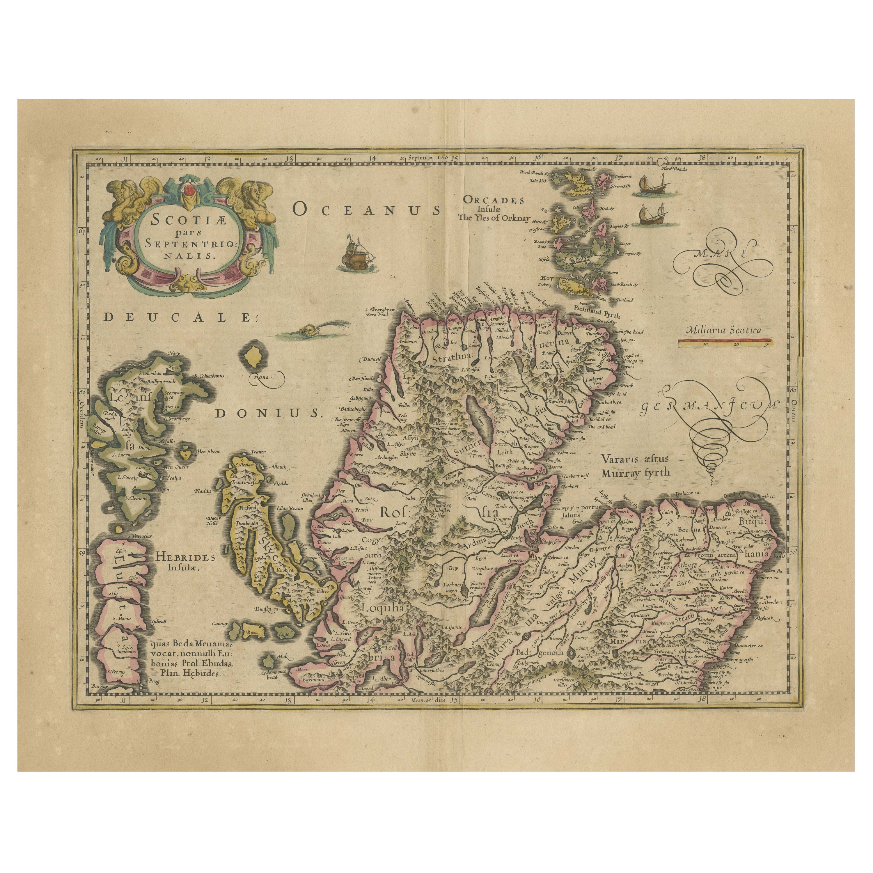
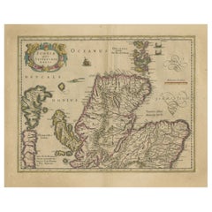
- Original Antique Map of the Northern Part of Scotland, circa 1640Located in Langweer, NLThe antique map, titled 'Scotiae pars septentrionalis,' depicts the northern part of Scotland. Crafted by Hondius around 1640, this map is a historical treasure showcasing the geogra...Category
Antique Mid-17th Century Maps
MaterialsPaper
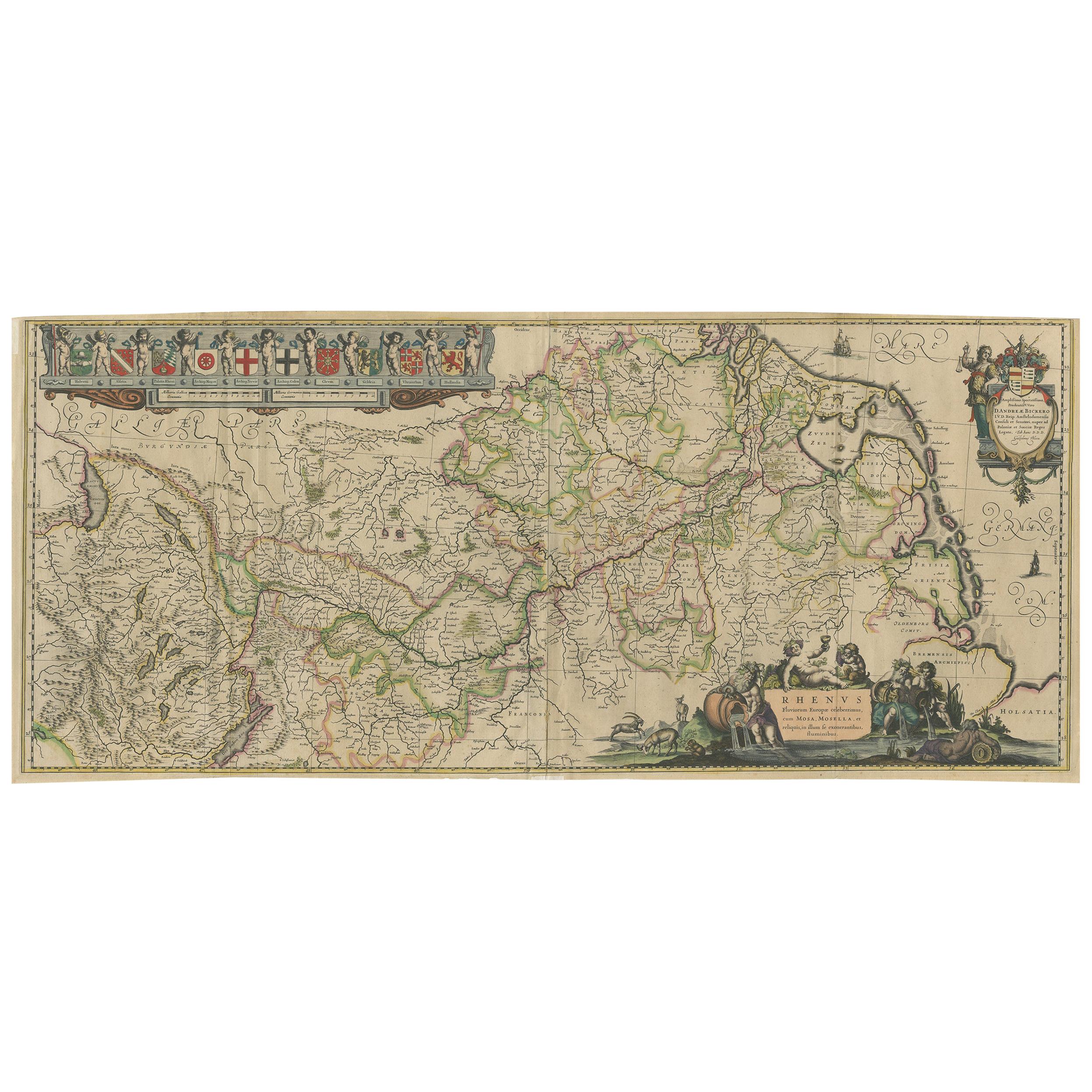
- Antique Map of the Course of the Rhine River by Blaeu, circa 1640Located in Langweer, NLAntique map titled 'Rhenus Fluviorum Europae celeberrimus, cum Mosa, Mosella, et reliquis, in illum se exonerantibus, fluminibus'. Beautiful map of the course of the Rhine River...Category
Antique Mid-17th Century Maps
MaterialsPaper
- Decorative Map of the Spice Islands in the Mollucas, Indonesia, ca.1640Located in Langweer, NLAntique map titled 'Moluccae Insulae Celeberrimae'. Decorative map of the Spice Islands. Inset of the Island of Bachian (Batjan) in an elaborate frame as well as a Moluccan couple in the lower right corner in Europeanized native dress. Artists and Engravers: Willem Janszoon Blaeu (1571-1638) was a prominent Dutch geographer and publisher. Born the son of a herring merchant, Blaeu chose not fish but mathematics and astronomy for his focus. He studied with the famous Danish astronomer Tycho...Category
Antique 1640s Maps
MaterialsPaper


Recently Viewed
View AllMore Ways To Browse
Used Furniture In The Area
City Used Office Furniture
Sale Italian Antique
Italian Vegetable
Italy Vegetables
The Captured Bird
Italian Coat Of Arms
Large Wall Map
Garden Tower
Used Tower Garden
Framed Coat Of Arms
Antique Italian Coat Of Arms
Large Wall Maps
Map Of Switzerland
Merian Engraving
Maritime Engraving
Tuscan Glass
Antique Parchment