Items Similar to Flanders, Holland & Norfolk: Hand-Colored 17th Century Sea Chart by Collins


Want more images or videos?
Request additional images or videos from the seller
1 of 8
Flanders, Holland & Norfolk: Hand-Colored 17th Century Sea Chart by Collins
About the Item
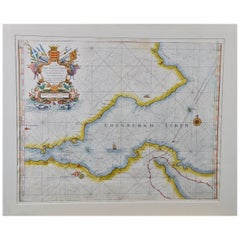
This hand-colored chart of the seas about Flanders, Holland, Frisia, and Norfolk is from "Great Britain's Coasting Pilot. Being a New and Exact Survey of the Sea-Coast of England" by Captain Greenville Collins, first published in 1693. It depicts the seas between the east coast of England and the west coast of Flanders and Holland, along with multiple islands adjacent to the coasts. Prominent land features include the cities of Amsterdam, Antwerp, Bruges, Delft, Rotterdam, Yarmouth and Dover. The chart includes several compass roses and extensive rhumb lines. A beautiful and colorful cartouche in the lower right includes a dedication to Sir John Ashby, "Admiral of the Blew".
These sea charts by Captain Greenvile Collins (1643-1694) are beautiful, colorful and striking, as well as historically very important to the British navy for approximately 100 years. Captain Collins was appointed “His Majesty’s Hydrographer” by King Charles II and asked to survey the coast of Great Britain and plot all of the harbors, rivers and islands, etc. This took seven years and the resulting charts were first published in 1693. They were published until 1792.
We have 16 sea charts from this series that are all the same size and are framed and matted identically. The frames are a unique plexiglass sleeve design, measuring 27.75" x 23' x 0.5" and the mats are a cream color. There is a central fold, as issued, and one tiny spot in the left lower chart. It is otherwise in excellent condition.
The provenance for these sea charts is very interesting. They were owned by Tom Perkins, who is considered one of the fathers of Silicon Valley. He was one of the founders of Kleiner Perkins Cauffield and Byers, the first big and most influential Silicon Valley venture capital company. Perkins himself was an avid sailor and had at the time the largest and most technologically advanced sailing yacht in the world, the Maltese Falcon. I have 16 of his sea charts that are all the same size and are framed and matted identically. The frames are a unique plexiglass sleeve design.
- Creator:Captain Greenvile Collins (Artist)
- Dimensions:Height: 23 in (58.42 cm)Width: 27.75 in (70.49 cm)Depth: 0.5 in (1.27 cm)
- Materials and Techniques:Paper,Engraved
- Place of Origin:
- Period:Late 17th Century
- Date of Manufacture:1693
- Condition:Wear consistent with age and use.
- Seller Location:Alamo, CA
- Reference Number:
About the Seller
5.0
Vetted Seller
These experienced sellers undergo a comprehensive evaluation by our team of in-house experts.
1stDibs seller since 2020
12 sales on 1stDibs
- ShippingRetrieving quote...Ships From: Alamo, CA
- Return PolicyA return for this item may be initiated within 7 days of delivery.
More From This SellerView All
- Plymouth, England: A Hand-Colored 17th Century Sea Chart by Captain CollinsBy Captain Greenvile CollinsLocated in Alamo, CAThis hand-colored sea chart of the area around Plymouth, England from "Great Britain's Coasting Pilot. Being a New and Exact Survey of the Sea-Coast of England", first published in 1...Category
Antique Late 17th Century English Maps
MaterialsPaper
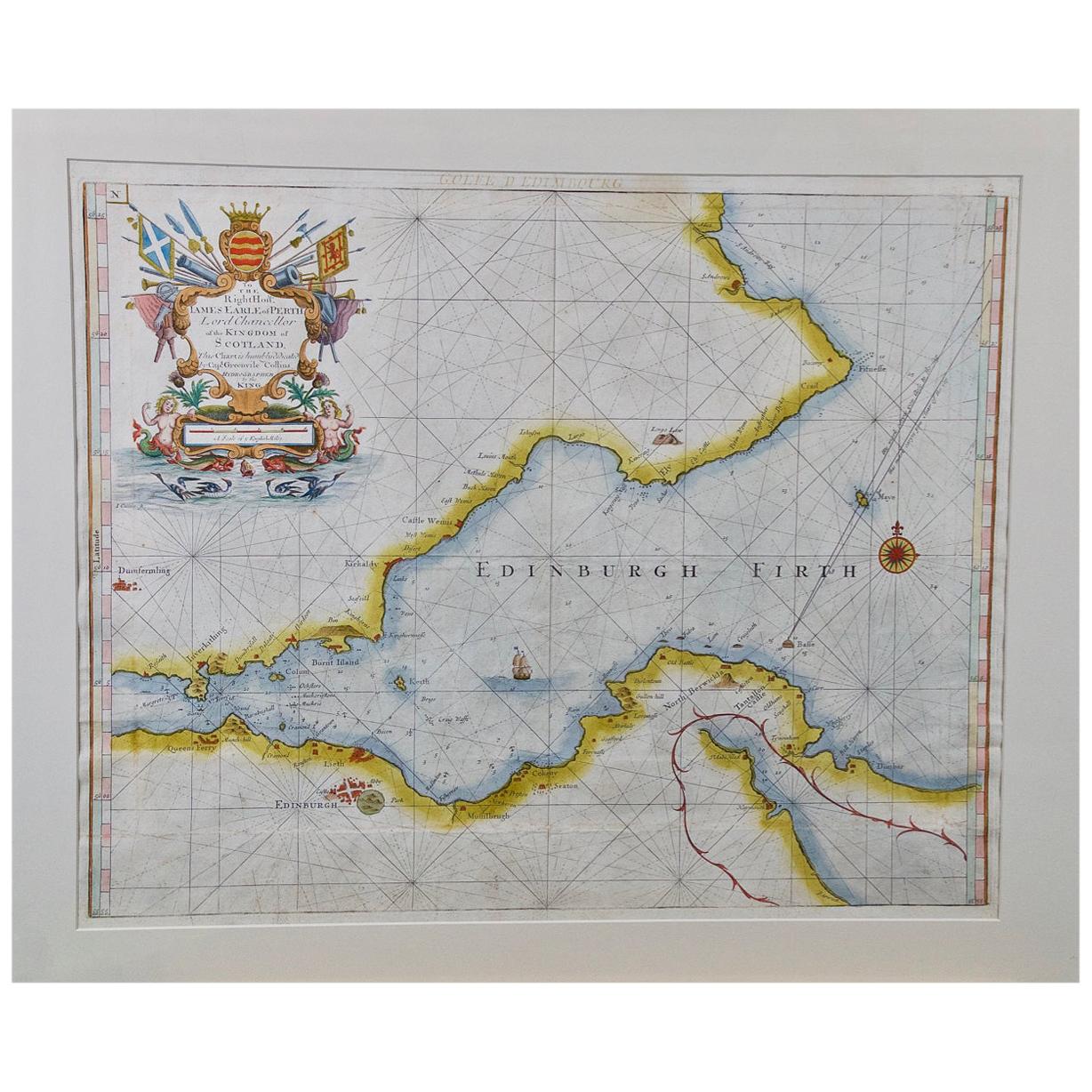
- Edinburgh, Scotland Coast: A 17th Century Hand-Colored Sea Chart by CollinsBy Captain Greenvile CollinsLocated in Alamo, CAThis hand-colored sea chart is entitled "Edinburgh Firth" from "Great Britain's Coasting Pilot. Being a New and Exact Survey of the Sea-Coast of England" by Captain Greenville Collin...Category
Antique Late 17th Century English Maps
MaterialsPaper
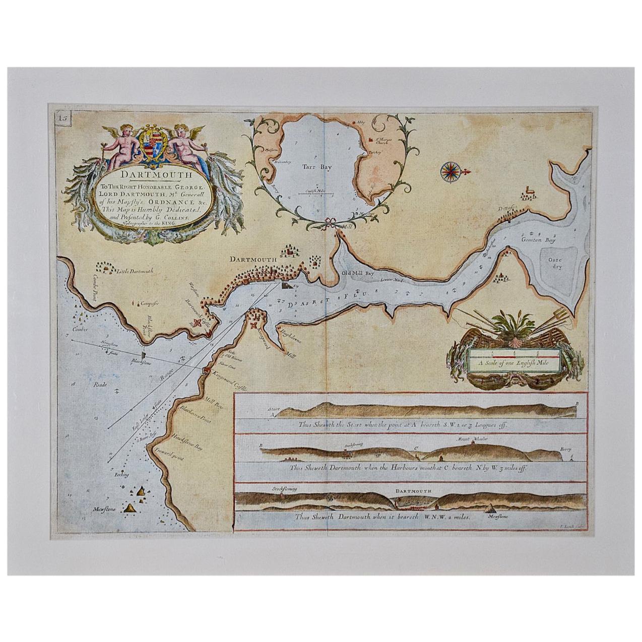
- Dartmouth, England: A Hand-Colored 17th Century Sea Chart by Captain CollinsBy Captain Greenvile CollinsLocated in Alamo, CAThis hand-colored sea chart of the area around Dartmouth, England is from "Great Britain's Coasting Pilot. Being a New and Exact Survey of the Sea-Coast of England", first published ...Category
Antique Late 17th Century English Maps
MaterialsPaper
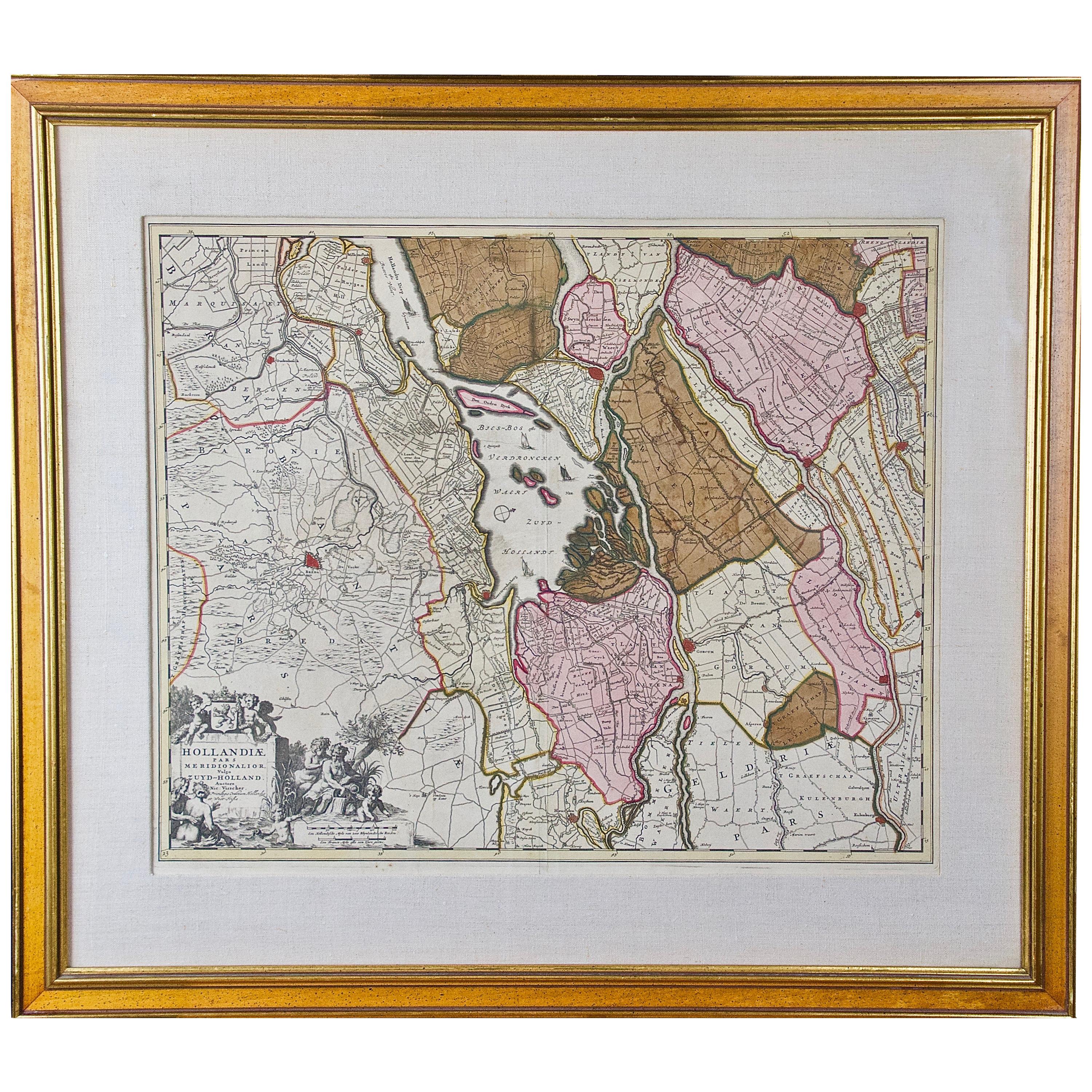
- Hand Colored 17th Century Visscher Map "Hollandiae" Southern HollandBy Nicolaes Visscher IILocated in Alamo, CAA hand colored 17th century map of the southern portions of Holland by Nicolaus (Nicolas) Visscher II entitled "Hollandiae pars Meridionalis, vulgo Zuyd-Holland", published in Amsterdam in 1678. The map shows the region between Breda, Heusden, Gornichem, Gouda, Dordrecht, and Willemstad. It includes a decorative cartouche in the lower left corner. The map is presented in an attractive maple colored wood frame with gold trim and a fabric mat. The Visscher family were one of the great cartographic families of the 17th century. Begun by Claes Jansz Visscher...Category
Antique Early 18th Century Dutch Maps
MaterialsPaper
- Northern Scotland: A 17th Century Hand-colored Map by MercatorBy Gerard MercatorLocated in Alamo, CAThis is a framed hand-colored 17th century map of Northern Scotland by Gerard Mercator entitled "Scotiae pars Septentrionalis", published in Amsterdam in 1636. It is a highly detailed map of the northern part of Scotland, with the northwest Highlands and the cities Inverness and Aberdeen, as well as the Orkney Islands and the Hebrides. There is a decorative title cartouche in the upper left corner. The map is presented in an antiqued brown wood...Category
Antique 1630s Dutch Maps
MaterialsPaper
- "Africa Vetus": a 17th Century Hand-Colored Map by SansonBy Nicolas SansonLocated in Alamo, CAThis original hand-colored copperplate engraved map of Africa entitled "Africa Vetus, Nicolai Sanson Christianiss Galliar Regis Geographi" was originally created by Nicholas Sanson d...Category
Antique Late 17th Century French Maps
MaterialsPaper


You May Also Like
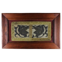
- 17th Century raised silverwork Embroidery stylized blooming Flowers FlandersLocated in Antwerpen, BEPresenting an exquisite 17th-century raised silverwork embroidery, featuring a stylized fragment of blooming flowers. This remarkable piece, handmade in Belgium's Flanders region, sh...Category
Antique 17th Century Belgian Baroque Revival Religious Items
MaterialsMetallic Thread
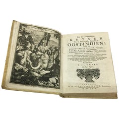
- 17th Century Dutch Book, Oost-Indien, 1694Located in Delft, NL17th Century Dutch Book, Oost-Indien, 1694 by Frikius, Hesse and Schweitzer, Simon de Vries Dutch translation by Simon de Vries of the accounts of three Ge...Category
Antique Late 17th Century Dutch Books
MaterialsPaper
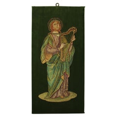
- 17th Century Embroidered King David With Harp Silk Tread Green Velvet FlandersLocated in Antwerpen, BEStep into the rich tapestry of the 17th century with our exquisite embroidered picture featuring King David With Harp. Meticulously crafted with silk thread, mounted on luscious gree...Category
Antique 17th Century Belgian Gothic Religious Items
MaterialsSilk, Velvet
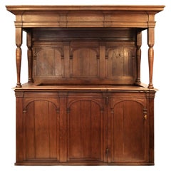
- 17th Century Large Dutch Private Pew Currently Converted into a BarLocated in Point Richmond, CA17th century large Dutch oak private pew currently converted into a bar Originally from a church in Amsterdam. The enclosure would have been used by a noble family and probably ha...Category
Antique 17th Century Dutch Dutch Colonial Religious Items
MaterialsWood
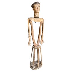
- Italian 17th Century MannequinLocated in Atlanta, GAA very beautiful 17th century articulating Mannequin from the Veneto region of Italy. Beautifully carved from polychromed wood with very handsome features. Mannequins such as this ...Category
Antique 17th Century Italian Religious Items
MaterialsWood
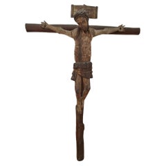
- Roman Christ 17th CenturyLocated in Madrid, ESRomanesque Christ of the 17th century carved in fruit wood with posterior cross. It has remains of the original Polychrome. Total dimensions: 58x43 cm.Category
Antique 15th Century and Earlier Religious Items
MaterialsFruitwood
Recently Viewed
View AllMore Ways To Browse
Holland And Company
Antique 17th Century Map
Captain Antique
Antique Charts
17th Century World Map
Antique 17th Century World Map
Map Colorful
Hand Compass
Great Britain Maps
17th Century Dutch Frame
Norfolk Furniture
Sailing Maps
Antique Map New England
Antique Map Of New England
Antique Maps New England
Dutch Navy
Antique World Chart
Colored Plexiglass