Items Similar to Antique Map of Mar del Sur, Chile, Peru, New Guinea and Tierra del Fuego, 1621


Want more images or videos?
Request additional images or videos from the seller
1 of 5
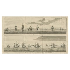
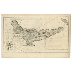
Antique Map of Mar del Sur, Chile, Peru, New Guinea and Tierra del Fuego, 1621
About the Item
Uncommon and rare map of Mar del Sur and the coast of Peru. With inset maps of part of New Guinea and Tierra del Fuego. This map originates from 'Miroir Oost & West-Indical, auquel sont descriptes les deux dernieres navigations (..)' published by J. Janssonius. It is one of the most famous early voyages around the world by Joris van Spilbergen (1568-1620), a veteran Dutch East Indies naval officer-turned-pirate, undertaken from 1614 to 1618. A short survey of another of the most important early voyages around the world, by Schouten and Le Maire in the years 1615 to 1617, is added at the end. It reports Le Maire's proof that Tierra del Fuego is an island and his discovery of what is still called the Strait of Le Maire, an alternative route to the Pacific Artists and Engravers: Jan Janssonius (also known as Johann or Jan Jansson or Janszoon) (1588-1664) was a renowned geographer and publisher of the seventeenth century, when the Dutch dominated map publishing in Europe.
Artist: Jan Janssonius (also known as Johann or Jan Jansson or Janszoon) (1588-1664) was a renowned geographer and publisher of the seventeenth century, when the Dutch dominated map publishing in Europe.
Condition: Good, general age-related toning. Original folding line, minor wear. Blank verso, please study image carefully.
Date: 1621
Overall size: 44 x 17 cm.
Image size: 43 x 15 cm.
- Dimensions:Height: 17.33 in (44 cm)Width: 6.7 in (17 cm)Depth: 0 in (0.01 mm)
- Materials and Techniques:
- Period:
- Date of Manufacture:1621
- Condition:
- Seller Location:Langweer, NL
- Reference Number:
About the Seller
5.0
Platinum Seller
These expertly vetted sellers are 1stDibs' most experienced sellers and are rated highest by our customers.
Established in 2009
1stDibs seller since 2017
1,966 sales on 1stDibs
Typical response time: <1 hour
- ShippingRetrieving quote...Ships From: Langweer, Netherlands
- Return PolicyA return for this item may be initiated within 14 days of delivery.
More From This SellerView All
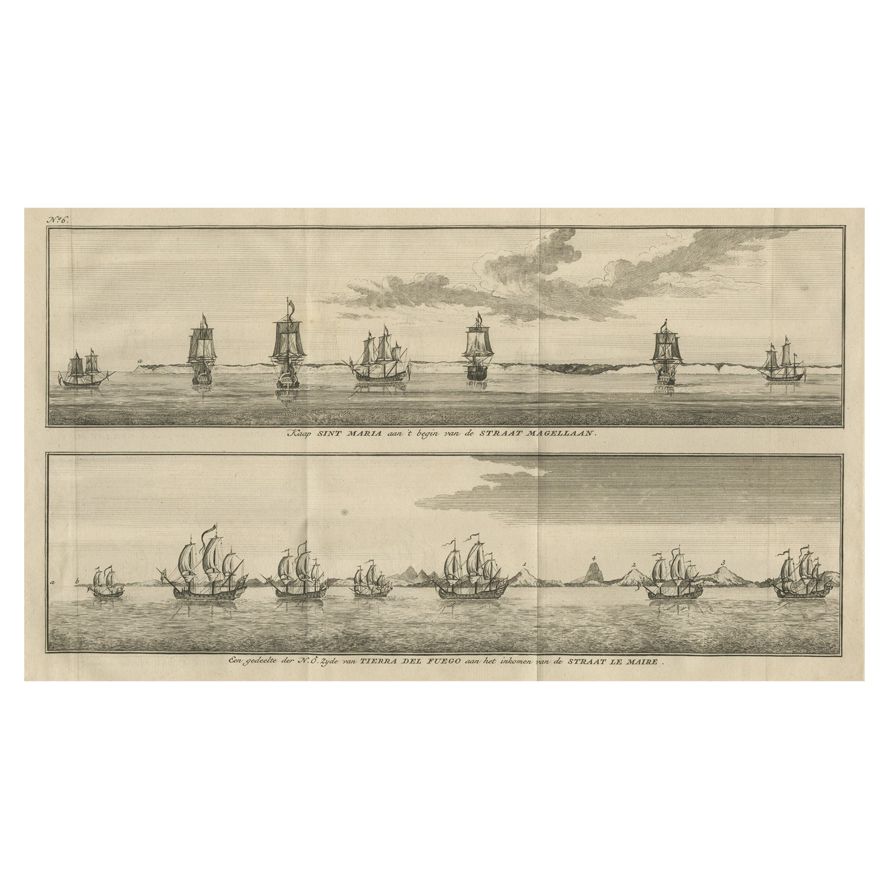
- Old Views of Cabo Santa Maria & Tierra del Fuego, Chile, 1749Located in Langweer, NLAntique print titled 'Kaap Sint Maria aan 't begin van de Straat Magellaan (..)'. Coastal views of Cabo Santa Maria and Tierra del Fuego on the Argent...Category
Antique 18th Century Prints
MaterialsPaper
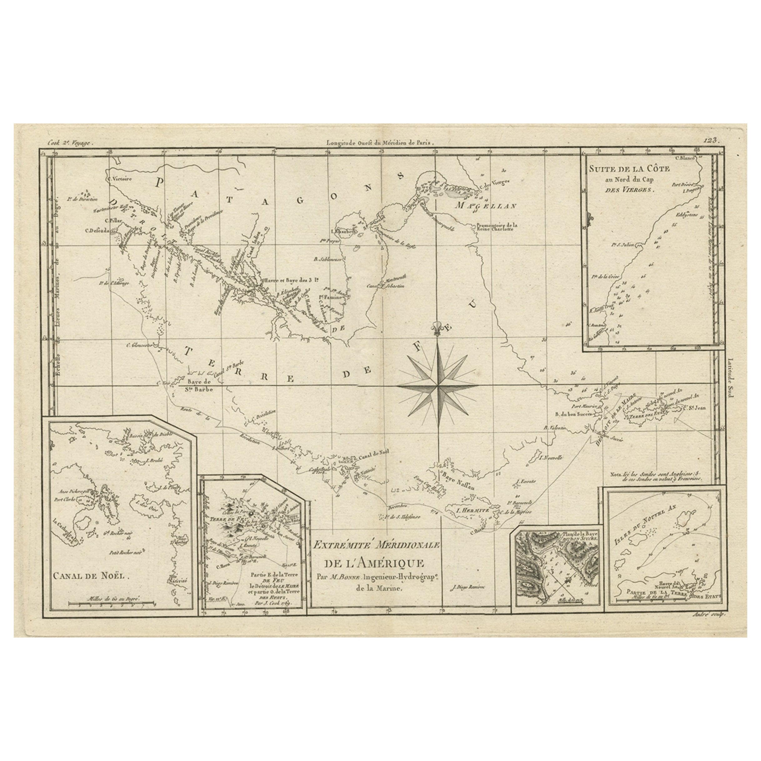
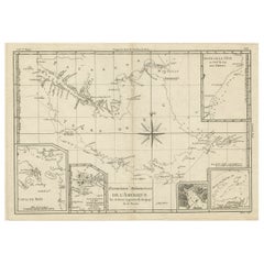
- Copper Engraved Map of Tierra del Fuego and the Strait of Magellan, c1780Located in Langweer, NLAntique map titled 'Extremite Meridionale de l'Amerique.' Copper engraved map of Tierra del Fuego and the Strait of Magellan with five detailed insets of the region showing soundings, anchorages, etc. Engraved by Andre. This map originates from 'Atlas de Toutes les Parties Connues du Globe Terrestre'. Artists and Engravers: Rigobert Bonne (1727-1795 ) was one of the most important cartographers of the late 18th century. In 1773 he succeeded Jacques Bellin as Royal Cartographer to France in the office of the Hydrographer at the Depôt de la Marine. Working in his official capacity Bonne compiled some of the most detailed and accurate maps of the period. Bonne's work represents an important step in the evolution of the cartographic ideology away from the decorative work of the 17th and early 18th century towards a more detail oriented and practical aesthetic. With regard to the rendering of terrain Bonne maps...Category
Antique 1780s Maps
MaterialsPaper
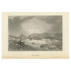
- Antique Print of Cape Horn, Tierra Del Fuego Archipelago of Southern ChileLocated in Langweer, NLAntique print titled 'Cap Horn'. View of Cape Horn, the southernmost headland of the Tierra del Fuego archipelago of southern Chile, located on the small Hornos Island. Originates fr...Category
Antique Mid-19th Century Prints
MaterialsPaper
- Antique Map of New Guinea and New Britain by P. Carteret, circa 1773Located in Langweer, NLAntique map titled 'A chart of captn Carteret's Discoveries at New Britain'. Philip Carterets map of New Guinea and the islands of New Britain and New Ireland with the tracks of William Dampier...Category
Antique Late 18th Century Maps
MaterialsPaper
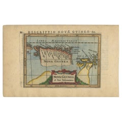
- Antique Miniature Map of New Guinea by Bertius, '1618'Located in Langweer, NLAntique miniature map titled 'Nova Guinea et Ins. Salomonis'. Rare miniature map of New Guinea (Solomon Islands). This map originates from 'Tabularum Geo...Category
Antique Early 17th Century Maps
MaterialsPaper
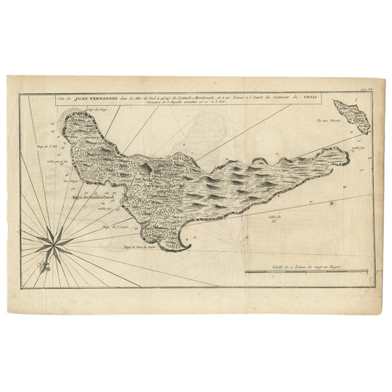
- Antique Map of Juan Fernandez, Chile, c.1740Located in Langweer, NLAntique map titled 'l'Ile de Juan Fernandes dans la Mer du Sud (..)'. This map depicts Juan Fernandez Island in the Southern Sea. Source unknown, to be determined. Artists and En...Category
Antique 18th Century Maps
MaterialsPaper

You May Also Like
- Antique Map of Principality of MonacoBy Antonio Vallardi EditoreLocated in Alessandria, PiemonteST/619 - "Old Geographical Atlas of Italy - Topographic map of ex-Principality of Monaco" - ediz Vallardi - Milano - A somewhat special edition ---Category
Antique Late 19th Century Italian Other Prints
MaterialsPaper
- Antique 1901 National Publishing Company's Road Map of New Jersey GeologicalLocated in Dayton, OHThe National Publishing Company's road map of New Jersey, showing all county and township divisions, cities villages and post-offices, railroads, ste...Category
Antique Early 1900s Victorian Prints
MaterialsPaper
- West Coast of Africa, Guinea & Sierra Leone: An 18th Century Map by BellinBy Jacques-Nicolas BellinLocated in Alamo, CAJacques Bellin's copper-plate map entitled "Partie de la Coste de Guinee Dupuis la Riviere de Sierra Leona Jusquau Cap das Palmas", depicting the coast of Guinea and Sierra Leone in ...Category
Antique Mid-18th Century French Maps
MaterialsPaper
- Dutch Map and City Plan of La Roche-sur-Foron, France, 17th Century Hand ColoredBy Coenraet DeckerLocated in Alamo, CA"Rupes Allobrogum vulgo La Roche" by Dutch engraver Coenraet Decker (1650-1685) is from the atlas Theatrum Statuum Regiae Celestudinis Sabaudiae Ducis, published in 1682. This richly...Category
Antique Late 17th Century Dutch Maps
MaterialsPaper
- Original Antique Map of Ireland- Tipperary and Waterford. C.1840Located in St Annes, LancashireGreat map of Tipperary and Waterford Steel engraving Drawn under the direction of A.Adlard Published by How and Parsons, C.1840 Unframed.Category
Antique 1840s English Maps
MaterialsPaper
- Original Antique Map of Spain and Portugal, circa 1790Located in St Annes, LancashireSuper map of Spain and Portugal Copper plate engraving by A. Bell Published, circa 1790. Unframed.Category
Antique 1790s English Other Maps
MaterialsPaper


Recently Viewed
View AllMore Ways To Browse
Antique Peruvian Furniture
Map Of The Pacific
Naval Officer
Antique Furniture Peru
Peruvian Antiques
Pacific Map
Map New Holland
Pirate Furniture
Map Of West Indies
West Indies Map
Antique Pirate
Pirate Antique
Antique Map Of The West Indies
Antique Maps West Indies
West Indies Antique Map
Map Of Peru
Peru Map
Dutch West Indies