Items Similar to Antique Map of Italy, North Part, by W. G. Blackie, 1859


Want more images or videos?
Request additional images or videos from the seller
1 of 6
Antique Map of Italy, North Part, by W. G. Blackie, 1859
About the Item
The "Antique Map of Italy, North Part" by W. G. Blackie, dated 1859, is a historically significant cartographic piece, showcasing the northern region of Italy in the mid-19th century. As part of Blackie's renowned cartographic works, this map offers a detailed and comprehensive view of Northern Italy, reflecting the geographical knowledge and cartographic style of the Victorian era.
**Key Features of the Map:**
1. **Geographical Detail**: The map covers the northern part of Italy, including regions such as Piedmont, Lombardy, Veneto, and parts of Tuscany and Emilia-Romagna. It meticulously represents the varied landscape, from the Alps in the north to the plains of the Po Valley.
2. **Political Boundaries**: During this period, Italy was undergoing significant political changes leading to its unification. The map likely details the various states and duchies that existed in Northern Italy at the time, such as the Kingdom of Sardinia and the Duchy of Milan.
3. **Urban Centers**: Major cities like Milan, Turin, Venice, Florence, and Bologna are prominently marked. The map provides a snapshot of urban development and the distribution of key cities in Northern Italy during the 19th century.
4. **Transportation Networks**: The map may include early railway lines, roads, and waterways, highlighting the transportation infrastructure of the time, which was pivotal in the region's economic and industrial development.
5. **Mountain Ranges and Water Bodies**: Detailed depictions of the Alps, Apennines, and significant lakes such as Lake Garda and Lake Como are likely featured, showcasing the natural beauty and geographic diversity of Northern Italy.
6. **Artistic Elements**: Consistent with the period's style, the map probably features ornate borders, decorative title script, and possibly other artistic embellishments that add to its aesthetic value.
7. **Educational and Historical Significance**: This map serves as an educational tool, offering insights into the geography and political landscape of Northern Italy before its unification. It is a valuable resource for historians, geographers, and enthusiasts of Italian history.
This antique map, with its rich detail and historical context, is not only a collector's item but also an important document that captures a pivotal moment in Italian history, making it a prized possession for those interested in the historical geography of Italy.
- Dimensions:Height: 14.57 in (37 cm)Width: 21.26 in (54 cm)Depth: 0.02 in (0.5 mm)
- Materials and Techniques:
- Period:
- Date of Manufacture:1859
- Condition:Wear consistent with age and use. General age-related toning. some foxing, Please study image carefully.
- Seller Location:Langweer, NL
- Reference Number:
About the Seller
5.0
Platinum Seller
These expertly vetted sellers are 1stDibs' most experienced sellers and are rated highest by our customers.
Established in 2009
1stDibs seller since 2017
1,966 sales on 1stDibs
Typical response time: <1 hour
- ShippingRetrieving quote...Ships From: Langweer, Netherlands
- Return PolicyA return for this item may be initiated within 14 days of delivery.
More From This SellerView All
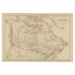
- Antique Map of British North America by W. G. Blackie, 1859Located in Langweer, NLAntique map titled 'British North America'. Original antique map of British North America. This map originates from ‘The Imperial Atlas of Mode...Category
Antique Mid-19th Century Maps
MaterialsPaper
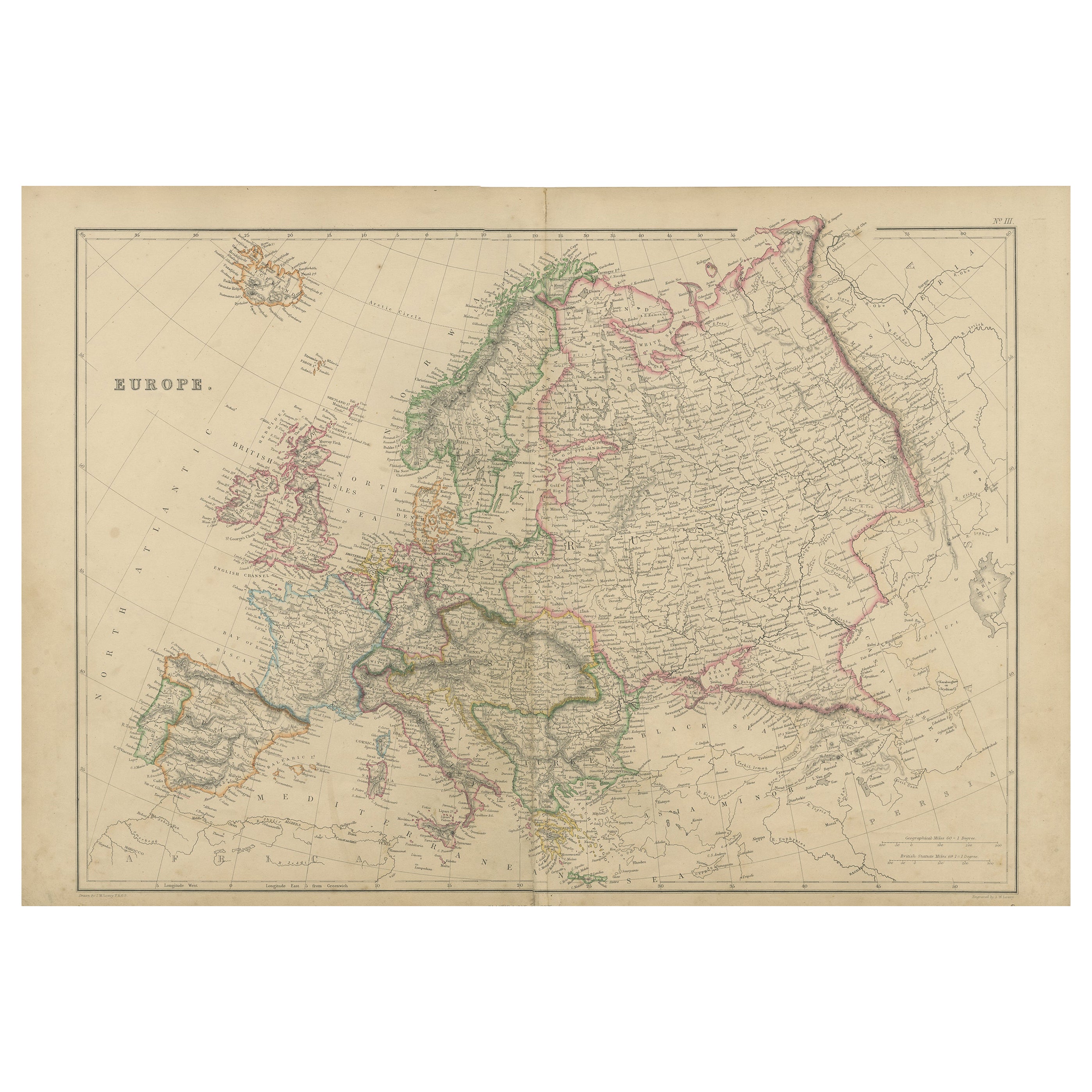
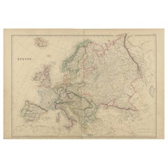
- Antique Map of Europe by W. G. Blackie, 1859Located in Langweer, NLAntique map titled 'Europe'. Original antique map of Europe. This map originates from ‘The Imperial Atlas of Modern Geography’. Published by W. G. Blackie, 1859.Category
Antique Mid-19th Century Maps
MaterialsPaper
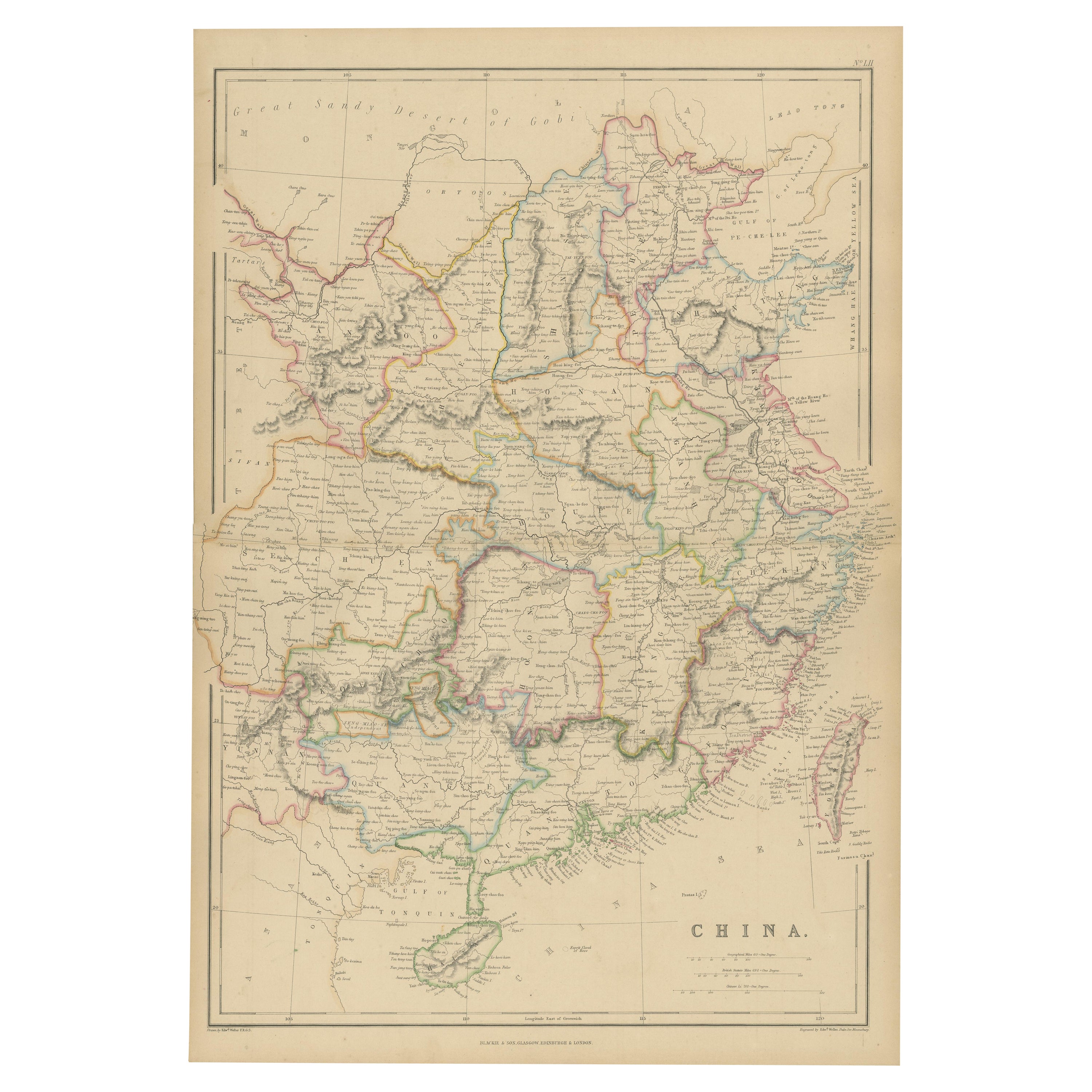
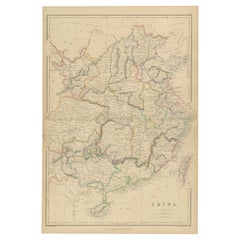
- Antique Map of China by W. G. Blackie, 1859Located in Langweer, NLAntique map titled 'China'. Original antique map of China. This map originates from ‘The Imperial Atlas of Modern Geography’. Published by W. G. Blackie, 1859.Category
Antique Mid-19th Century Maps
MaterialsPaper
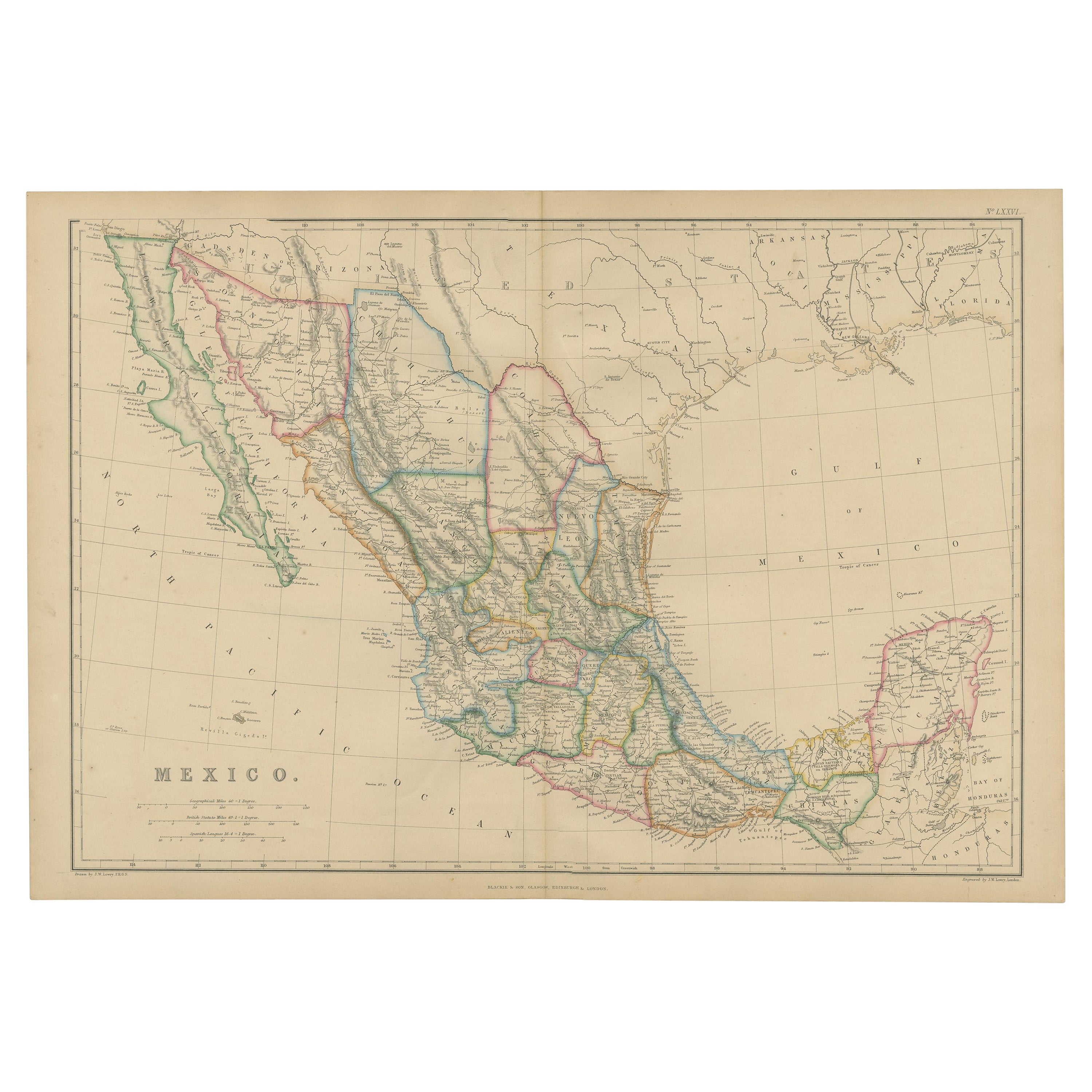
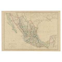
- Antique Map of Mexico by W. G. Blackie, 1859Located in Langweer, NLAntique map titled 'Mexico'. Original antique map of Mexico. This map originates from ‘The Imperial Atlas of Modern Geography’. Published by W. G. Blackie, 1859.Category
Antique Mid-19th Century Maps
MaterialsPaper
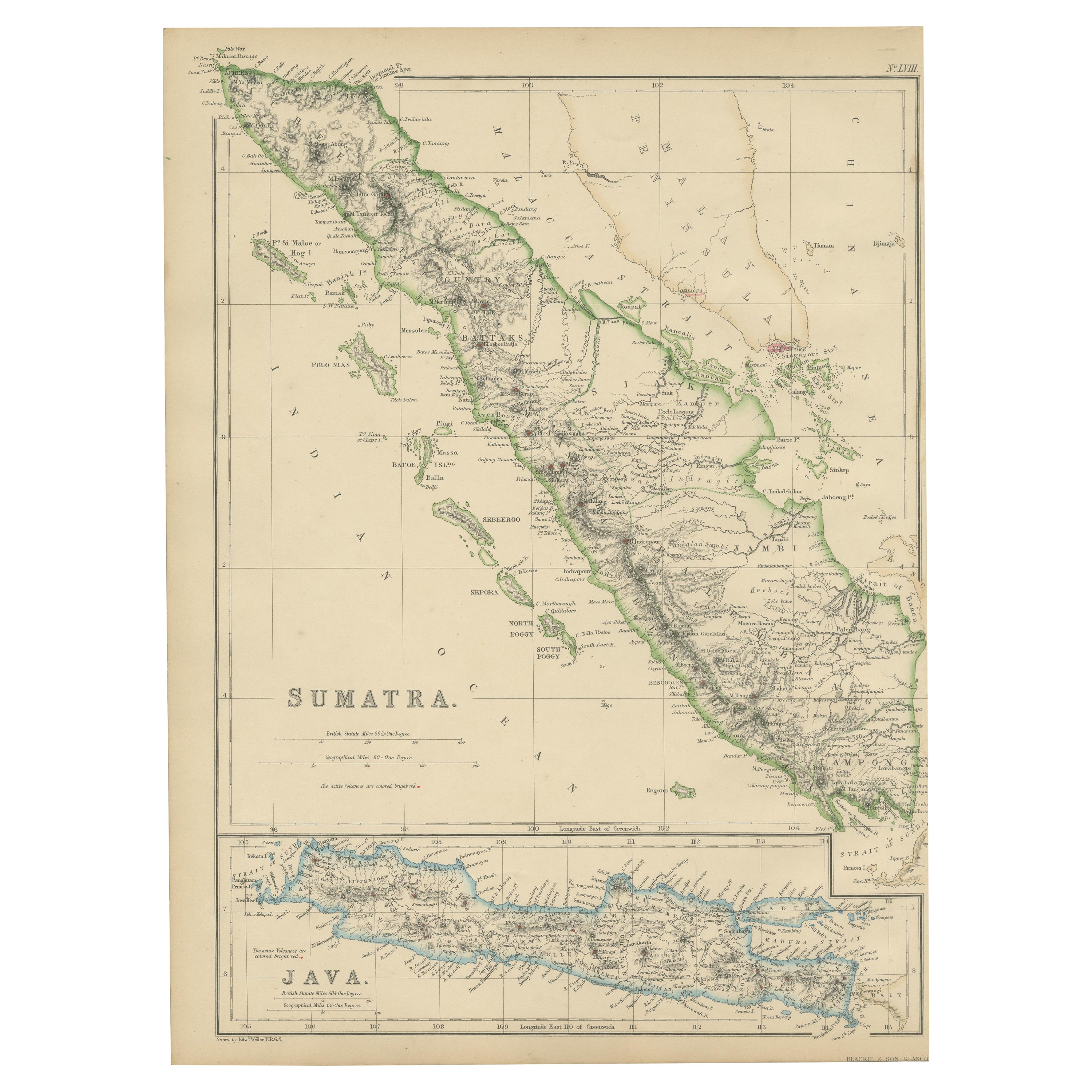
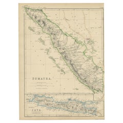
- Antique Map of Sumatra by W. G. Blackie, 1859Located in Langweer, NLAntique map titled 'Sumatra'. Original antique map of Sumatra with inset map of Java. This map originates from ‘The Imperial Atlas of Modern Geography’. Published by W. G. Blackie, 1...Category
Antique Mid-19th Century Maps
MaterialsPaper
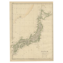
- Antique Map of Japan by W. G. Blackie, 1859Located in Langweer, NLAntique map titled 'Japan'. Original antique map of Japan. This map originates from ‘The Imperial Atlas of Modern Geography’. Published by W. G. B...Category
Antique Mid-19th Century Maps
MaterialsPaper
You May Also Like
- Large Antique 1859 Map of North AmericaLocated in Sag Harbor, NYThis Map was made by Augustus Mitchell in 1859 It is in amazing condition for being 163 years old. This price is for the rolled up easy to ship version of this piece. I will be Frami...Category
Antique Mid-19th Century American Maps
MaterialsCanvas, Paper

- Antique Map of Italy by Andriveau-Goujon, 1843By Andriveau-GoujonLocated in New York, NYAntique Map of Italy by Andriveau-Goujon, 1843. Map of Italy in two parts by Andriveau-Goujon for the Library of Prince Carini at Palazzo Carini i...Category
Antique 1840s French Maps
MaterialsLinen, Paper
- Original Antique English County Map, North Yorkshire, J & C Walker, 1851Located in St Annes, LancashireGreat map of North Yorkshire Original colour By J & C Walker Published by Longman, Rees, Orme, Brown & Co. 1851 Unframed.Category
Antique 1850s English Other Maps
MaterialsPaper
- Original Antique Map of Italy. Arrowsmith. 1820Located in St Annes, LancashireGreat map of Italy Drawn under the direction of Arrowsmith Copper-plate engraving Published by Longman, Hurst, Rees, Orme and Brown, 1820 Unframed.Category
Antique 1820s English Maps
MaterialsPaper
- New Map of North America from the Latest Discoveries, 1763Located in Philadelphia, PAA fine antique 18th century map of the North American seaboard. Entitled "A New Map of North America from the Latest Discoveries 1763". By the Cartographer/Engraver - John Spil...Category
Antique Mid-18th Century English Georgian Maps
MaterialsPaper
- Antique Map of Principality of MonacoBy Antonio Vallardi EditoreLocated in Alessandria, PiemonteST/619 - "Old Geographical Atlas of Italy - Topographic map of ex-Principality of Monaco" - ediz Vallardi - Milano - A somewhat special edition ---Category
Antique Late 19th Century Italian Other Prints
MaterialsPaper


Recently Viewed
View AllMore Ways To Browse
G Key
Important Documented
Antique Italian Maps
Antique Maps Italy
Antique Map Of Italy
Antique Maps Of Italy
Antique Map Border
Northern Plains
Antique Road Maps
Antique Mountain Maps
Railway Map
Antique Industrial Tools
Antique Map Venice
Antique Maps Venice
Antique Map Of Venice
Map Tuscany
Antique Map Of Florence
Antique Po