Items Similar to Antique Map of the City of Materan 'Indonesia' by P. van der Aa, circa 1725


Want more images or videos?
Request additional images or videos from the seller
1 of 5
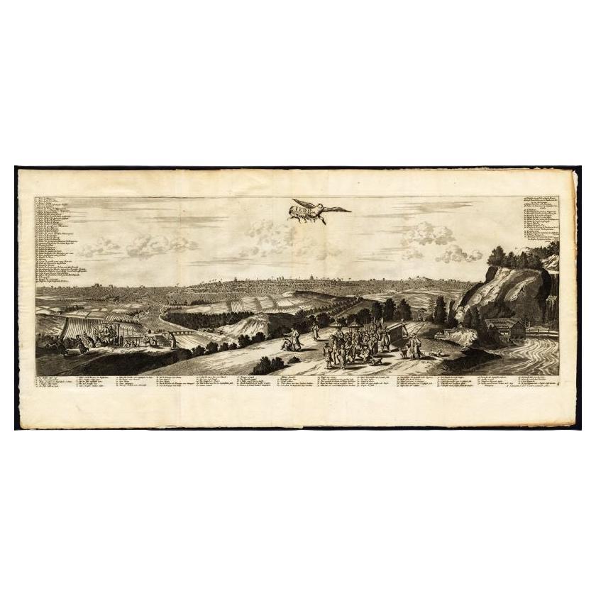
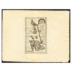
Antique Map of the City of Materan 'Indonesia' by P. van der Aa, circa 1725
About the Item
Antique map titled 'La Ville de Materan, capitale de Roiaume de meme nom, avec ses environs. Le tout environne de Montagnes qui lui serve de murailles.' The city of Materan, capital of the kingdom by the same name, with its surroundings. All surrounded by mountains that serve as a protective wall. This map depicts the area of Yogyakarta (Java, Indonesia). The city is named after the Indian city of Ayodhya from the Ramayana epic. Yogya means "suitable, fit, proper", and karta, "prosperous, flourishing". According to Canggal inscription dated 732, the area traditionally known as "Mataram" became the capital of the Medang Kingdom, identified as Mdang i Bhumi Mataram established by King Sanjaya.
This map originates from 'Voyages celebres & remarquables, faits de Perse aux Indes Orientales' by J.A. von Mandelslo. Published in Amsterdam, 1727.
- Creator:Pieter Van Der Aa (Artist)
- Dimensions:Height: 13 in (33 cm)Width: 15.83 in (40.2 cm)Depth: 0.02 in (0.5 mm)
- Materials and Techniques:
- Period:
- Date of Manufacture:circa 1725
- Condition:Please study image carefully.
- Seller Location:Langweer, NL
- Reference Number:
Pieter Van Der Aa
Pieter van der Aa began his career at Leiden in 1683 as a Latin trade publisher, publishing classical texts about medicine and science. He was a Dutch publisher of maps and atlases active in the late 17th and early 18th centuries. During his long and impressive career, Van der Aa produced thousands of maps, including a vast 28 volume atlas containing no less than 3,000 maps.
About the Seller
5.0
Platinum Seller
These expertly vetted sellers are 1stDibs' most experienced sellers and are rated highest by our customers.
Established in 2009
1stDibs seller since 2017
1,965 sales on 1stDibs
Typical response time: <1 hour
- ShippingRetrieving quote...Ships From: Langweer, Netherlands
- Return PolicyA return for this item may be initiated within 14 days of delivery.
More From This SellerView All
- Antique Map of the Mughal Empire by Van der Aa, C.1725By Pieter Van Der AaLocated in Langweer, NLAntique map titled 'Royaume de Grand Mogol (..).' This map shows the extend of the Mughal Empire, which includes northern India, from Golconda to Afghanistan and eastwards to Bengal....Category
Antique 18th Century Maps
MaterialsPaper
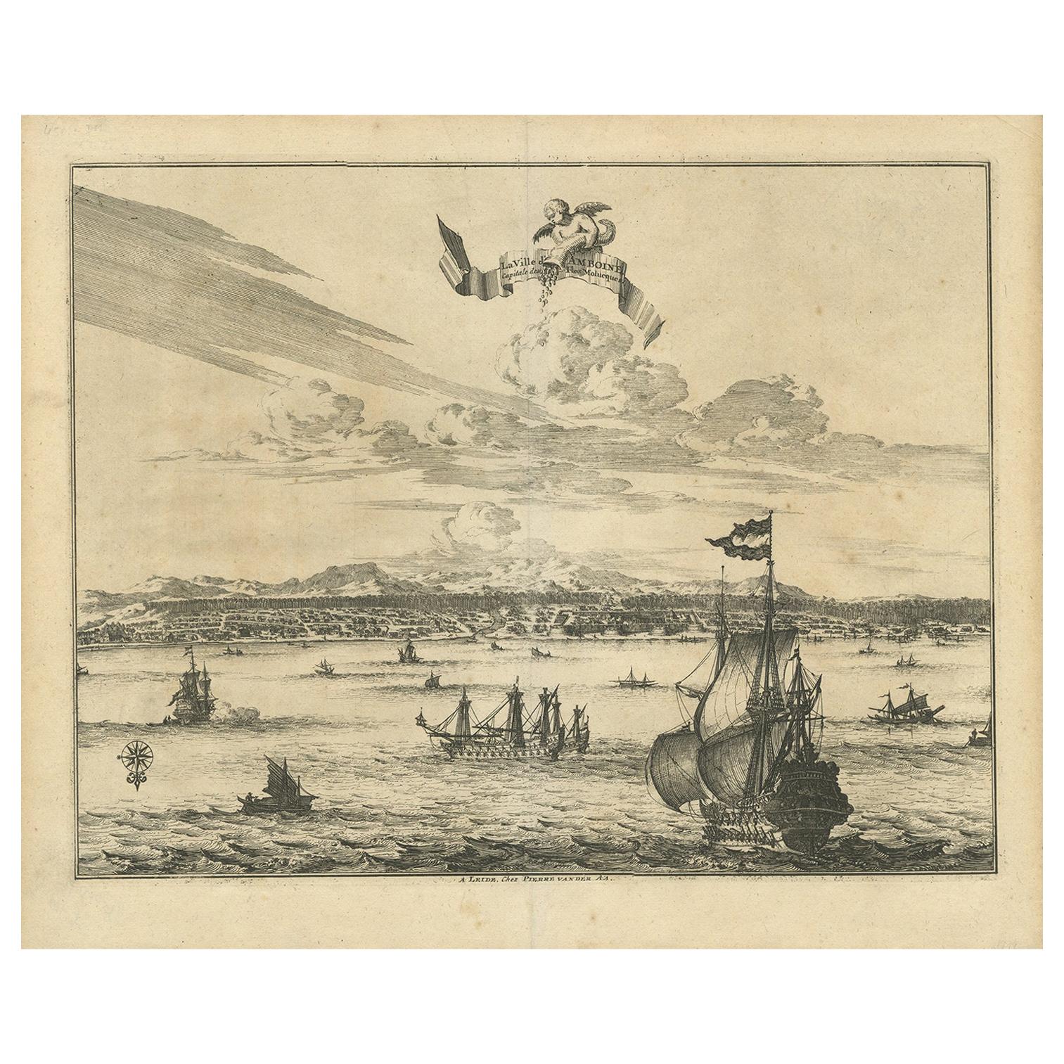
- Antique Map of the Maluku Islands by Van der Aa, 1725By Pieter Van Der AaLocated in Langweer, NLAntique map titled 'Les Iles Moluques (..).' (The Moluccan Islands, Maluku, Moluccas, Spice Islands, Indonesia.) Extremely rare in this edition. This plate originates from the very s...Category
Antique 18th Century Maps
MaterialsPaper
- Antique Map of the City of Batavia by Van der Aa 'c.1730'Located in Langweer, NLAntique map titled 'Plan de la Ville et du Chateau de Batavia en l'Isle de Iava - Ware affbeeldinge wegens het Casteel ende Stadt Batavia gelegen op groot Eylant Java'. Detailed plan...Category
Antique Mid-18th Century Maps
MaterialsPaper
- Antique Map of the Island of Java, Indonesia by P. Van Der Aa, 1713Located in Langweer, NLThis rare map shows the Indonesian island of Java. With compass rose and scale. From: Nouvel Atlas, très exact et fort commode pour toutes sortes de personnes, Contenant Les Principa...Category
Antique Early 18th Century Maps
MaterialsPaper
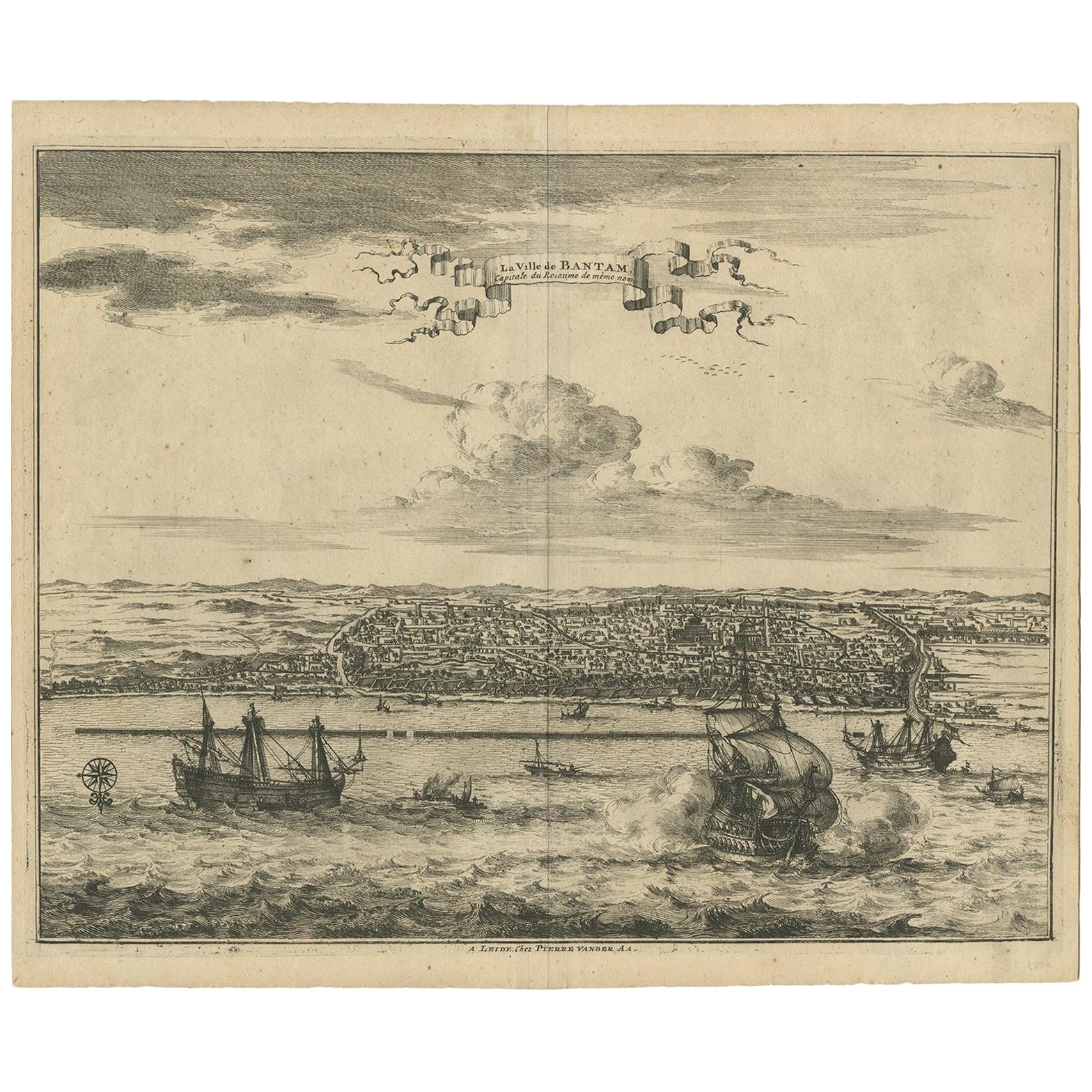
- Antique Map of the Roadstead of Bantam by Van der Aa, 1725By Pieter Van Der AaLocated in Langweer, NLAntique map titled 'La rade de Bantam'. (The roadstead of Bantam.) This map shows the Indonesian city of Banten / Bantam on Java, Indonesia and its roadstead. With compass rose and s...Category
Antique 18th Century Maps
MaterialsPaper
- Antique Map of the Island of Java by Van Der Aa, 1725By Pieter Van Der AaLocated in Langweer, NLAntique map titled 'Map: 'L'Ile de Java'. (The island of Java.) This map shows the Indonesian island of Java. With compass rose and scale. This plate originates from the very scarse:...Category
Antique 18th Century Maps
MaterialsPaper


You May Also Like
- Original Antique Map / City Plan of Brussels by Tallis, circa 1850Located in St Annes, LancashireGreat map of Brussels. Steel engraving. Published by London Printing & Publishing Co. (Formerly Tallis), C.1850 Free shipping.Category
Antique 1850s English Maps
MaterialsPaper
- Original Antique Map of Belgium by Tallis, Circa 1850Located in St Annes, LancashireGreat map of Belgium Steel engraving Many lovely vignettes Published by London Printing & Publishing Co. ( Formerly Tallis ), C.1850 Origin...Category
Antique 1850s English Maps
MaterialsPaper
- Original Antique Map of The World by Thomas Clerk, 1817Located in St Annes, LancashireGreat map of The Eastern and Western Hemispheres On 2 sheets Copper-plate engraving Drawn and engraved by Thomas Clerk, Edinburgh. Published by Mackenzie And Dent, 1817 ...Category
Antique 1810s English Maps
MaterialsPaper
- Original Antique Map of South America, circa 1830Located in St Annes, LancashireGreat map of South America Copper plate engraving Published by Butterworth, Livesey & Co., circa 1830 Unframed.Category
Antique Early 1800s English Other Maps
MaterialsPaper
- Original Antique Map of South East Asia by Becker, circa 1840Located in St Annes, LancashireGreat map of South East Asia Steel engraving with original color outline Engraved by Becker Published by Virtue, circa 1840. Unframed.Category
Antique 1840s English Other Maps
MaterialsPaper
- Original Antique Map of Spain and Portugal, circa 1790Located in St Annes, LancashireSuper map of Spain and Portugal Copper plate engraving by A. Bell Published, circa 1790. Unframed.Category
Antique 1790s English Other Maps
MaterialsPaper


Recently Viewed
View AllMore Ways To Browse
Capital Of Antique
Epic Antique
Antique Memes
King Lui
Pieter Van Der Aa On Sale
Antique Furniture Dundee
Antique Map Chicago
Antique Map Copenhagen
Antique Map Malta
Antique Map Of Malta
Antique Maps Of Malta
Antique Maps Of Pennsylvania
Antique Queensland
Mitchell Antique Maps
North Carolina Map
Otto Petri
Ottoman Map
Alexandria Map