Items Similar to Antique Map of America with California as an Island by Homann '1710'
Want more images or videos?
Request additional images or videos from the seller
1 of 6
Antique Map of America with California as an Island by Homann '1710'
About the Item
This antique map, titled "Totius Americae Septentrionalis et Meridionalis," represents a significant cartographic piece from 1710 by Johann Baptist Homann. Here's a description of this remarkable map:
- **Title**: Totius Americae Septentrionalis et Meridionalis (...)
- **Date**: Published in 1710 by Johann Baptist Homann.
**Description**:
This map is a first edition of Johann Baptiste Homann's map of America, and it is notable for several cartographic features and historical representations:
1. **California as an Island**: One of the most distinctive features of this map is the depiction of California as an island. This was a common misconception among cartographers of the time and persisted for several years before being corrected.
2. **Straits of Anian**: The map shows the Straits of Anian, which were believed to be a potential Northwest Passage, forming a connection between California and the mythical Terra Esonis. This representation reflects the curiosity and exploration of the era when the geography of North America was still being explored and understood.
3. **Pays de Moozemleck**: East of the Straits of Anian, you can see the "Pays de Moozemleck," a toponym that remained relatively consistent in Homann's maps of America. Despite changes in the depiction of California, this landmark remained largely unchanged, resulting in a somewhat perplexing shift from a coastal to a seemingly landlocked position.
4. **Great Lakes and Mississippi River**: The map provides detailed information about the Great Lakes and the course of the Mississippi River. The representation of the Mississippi River reflects the explorations conducted by early French Jesuits, with its sources extending farther north than on maps produced a few decades earlier.
5. **Le Moyne's Mythical Lake**: In the southeastern United States, you can observe a lake with a mystical quality. This lake is associated with Le Moyne's earlier explorations and remained on maps as a reference point.
This antique map offers valuable insights into the evolving understanding of the American continent during the early 18th century. It captures the geographical knowledge, myths, and exploratory spirit of the era and is a significant piece of cartographic history.
- Dimensions:Height: 22.05 in (56 cm)Width: 25.99 in (66 cm)Depth: 0.02 in (0.5 mm)
- Materials and Techniques:
- Period:
- Date of Manufacture:1710
- Condition:Repaired: Repair on folding line. General age-related toning. Professionally restored on folding line and plate marks. Minor wear, blank verso. Please study images carefully.
- Seller Location:Langweer, NL
- Reference Number:
About the Seller
5.0
Platinum Seller
These expertly vetted sellers are 1stDibs' most experienced sellers and are rated highest by our customers.
Established in 2009
1stDibs seller since 2017
1,965 sales on 1stDibs
Typical response time: <1 hour
- ShippingRetrieving quote...Ships From: Langweer, Netherlands
- Return PolicyA return for this item may be initiated within 14 days of delivery.
More From This SellerView All
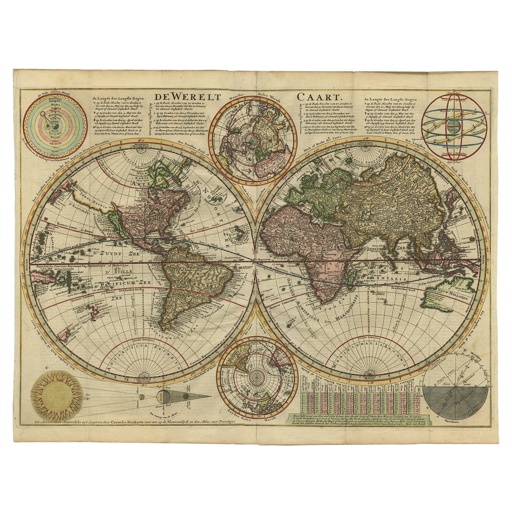
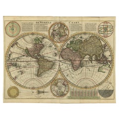
- Antique Double Hemisphere World Map with California as an Island, 1710Located in Langweer, NLDescription: Antique map titled 'De Werelt Caart'. First state (out of three) antique double hemisphere world map from a Dutch bible by Cornelis D...Category
Antique 1710s Maps
MaterialsPaper
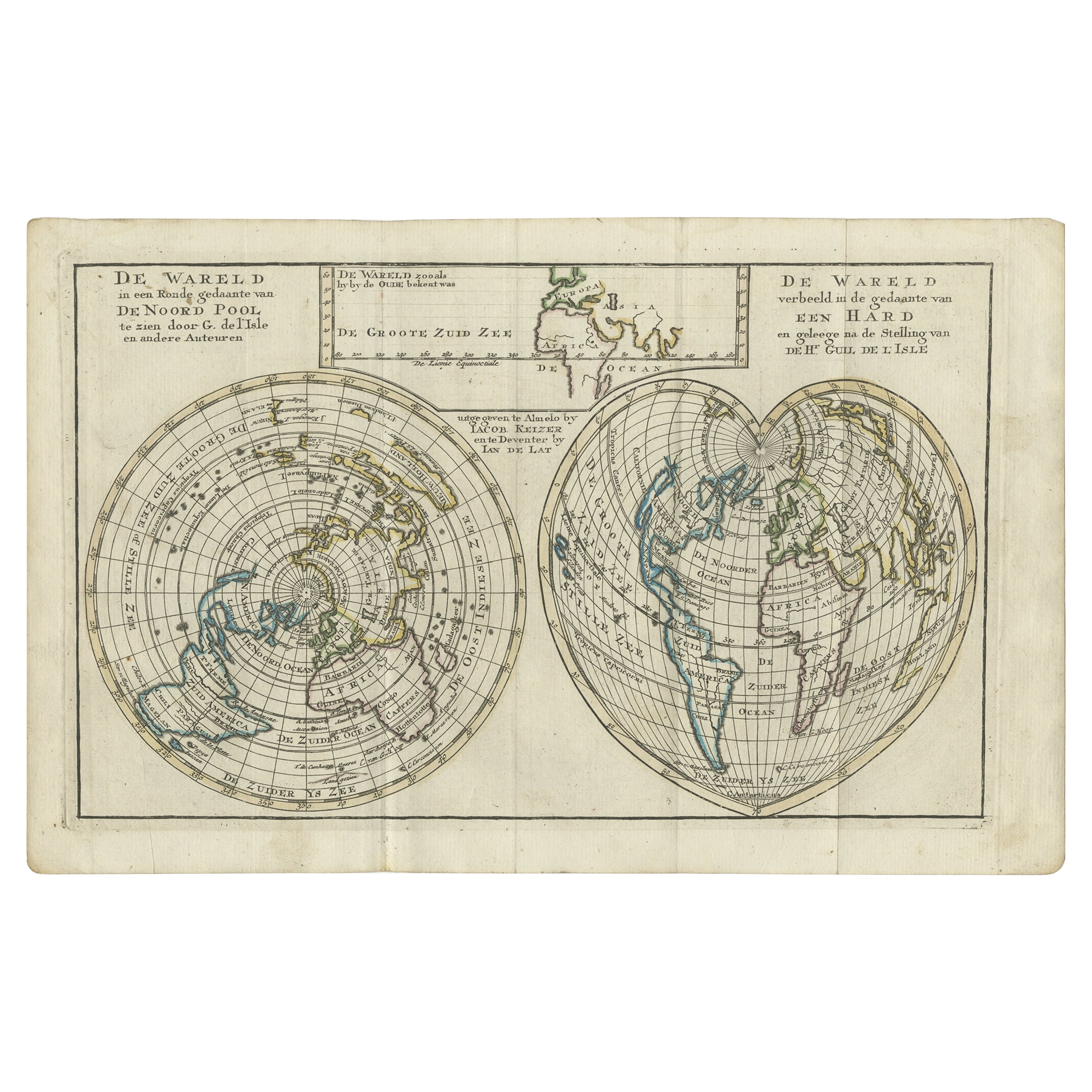
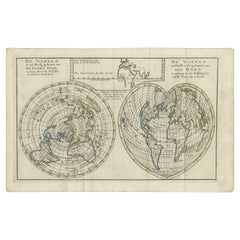
- Antique Map of the World with California as an Island, 1788Located in Langweer, NLDescription: Antique map titled 'De wareld in een ronde gedaante van de Noord Pool te zien - De Wareld verbeeld in de gedaante van een hard'. This interesting composition contains three world maps on the sheet. At left is a northern projection showing all the landmasses. At right is a cordiform projection (heart-shaped). At top is a map of the world as known to the ancients. Both the polar and cordiform projections show California as an island...Category
Antique 1780s Maps
MaterialsPaper
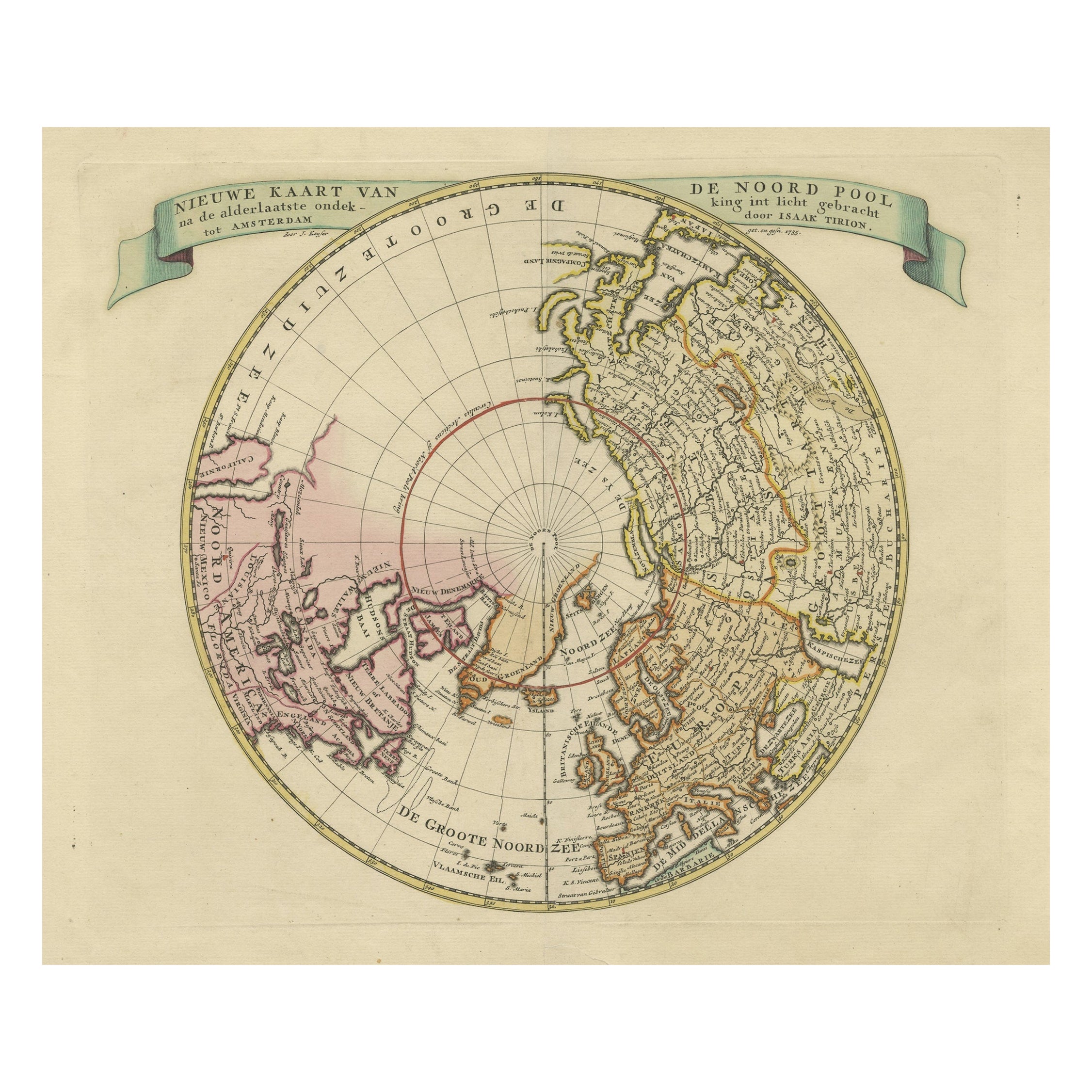
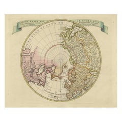
- Beautiful Antique Map of the Northern Hemisphere with California as an IslandBy Isaak TirionLocated in Langweer, NLAntique map titled 'Nieuwe Kaart van de Noord Pool na de alderlaatste ontdekking int licht gebracht tot Amsterdam door Isaak Tirion'. Beautiful map of the Northern Hemisphere and Nor...Category
Antique Mid-18th Century Maps
MaterialsPaper
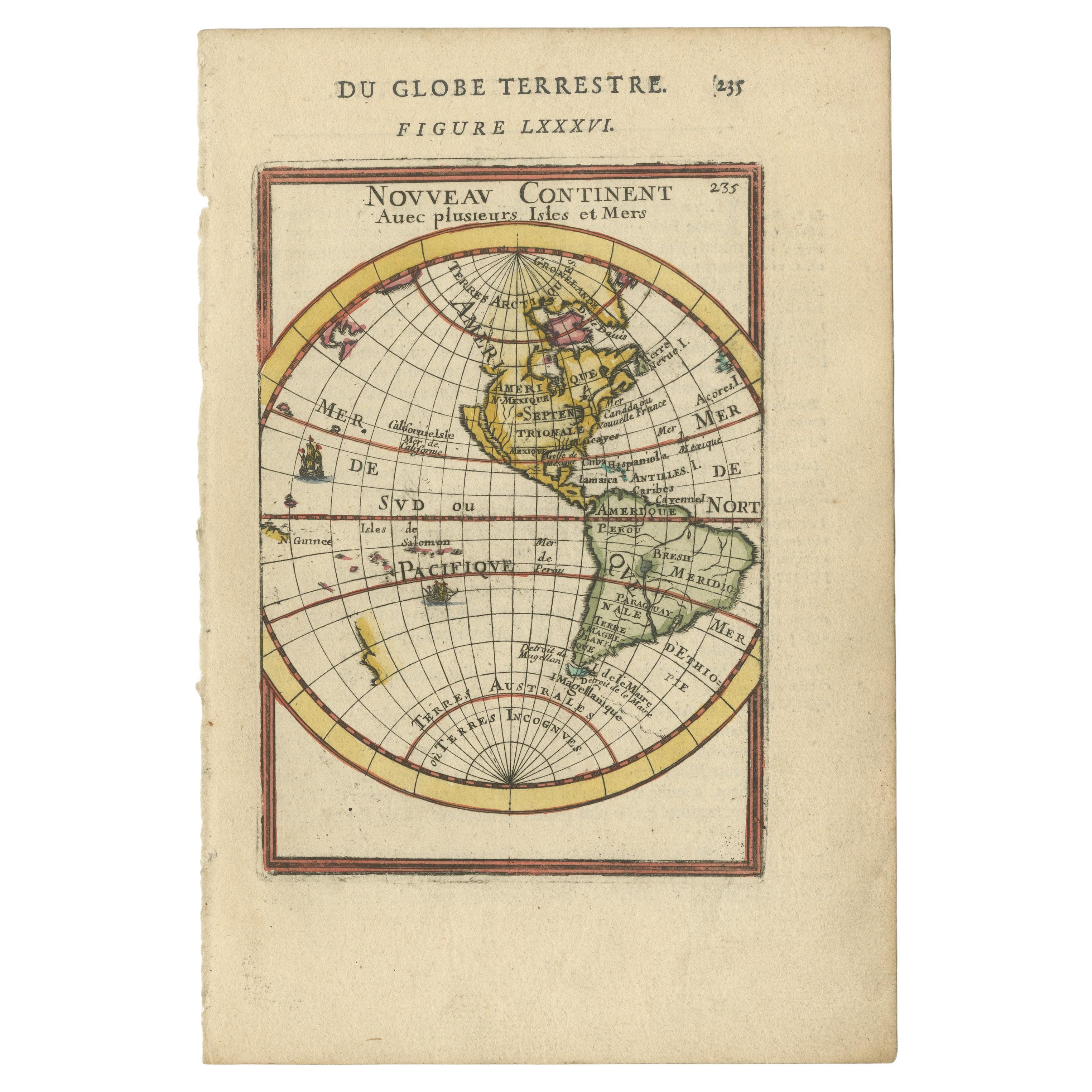
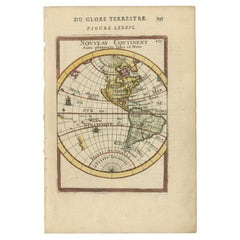
- Antique Miniature Map of the Western Hemisphere, with California as an IslandLocated in Langweer, NLAntique miniature map titled 'Nouveau Continent avec plusieurs Isles et Mers'. Decorative map of the Western Hemisphere, published by Alain Manesson Mallet. The map shows California as an Island...Category
Antique Late 17th Century Maps
MaterialsPaper
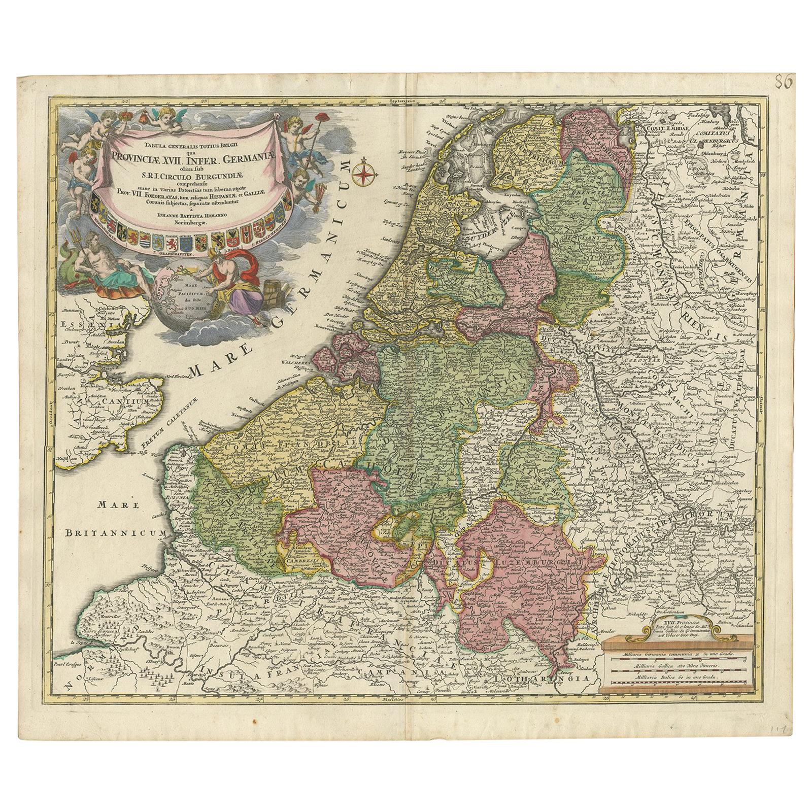
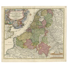
- Antique Map of the Netherlands and Belgium by Homann, circa 1710By Johann Baptist HomannLocated in Langweer, NLAntique map titled 'Tabula Generalis Totius Belgii Provinciae XVII. Infer. Germaniae (..)'. Map of the Benelux countries by Johann Baptist Homann. Shows the area between the Seine es...Category
Antique Early 18th Century German Maps
MaterialsPaper
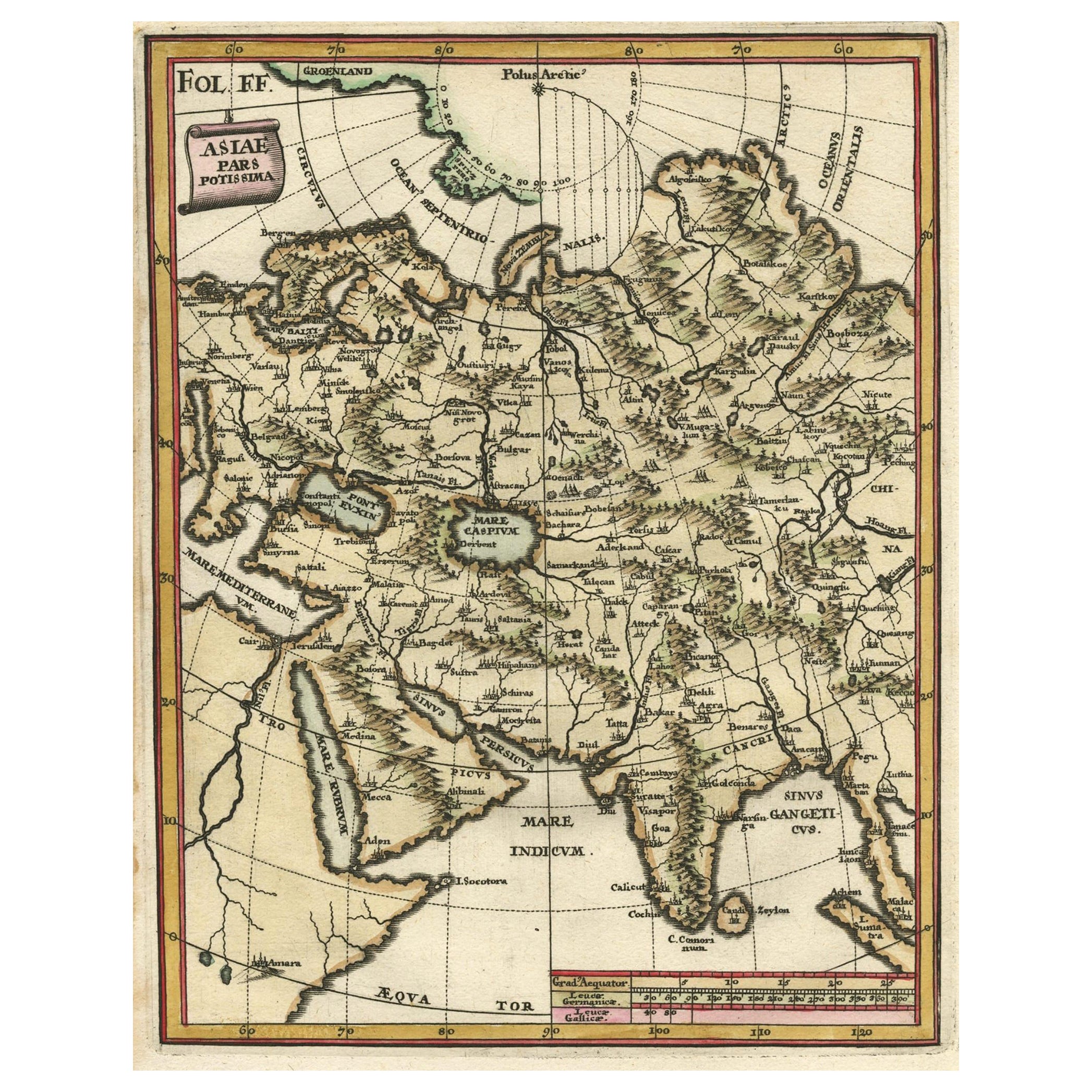
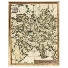
- Antique Map of Central Asia Wiht Nova Zembla as an Island, C.1700Located in Langweer, NLAntique map titled 'Asiae Pars Potissima.' Attractive map focusing on the central part of Asia but extending to include much of Eastern Europe and Northeastern Africa. The Caspian Se...Category
Antique 18th Century Maps
MaterialsPaper
You May Also Like
- Hand-Colored 18th Century Homann Map of Denmark and Islands in the Baltic SeaBy Johann Baptist HomannLocated in Alamo, CAAn 18th century copper plate hand-colored map entitled "Insulae Danicae in Mari Balthico Sitae utpote Zeelandia, Fionia, Langelandia, Lalandia, Falstria, Fembria Mona" created by Joh...Category
Antique Early 18th Century German Maps
MaterialsPaper
- West Africa Entitled "Guinea Propria": An 18th Century Hand Colored Homann MapBy Johann Baptist HomannLocated in Alamo, CAThis is a scarce richly hand colored copper plate engraved map of Africa entitled "Guinea Propria, nec non Nigritiae vel Terrae Nigrorum Maxima Pars" by Johann Baptist Homann (1664-1...Category
Antique Mid-18th Century German Maps
MaterialsPaper
- Sweden & Adjacent Portions of Scandinavia: A Hand-Colored 18th C. Map by HomannBy Johann Baptist HomannLocated in Alamo, CAThis hand-colored map of Sweden and adjacent portions of Scandinavia entitled "Regni Sueciae in Omnes suas Subjacentes Provincias accurate divisi Tabula Generalis" was created by Joh...Category
Antique 1720s German Maps
MaterialsPaper
- Large Antique 1859 Map of North AmericaLocated in Sag Harbor, NYThis Map was made by Augustus Mitchell in 1859 It is in amazing condition for being 163 years old. This price is for the rolled up easy to ship version of this piece. I will be Frami...Category
Antique Mid-19th Century American Maps
MaterialsCanvas, Paper

- Original Antique Map of South America. C.1780Located in St Annes, LancashireGreat map of South America Copper-plate engraving Published C.1780 Two small worm holes to left side of map Unframed.Category
Antique Early 1800s English Georgian Maps
MaterialsPaper
- Original Antique Map of South America by Thomas Clerk, 1817Located in St Annes, LancashireGreat map of South America Copper-plate engraving Drawn and engraved by Thomas Clerk, Edinburgh. Published by Mackenzie And Dent, 1817 Unframed.Category
Antique 1810s English Maps
MaterialsPaper


Recently Viewed
View AllMore Ways To Browse
18th Century American Antiques
Early California Furniture
Antique Furniture California
Antique Map Of America
Great Lakes Antique
French Map Of America
California Map
Antique Maps North America
Antique Maps Of North America
Coastal Maps
North By Northwest
18th Century Maps America
Mississippi Furniture
Mississippi Antique
East Lake Furniture
Maps Great Lakes
Antique Map California
Antique Map Of California