Items Similar to Nelson's Guide to the City of New York and its Neighbourhood, 1858
Want more images or videos?
Request additional images or videos from the seller
1 of 6
Nelson's Guide to the City of New York and its Neighbourhood, 1858
About the Item
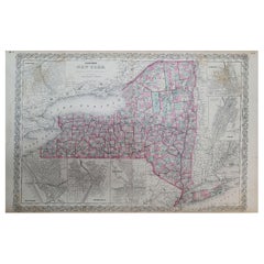
"Nelson's Guide to the City of New York and its Neighbourhood," published in 1858 by T. Nelson in London and New York, serves as an invaluable resource for exploring the historical and cultural richness of New York City during the mid-19th century.
This small guidebook encapsulates a diverse range of topics including a Historical Retrospect, Places of Amusement, the vibrant Broadway scene, the New Bible House, various Churches, the Crystal Palace, the Croton Aqueduct, significant Public Works, Literary Institutions, and Union Square among others. It is designed to cater to both residents and visitors, providing a comprehensive overview of the city's attractions and infrastructural achievements.
The physical attributes of the book contribute to its charm and historical value. It is a 16mo size, making it conveniently portable, and comprises 64 printed text pages, along with a frontispiece featuring a map of New York City. The inclusion of 9 printed color plates alongside illustrations interspersed throughout the text enriches the reader's visual experience, offering a glimpse into the architectural and cultural landmarks of the time. Additionally, a second map is creatively incorporated into the title page, enhancing the guide's utility and appeal.
The book is bound in blue cloth covers, with the title elegantly presented in gilt letters on both the cover and spine, indicating the guide's prestigious nature and the care taken in its presentation. However, it shows signs of wear and age, with chipping noted at the top and edge of the spine, which adds to the book's character and testifies to its historical journey and the hands it has passed through over the years.
On the first page there is a handwritten note to " en Madame Joseph De Decker avec les compliments du H. Amy. N.Y. 27 Janvier 1865"
"Nelson's Guide to the City of New York and its Neighbourhood" stands as a testament to the city's rich history and cultural vibrancy in the 1850s, offering modern readers a window into the past and an opportunity to explore the evolution of New York City through its pages.
- Dimensions:Height: 5.91 in (15 cm)Width: 3.94 in (10 cm)Depth: 0.4 in (1 cm)
- Materials and Techniques:
- Period:
- Date of Manufacture:1858
- Condition:Wear consistent with age and use. Minor structural damages. Fair to good. Some minor foxing on text pages and a few pages letting loose. The printed color prints are very good still. Study the images carefully.
- Seller Location:Langweer, NL
- Reference Number:
About the Seller
5.0
Platinum Seller
These expertly vetted sellers are 1stDibs' most experienced sellers and are rated highest by our customers.
Established in 2009
1stDibs seller since 2017
1,965 sales on 1stDibs
Typical response time: <1 hour
- ShippingRetrieving quote...Ships From: Langweer, Netherlands
- Return PolicyA return for this item may be initiated within 14 days of delivery.
More From This SellerView All
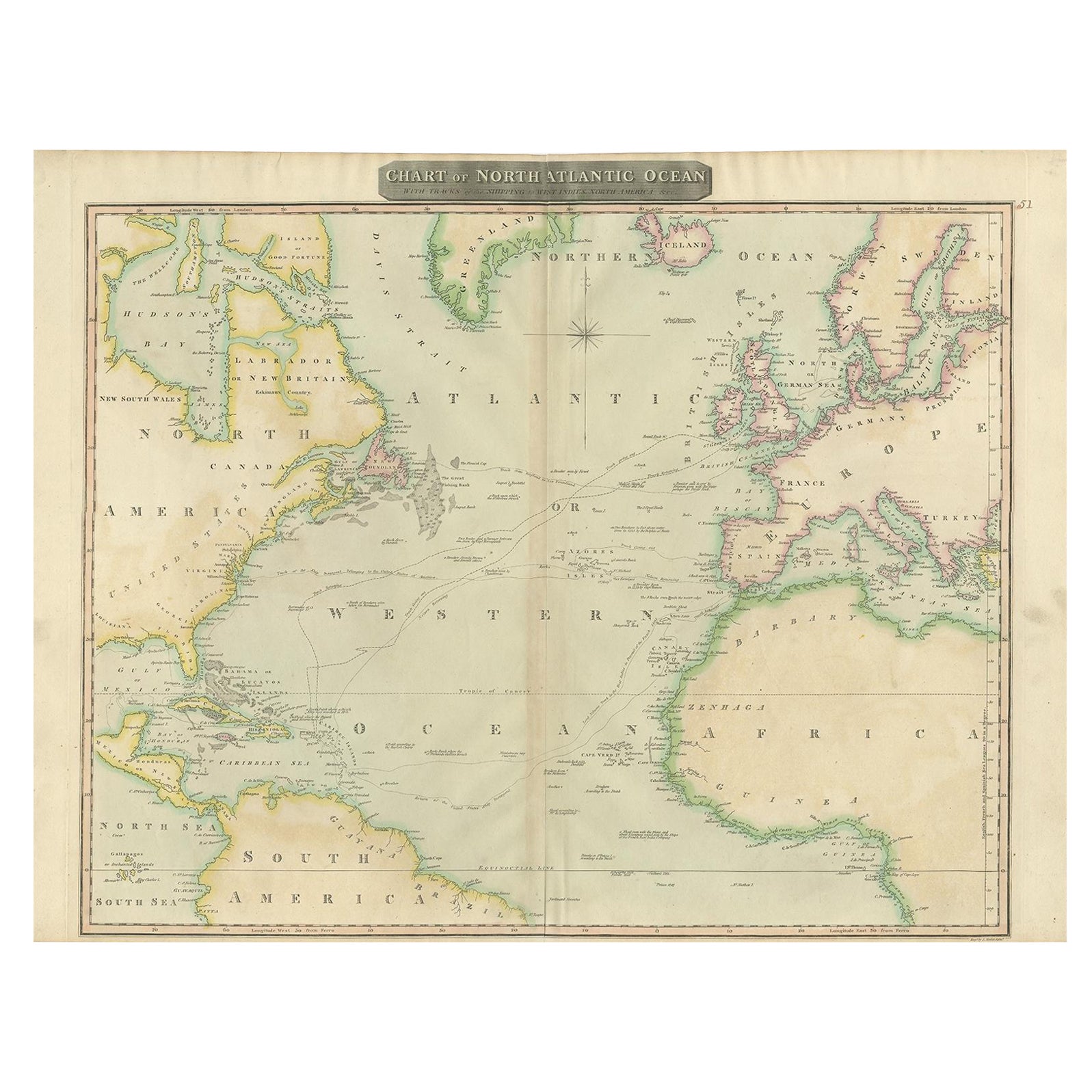
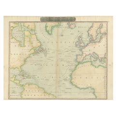
- Interesting Map of the Atlantic Showing Nelson's and Trade Routes, 1817By John ThomsonLocated in Langweer, NLAntique map titled 'Chart of the North Atlantic Ocean with Tracks of the Shipping to West Indies, North America, &cc'. Large map of the Atlantic, showing the tracks of the ships trad...Category
Antique 19th Century Maps
MaterialsPaper
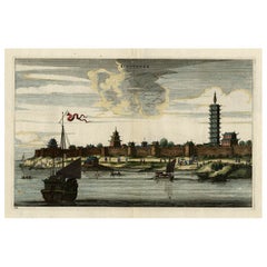
- Original Antique Print of the Chinese City of Kinnungam with its Ramparts, 1665Located in Langweer, NLAntique print, titled: 'Kinnungam' View of the Chinese city of Kinnungam with its ramparts. Also depicted are ships and a pagoda can be seen as well. ...Category
Antique 1660s Maps
MaterialsPaper
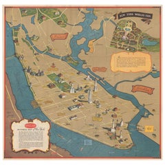
- Pictorial Vintage Map of New York City Showing Numerous Landmarks, 1939Located in Langweer, NLThis pictorial souvenir map focuses on New York City and the site of the 1939 World's Fair. It was drawn by graphic artist George Annand and published by Sinclair Oil...Category
Vintage 1930s Maps
MaterialsPaper
- Antique Print of the City of Edam, Famous for its Dutch Cheeses, 1858Located in Langweer, NLAntique print titled 'Edam, van den Purmerringdyk gezien'. View of the city of Edam, the Netherlands. This print originates from 'Het koningrijk der Nederlanden voorgesteld in eene r...Category
Antique 19th Century Prints
MaterialsPaper
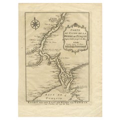
- Antique Map of the Tunquin River and Bay to Cacho, the Capital City, Siam, 1758Located in Langweer, NLAntique map titled ‘Kaart van den Loop der Rivier van Tonkin van Cacho tot aan de Zee / Carte du Cours de la Riviere de Tunquin Depuis Cacho jusqu'à la Mer J. v. Schley direx.’ Detailed map of the Tunquin River and Bay, extending north to Cacho, the capital...Category
Antique 18th Century Maps
MaterialsPaper
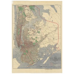
- Antique Map of the Passenger Transportation Systems of New York, 1901Located in Langweer, NLAntique map titled 'Map of New York City except Richmond Borough showing Passenger Transportation Systems'. Map of New York City showing passenger...Category
20th Century Maps
MaterialsPaper
You May Also Like
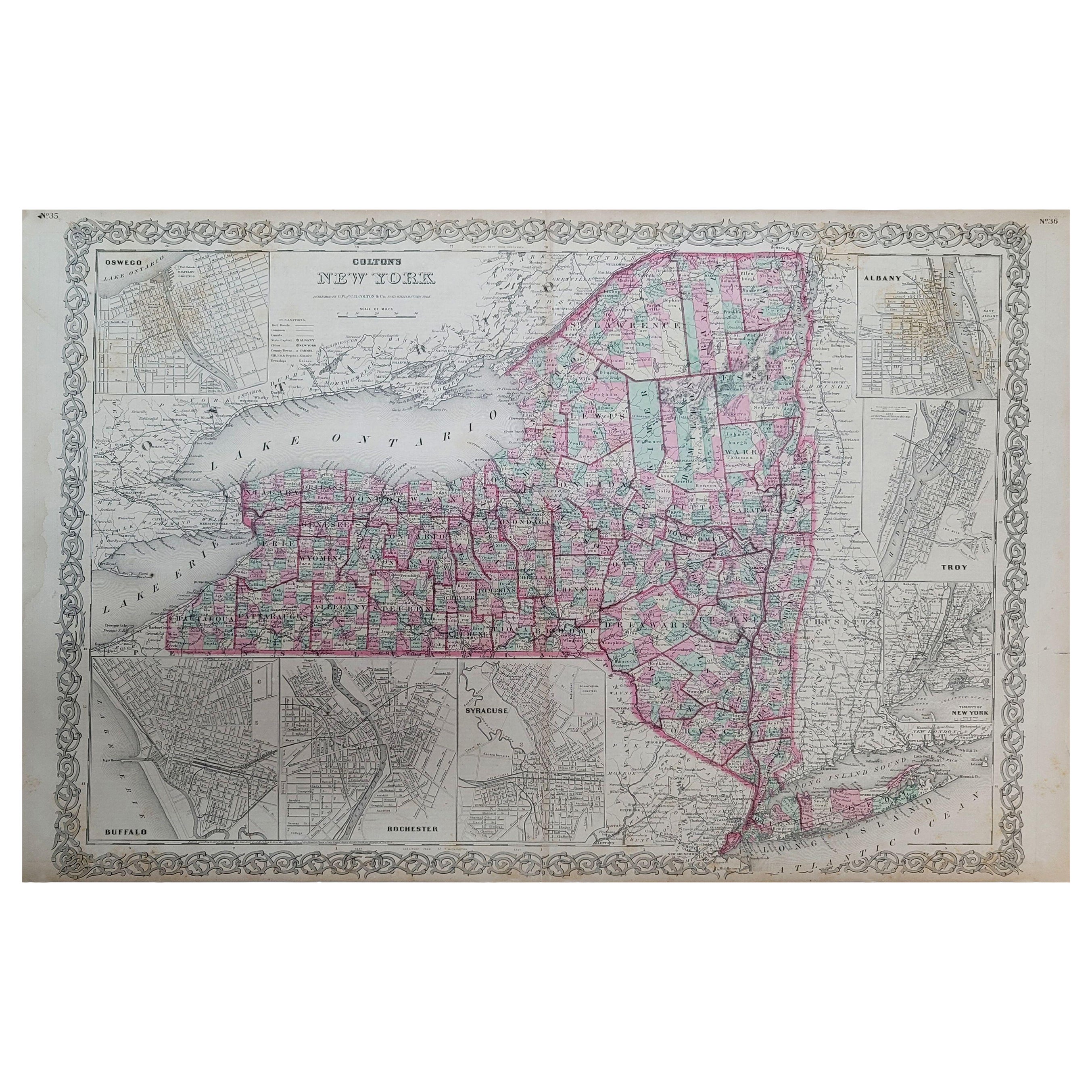
- 1858 Colton's Map of New York, Ric.B011Located in Norton, MAAn 1858 Colton's map of New York Ric.b011 Colton’s New York, 1858 - A large original color engraved and very detailed map of the state of New York,...Category
Antique 19th Century Unknown Maps
MaterialsPaper
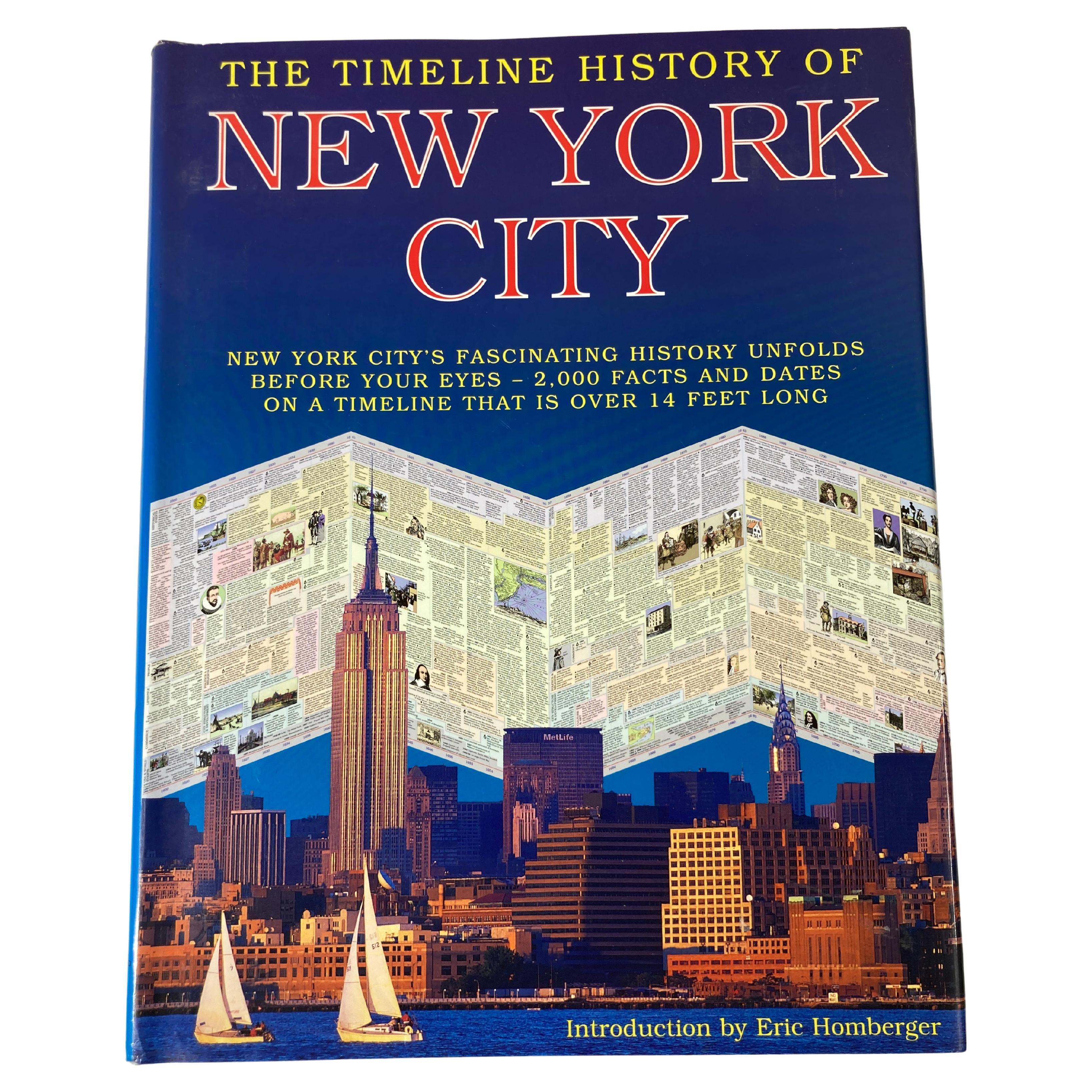
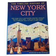
- The Timeline History of New York City BookLocated in North Hollywood, CAThe Timeline History of New York City Book Playne Books Ltd; Worth Press Ltd; Hardcover book. A hands-on presentation of New York's history feat...Category
21st Century and Contemporary American Expressionist Books
MaterialsPaper
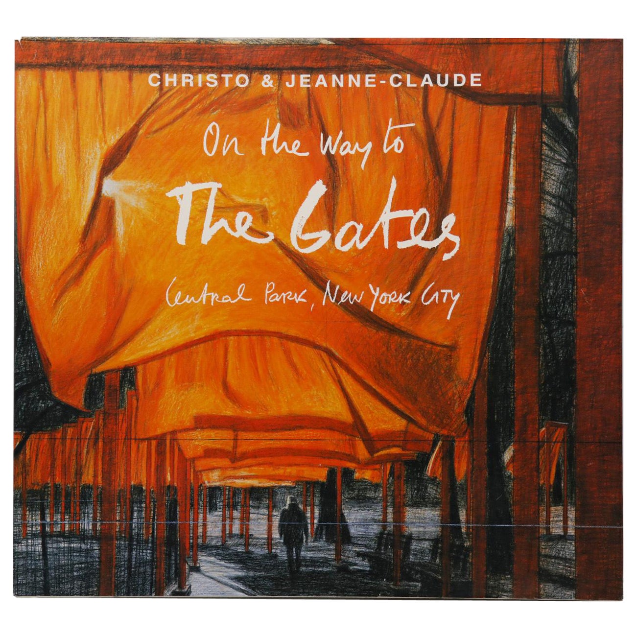
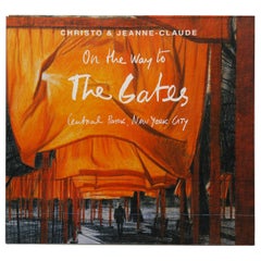
- Christo & Jeanne-Claude, on the Way to the Gates, Central Park, New York CityLocated in Bradenton, FLChristo and Jeanne-Claude, On the Way to the Gates, Central Park, New York City. Book by Jonathan Fineberg with photographs by Wolfgang Volz. Published in conjunction with a major ex...Category
21st Century and Contemporary Books
MaterialsPaper
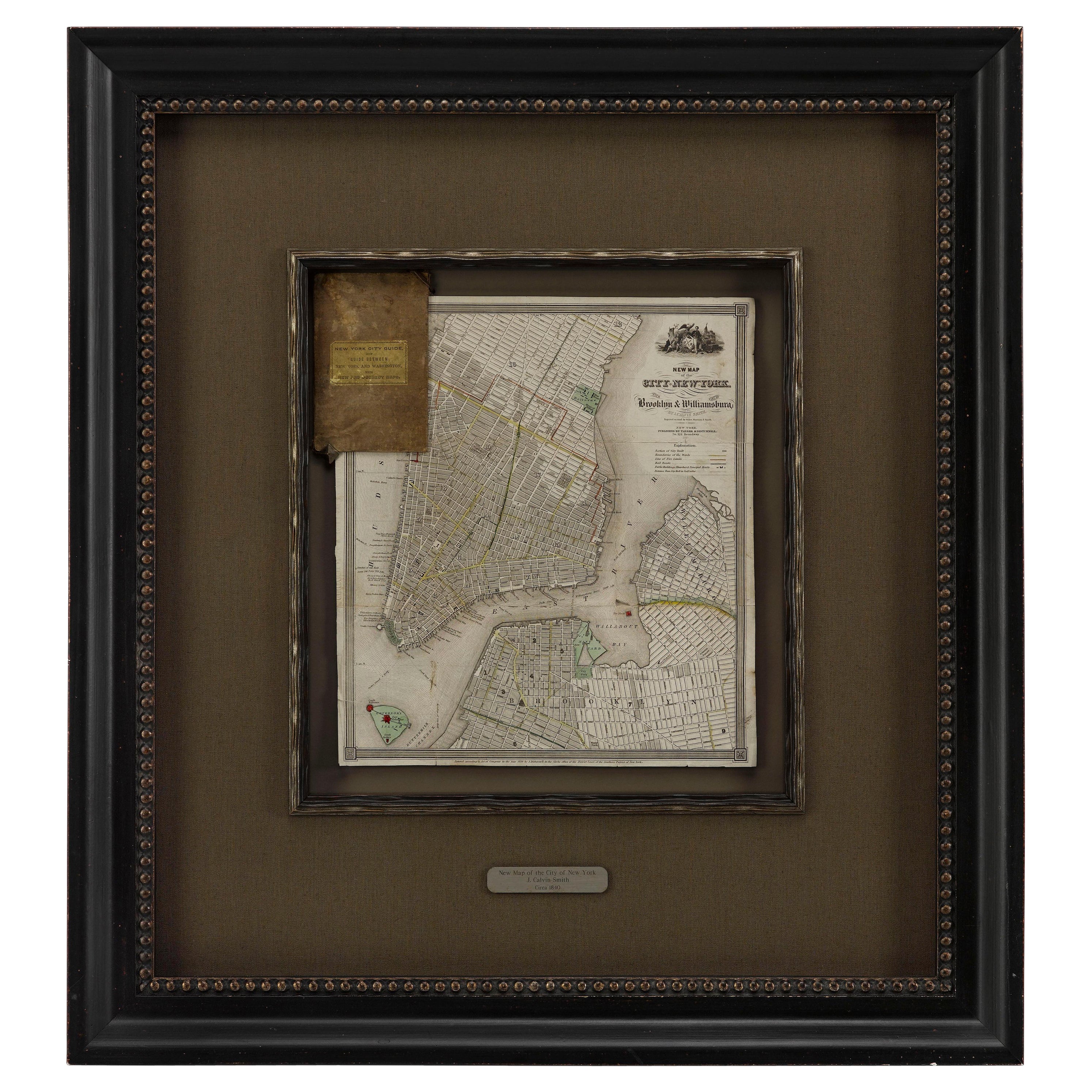
- 1840 "New Map of the City of New York With Part of Brooklyn & Williamsburg"Located in Colorado Springs, COPresented is a hand-colored, engraved folding map titled "New Map of the City of New York With Part of Brooklyn & Williamsburg" by J. Calvin Smith. The map was issued bound in the bo...Category
Antique 1840s American Maps
MaterialsPaper
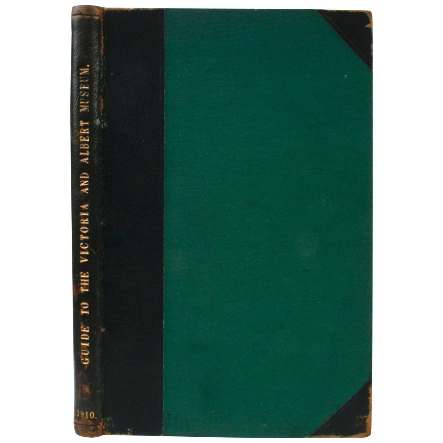
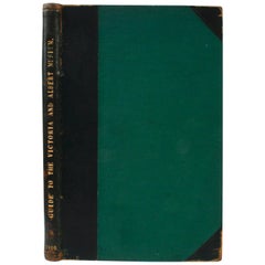
- Guide to The Victoria and Albert Museum, 1910Located in valatie, NYGuide to The Victoria and Albert Museum. London: His Majesty's Stationery Office, 1910. Moroccan leather and green cloth hardcover with gilt lettering and no dust jacket as issued. 62 pp. An antique guide to the Victoria and Albert Museum in South Kensington, England. The guide includes the museum's hours, a list of rooms and galleries. Departments include Architecture and Sculpture, Ceramics, Glass, and Enamels, Engraving, Illustration, and Design, Library and Book Production, Metal Work, Paintings, Textiles, Woodwork, Furniture, and Leather. With 30+ illustrations in black and white with four fold-out floor plan maps in color. The binding is labeled and by Jas. Truscott & Sons, Book Binders...Category
Early 20th Century English Books
MaterialsPaper
- Antique Map of American Cities, Vignette of New York City, circa 1920Located in St Annes, LancashireGreat maps of American Cities Unframed Original color By John Bartholomew and Co. Edinburgh Geographical Institute Published, circa 1920Category
Vintage 1920s British Maps
MaterialsPaper


Recently Viewed
View AllMore Ways To Browse
New York City Used Furniture
Used Furniture In New York City
New York City Mid Century Modern Furniture
Antique Explorer
Antique Furniture New York City
Antique Church Collectibles
Antique New Testament
Map Stand
Crystal Palace Antique
Antique T Square
Small Book Stand
Antique Windows London
Antique Nelson
The Broadway Furniture
Antique Church Window
Antique Church Windows
Antique Map New York
Antique Maps New York