Travel Maps
4
to
43
659
420
550
456
341
183
145
132
113
89
77
77
68
52
37
35
29
24
23
20
17
14
13
12
12
10
10
9
9
8
8
7
6
6
6
5
4
4
4
3
2
2
2
1
1
1
1
1
1
1
1
1
1
65
51
42
42
27
Sort By
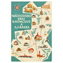
Original Vintage Pictorial Travel Map Nachod Region Czechoslovakia Czech Design
Located in London, GB
Original vintage pictorial travel map Nachod Region B. Nemcove and A. Jiraska invite you to visit
Category
Vintage 1960s Czech Posters
Materials
Paper
H 33.08 in W 22.45 in D 0.04 in
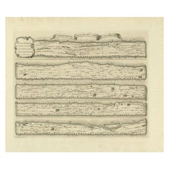
Antique Map Made After a Roman Papyrus Travel Map, Known as Peutinger Map, 1773
Located in Langweer, NL
Old Dutch engraving with title: 'Romeinsche Reis Kaart van K. Peutinger'.
Rare antique map based
Category
Antique 18th Century Maps
Materials
Paper
H 15.56 in W 18.51 in D 0 in
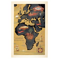
Original Vintage Poster Sabena Belgian Airlines To Europe Asia Africa Travel Map
Located in London, GB
Original vintage pictorial travel map poster advertising Sabena Belgian Airlines flights to Europe
Category
Vintage 1950s Belgian Posters
Materials
Paper
H 39.38 in W 25.6 in D 0.04 in
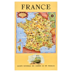
Original Vintage Rail Travel Map Poster France Map SNCF National French Railway
Located in London, GB
Original vintage rail travel map poster - France Societe Nationale des Chemins de Fer Francais
Category
Vintage 1950s French Posters
Materials
Paper
H 39.38 in W 24.41 in D 0.04 in
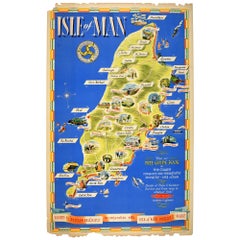
Original Vintage Train Travel Map Poster Isle Of Man British Railways UK Manx
Located in London, GB
Original vintage travel map poster for the Isle of Man issued by British Railways in conjunction
Category
Vintage 1950s British Posters
Materials
Paper
H 40.16 in W 24.81 in D 0.04 in
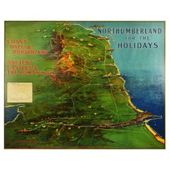
Original Antique Poster Northumberland Holidays Rail Travel Map Golf Roman Wall
By Frank Henry Mason
Located in London, GB
Original antique train travel poster issued by NER North Eastern Railway - Northumberland for the
Category
Vintage 1920s British Posters
Materials
Paper
H 39.97 in W 49.81 in D 0.04 in
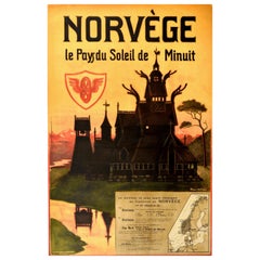
Original Antique Poster Norvege Norway Midnight Sun Stavkirke Church Travel Map
Located in London, GB
and the building reflected in the calm water next to a route map marking travel over the Atlantic
Category
Antique 1610s Norwegian Posters
Materials
Paper
H 38.98 in W 25.6 in D 0.04 in
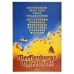
Original Vintage Poster Mecklenburg Germany Baltic Sea Beach Resorts Travel Map
Located in London, GB
Original vintage travel poster promoting Mecklenburg Baltic seaside resorts - Boltenhagel, Jnsel
Category
Vintage 1930s German Art Deco Posters
Materials
Paper
H 46.86 in W 33.08 in D 0.04 in
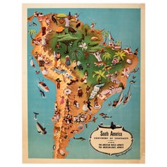
Original Vintage Pan Am Travel Map Poster South America Continent Of Contrasts
Located in London, GB
Original vintage Pan Am travel advertising map poster - South America Continent of Contrasts served
Category
Vintage 1940s American Posters
Materials
Paper
H 14.57 in W 11.42 in D 0.04 in
Original Vintage Poster East Coast England LNER Railway Travel Map Sun Sport Art
Located in London, GB
Original vintage LNER travel poster issued by the London and North Eastern Railway, meet the sun
Category
Vintage 1930s British Posters
Materials
Paper
H 40.16 in W 25.2 in D 0.04 in
Antique Map Travel Children of Israel by Keur, 1748
Located in Langweer, NL
Antique biblical map titled 'Perigrinatie ofte veertigh-Iarige Reyse der Kinderen Israels uyt
Category
Antique Mid-18th Century Dutch Maps
Materials
Paper
1899 Poole Brothers Antique Railroad Map of the Illinois Central Railroad
Located in Colorado Springs, CO
travel maps.
In 1868, George Amos Poole along with his uncle William H. Rand and Andrew McNally formed
Category
Antique 1890s American Maps
Materials
Paper
Original Vintage Travel Poster Eastern Bohemia Vychodni Cechy Map Czechoslovakia
Located in London, GB
Original vintage travel map for Eastern Bohemia / Vychodni Cechy featuring route lines through the
Category
Vintage 1960s Czech Posters
Materials
Paper
H 25.6 in W 37.41 in D 0.04 in
Colourful Old Map of the Austrian Empire, with an Inset Map of Vienna, 1846
Located in Langweer, NL
geography: maps, travel guides, textbooks, and more.
Condition: Good, original/contemporary hand
Category
Antique 1840s Maps
Materials
Paper
H 13.78 in W 17.13 in D 0 in
Decorative Antique Map of Germany, 1846
Located in Langweer, NL
, became owner in 1860. Their publications covered all genres of geography: maps, travel guides, textbooks
Category
Antique 1840s Maps
Materials
Paper
Colourful Antique Map of Switzerland, 1846
Located in Langweer, NL
, became owner in 1860. Their publications covered all genres of geography: maps, travel guides, textbooks
Category
Antique 1840s Maps
Materials
Paper
Old Map of Spain and Portugal, with an Inset Map of the Region of Madrid, 1846
Located in Langweer, NL
. Their publications covered all genres of geography: maps, travel guides, textbooks, and more.
Category
Antique 1840s Maps
Materials
Paper
H 13.78 in W 17.13 in D 0 in
Antique Map of Britain in Roman Times
Located in Langweer, NL
Antique map titled 'Britannia Romana collected from Ptolemy (..)'. Map of Britain in Roman times
Category
Antique Early 19th Century Maps
Materials
Paper
Antique Map of Old European Russia, 1846
Located in Langweer, NL
, became owner in 1860. Their publications covered all genres of geography: maps, travel guides, textbooks
Category
Antique 19th Century Maps
Materials
Paper
Original Antique Map of The Austrian Empire, 1882
Located in Langweer, NL
Step into the past with an original Antique Map of The Austrian Empire from the esteemed
Category
Antique 1880s Maps
Materials
Paper
Old Colourful Map of Sweden and Norway, 1846
Located in Langweer, NL
Mitchell, became owner in 1860. Their publications covered all genres of geography: maps, travel guides
Category
Antique 1840s Maps
Materials
Paper
Antique Map of Guadelupe in the Caribbean, 1759
By Jacques-Nicolas Bellin
Located in Langweer, NL
Antique map titled 'Carte De L'Isle De La Guadeloupe'. Detailed map of Guadalupe, Mari-Galante and
Category
Antique Mid-18th Century French Maps
Materials
Paper
Antique Map of Austria by Ortelius, c.1612
Located in Langweer, NL
Antique map titled 'Austriae Descrip. per Wolfgangum Lazium' Original antique map of Austria
Category
Antique 17th Century Maps
Materials
Paper
Decorative Antique Map of Eastern Canada, Published in 1882
Located in Langweer, NL
This is a historical map from the 1882 Blackie Atlas, focused on eastern Canada and the maritime
Category
Antique 1880s Maps
Materials
Paper
Free Shipping
H 14.97 in W 22.45 in D 0 in
Antique Map of The German Empire (West Sheet), 1882
Located in Langweer, NL
dedication.
More than a mere map, it's a time-traveling companion eager to grace your home or office walls
Category
Antique 1880s Maps
Materials
Paper
Old Colourful Decorative Map of Turkey in Europe, 1846
Located in Langweer, NL
Mitchell, became owner in 1860. Their publications covered all genres of geography: maps, travel guides
Category
Antique 1840s Maps
Materials
Paper
Old Antique Colourful Decorative Map of Northern Italy, 1846
Located in Langweer, NL
. Augustus Mitchell, became owner in 1860. Their publications covered all genres of geography: maps, travel
Category
Antique 1840s Maps
Materials
Paper
Antique Nicely Colored Map of Holland and Belgium, 1846
Located in Langweer, NL
Mitchell, became owner in 1860. Their publications covered all genres of geography: maps, travel guides
Category
Antique 19th Century Maps
Materials
Paper
Antique Map of Spain and Portugal by Mitchell, 1846
Located in Langweer, NL
covered all genres of geography: maps, travel guides, textbooks, and more.
Artist: Samuel Augustus
Category
Antique 19th Century Maps
Materials
Paper
Antique Map of the Kingdom of Tunisia, Africa, 1773
Located in Langweer, NL
Antique map titled 'Kaart van het Koningryk van Tunis'. Old map of the Kingdom of Tunisia
Category
Antique 18th Century Maps
Materials
Paper
Antique Map of the Holy Land by Keur, 1748
Located in Langweer, NL
Antique biblical map titled 'Perigrinatie ofte veertigh-Iarige Reyse der Kinderen Israels uyt
Category
Antique 18th Century Maps
Materials
Paper
Antique Map of Denmark, Original and Decorative, c.1846
Located in Langweer, NL
. Their publications covered all genres of geography: maps, travel guides, textbooks, and more
Category
Antique 19th Century Maps
Materials
Paper
Antique Map of Sweden and Norway by Mitchell, 1846
Located in Langweer, NL
, became owner in 1860. Their publications covered all genres of geography: maps, travel guides, textbooks
Category
Antique 19th Century Maps
Materials
Paper
Antique Map of Asia Showing Its Political Divisions, 1874
Located in Langweer, NL
Travel between London & India, China & Japan & c'. This map covers from the Arabian Peninsula and Turkey
Category
Antique 19th Century Maps
Materials
Paper
Antique Map of Japan by J.N. Bellin, 1752
Located in Langweer, NL
Bellin's wonderfully detailed map of Japan from the atlas of Prevost d'Exiles' influential
Category
Antique Mid-18th Century Maps
Materials
Paper
Antique Map of Russia in Europe by Tallis, '1851'
Located in Langweer, NL
Antique map titled 'Russia in Europe'. Map of European Russia. Showing vignettes of the Neoskoi
Category
Antique Mid-19th Century Maps
Materials
Paper
Antique Map of North Africa by Ortelius, c.1600
Located in Langweer, NL
Antique map titled 'Barbariae et Biledulgerid nova descriptio'.
Old map of coastal North Africa
Category
Antique 17th Century Maps
Materials
Paper
Rare Antique Map of the Moghul Empire, ca.1725
Located in Langweer, NL
Antique map titled 'Oost-Indize Voyagie door William Hawkins van Suratte gedaan na 't Hof van den
Category
Antique 1720s Maps
Materials
Paper
Antique Map of Turkmenistan, Uzbekistan, Tajikistan and Kyrgyzstan, 1749
Located in Langweer, NL
Antique map titled ‘Carte de la Petite Bukharie et Pays Voisins – Tirée des Auteurs Anglois pour
Category
Antique 18th Century Maps
Materials
Paper
H 10.32 in W 14.26 in D 0 in
Antique 19th Century Map of China by Blackie & Son, 1882
Located in Langweer, NL
This map is an 1882 Blackie & Son map of China. The title "CHINA." is prominently displayed at the
Category
Antique 1880s Maps
Materials
Paper
1866 Ensign & Bridgman's Rail Road Map of the United States
Located in Colorado Springs, CO
, where early American rail travel first flourished.
CONDITION:
Engraved map. Hand coloring to outlines
Category
Antique 1860s American Late Victorian Maps
Materials
Paper
Original Antique Coloured Map of Western Africa, Published in 1882
Located in Langweer, NL
This is a map of Western Africa from the 1882 Blackie & Son atlas. The map details the West African
Category
Antique 1880s Maps
Materials
Paper
Free Shipping
H 14.97 in W 22.45 in D 0 in
Antique Map of The United States of North America, 1882
Located in Langweer, NL
This is a historical map titled "The United States of North America, Central Part" from the 1882
Category
Antique 1880s Maps
Materials
Paper
Antique Map of Manchuria and the Northeast Portion of Tartary
Located in Langweer, NL
Antique map titled 'Carte de la Tartarie Orientale (..)'. Detailed map of Manchuria and the
Category
Antique Mid-18th Century Maps
Materials
Paper
Antique Map of Edom, an Ancient Kingdom in Transjordan, 1773
Located in Langweer, NL
Antique print titled 'Idumea, of thet Land der Philistynen'. Old map of Edom, an ancient kingdom in
Category
Antique 18th Century Maps
Materials
Paper
Decorative Original Antique Map of Greece by Ortelius, c.1609
Located in Langweer, NL
Antique map titled 'Graeciae Universae secundum Hodiernum situm Neoterica descriptio'.
Decorative
Category
Antique 17th Century Maps
Materials
Paper
Old Dutch Map of Part of Syria and Phoenicia, 1773
Located in Langweer, NL
Antique print titled 'Gedeelte van Syriën en Phenicië'.
Old map of part of Syria and Phoenicia
Category
Antique 1770s Maps
Materials
Paper
Antique Map of the Banda Islands by Commelin, 1646
Located in Langweer, NL
with a Spanish-Portuguese fleet. This prompted him to retire from exploration and travel. He later
Category
Antique 17th Century Maps
Materials
Paper
Antique Map of Eastern Siberia Extending to Kamtchatka, Russia, 1764
By Jacques-Nicolas Bellin
Located in Langweer, NL
Antique map titled 'Suite De La Carte De La Siberie Et le Pays de Kamtchatka'. Detailed map the
Category
Antique 18th Century Maps
Materials
Paper
Map of Independent Tartary with Vignettes of the Region's Culture, 1851
Located in Langweer, NL
The map of Independent Tartary is part of the collection by John Tallis & Company, which were
Category
Antique 1850s Maps
Materials
Paper
No Reserve
H 10.71 in W 14.26 in D 0 in
Decorative Original Antique Map of Valencia in Southern Spain, circa 1601
Located in Langweer, NL
This is an original antique map titled 'Valentiae Regni olim Contestanorum Si Ptolemaeo
Category
Antique Early 17th Century Maps
Materials
Paper
No Reserve
H 17.52 in W 22.45 in D 0.02 in
Antique Map of Saxon England according to the Anglo-Saxon Chronicle
Located in Langweer, NL
Antique map titled 'Saxon England According to the Saxon Chronicle'. Map of Saxon England based
Category
Antique Early 19th Century Maps
Materials
Paper
Large Map of Castile's Southern Realms - Granada, Andalusia, and Murcia, 1652
Located in Langweer, NL
This antique map, titled 'Les Etats de la Couronne de Castille', represents the southern regions of
Category
Antique Mid-17th Century Maps
Materials
Paper
H 17.64 in W 23.75 in D 0.02 in
Antique Map of Germany from an American 19th Century Atlas, 1846
Located in Langweer, NL
. Their publications covered all genres of geography: maps, travel guides, textbooks, and more.
Artist
Category
Antique 19th Century Maps
Materials
Paper
Oriental Realms: A Detailed Map of Persia, Afghanistan, and Beloochistan, 1882
Located in Langweer, NL
This historical map from the 1882 atlas published by Blackie & Son is a comprehensive depiction of
Category
Antique 1880s Maps
Materials
Paper
H 14.97 in W 22.45 in D 0 in
Antique Map of Nova Zembla 'Russia' by J.N. Bellin, 1757
Located in Langweer, NL
cartouche. One of the maps produced by Jacques-Nicolas Bellin for Prevost d'Exiles influential travel book
Category
Antique Mid-18th Century Maps
Materials
Paper
Old Dutch Map of the Region Around the Mediterranean Sea, 1773
Located in Langweer, NL
Antique map titled 'Kaart van een Deel der Middelandsche Zee (..)'.
Old map of the region
Category
Antique 1770s Maps
Materials
Paper
Rare Antique Map of Yam Suph, Egypt and Red Sea, 1773
Located in Langweer, NL
Antique print with two maps titled 'Uittreksel van de Kaart van Egipten en de Roode Zee' and
Category
Antique 18th Century Maps
Materials
Paper
Antique Map of the Coast of Acapulco by Anson, c.1740
Located in Langweer, NL
Antique map titled 'Disposition des Vaisseaux de l'Escadre commandée par Mr. Anson croisant vis à
Category
Antique 18th Century Maps
Materials
Paper
Original Old Map of the Coast of Syria and Phoenicia, 1773
Located in Langweer, NL
Antique map titled 'Kaart van de Zee Kust van Syrië (..)'.
Old map of the coast of Syria and
Category
Antique 1770s Maps
Materials
Paper
- 1
- ...
Get Updated with New Arrivals
Save "Travel Maps", and we’ll notify you when there are new listings in this category.
Travel Maps For Sale on 1stDibs
Find a variety of travel maps available on 1stDibs. Browse a selection of abstract, contemporary or Old Masters versions of these works for sale today — there are 179 abstract, 135 contemporary, 104 modern, 13 Art Deco and 5 Old Masters examples available. There are many variations of these items available, from those made as long ago as the 18th Century to those made as recently as the 21st Century. Adding a colorful piece of art to a room that is mostly decorated in warm neutral tones can yield a welcome change — see the travel maps on 1stDibs that include elements of gray, brown, beige, blue and more. Many versions of these artworks are appealing in their rich colors and composition, but Stephen Walling, Heny Steinberg, (after) Henri Matisse, Henri Matisse and Chelsea Davine produced especially popular works that are worth a look. Each of these unique pieces was handmade with extraordinary care, with artists most often working in paint, paper and synthetic resin paint.
How Much are Travel Maps?
Prices for art of this kind can differ depending upon size, time period and other attributes — travel maps in our inventory begin at $20 and can go as high as $968,768, while the average can fetch as much as $1,873.
More Ways To Browse
Madagascar Poster
Grand Canyon Poster
Wisconsin Map
Map Of Native American Tribes
Maps Cambridge England
Native American Tribes Map
Antique Doors Pakistan
Antique Map Delaware
Antique Maps Michigan
Antique Wisconsin Maps
Canadian Railway Map
Isle Of Man Tt
Vintage French Poster Cognac
Vintage Las Vegas Strip
Vintage St Louis Charm
Wicker Carriage
Bavaria Rose Set
Bo Peep
