River Map Long
2
to
11
164
68
108
88
77
58
54
29
28
21
19
16
15
14
13
8
5
5
5
4
4
4
4
3
3
3
3
3
3
2
2
2
2
2
2
2
2
1
1
1
1
1
1
1
1
1
42
42
19
16
12
Sort By
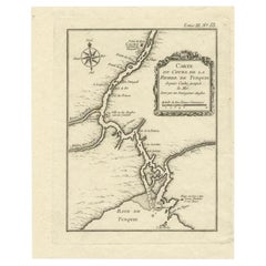
Antique Map of the Tunquin River and Bay, Siam, 1757
Located in Langweer, NL
map of the Tunquin River and Bay, extending north to Cacho, the capital city. Made by Bellin for
Category
Antique 18th Century Maps
Materials
Paper
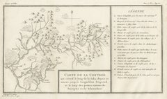
Antique Map of the Region of the Sok River in Russia, 1794
Located in Langweer, NL
Antique map titled 'Carte de la Contrée qui s’étend le long de la Soka, depuis sa source jusquá
Category
Antique 18th Century Maps
Materials
Paper
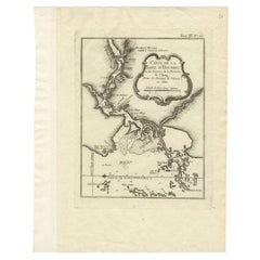
Antique Map of the Mouth of the Chiang River by Bellin, 1764
By Jacques-Nicolas Bellin
Located in Langweer, NL
Province de Fokyen en Chine’. This impressive map or sea chart details the mouth of the Chiang River in the
Category
Antique 18th Century Maps
Materials
Paper
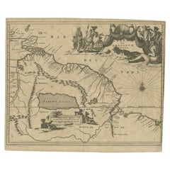
Antique Map of the Amazon River and surroundings by Ogilby, c.1672
Located in Langweer, NL
Antique map titled 'Guiana siue Amazonum Regio'. Antique map depicting the Amazon river and its
Category
Antique 17th Century Maps
Materials
Paper
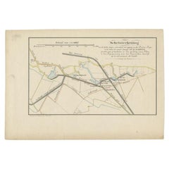
Antique Map of the Breaches of the Oude Rijn River, C.1890
Located in Langweer, NL
(..)'. Map illustrating the breaches of the Oude Rijn river near Babberich. Source unknown, to be determined
Category
Antique 19th Century Maps
Materials
Paper
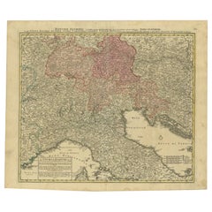
Antique Map of the Danube River and Surroundings by Homann Heirs, c.1730
By Homann Heirs
Located in Langweer, NL
Antique map titled 'Danubii Fluminus (a fontibus prope Doneschingam usq Posonium urbem defignati
Category
Antique 18th Century Maps
Materials
Paper
H 21.15 in W 25.01 in D 0 in
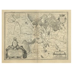
Lovely Antique Map Centered on Sedan and Doncheri and the Meuze River, ca.1650
Located in Langweer, NL
Doncheri', is an antique map centered on Sedan and Doncheri, along with the Meuze River from Charleville
Category
Antique 1650s Maps
Materials
Paper
H 19.69 in W 23.23 in D 0 in
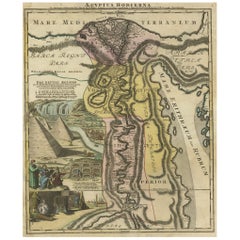
Antique Map of Egypt and the Nile River with Sphinx, Pyramids, Etc, c.1720
Located in Langweer, NL
'. Following the long period of Dutch domination, the Homann family became the most important map publishers in
Category
Antique 18th Century Maps
Materials
Paper
H 24.41 in W 21.07 in D 0 in
Antique Map of Northern China and Far Eastern Russia Around the Amur River, 1754
Located in Langweer, NL
work, which is described as "long, unpleasant, and hard." In addition to numerous maps and charts
Category
Antique 1750s Maps
Materials
Paper
H 10.63 in W 15.16 in D 0 in
Antique Map of America by Vaugondy, 1778
Located in Langweer, NL
being traversed by branches of these long rivers, searching for a watercourse to the Mississippi. Large
Category
Antique Late 18th Century Maps
Materials
Paper
1814 Map of "Russian Empire" Ric.r032
Located in Norton, MA
1814 Map of
"Russian Empire"
Ric.r032
Russian Empire. Description: This is an 1814 John
Category
Antique 19th Century Unknown Maps
Materials
Paper
Antique Map of Sweden by Bowen, 1747
Located in Langweer, NL
Antique map titled 'A New & Accurate Map of Sweden'. This map covers Sweden and Finland (shown as
Category
Antique 18th Century Maps
Materials
Paper
Antique Map of Stavoren by Priorato, 1673
Located in Langweer, NL
Antique map titled 'Staveren'. Original antique map of the city of Stavoren, Friesland, the
Category
Antique 17th Century Maps
Materials
Paper
Antique Map of Stavoren by Priorato, 1673
Located in Langweer, NL
Antique map titled 'Staveren'. Original antique map of the city of Stavoren, Friesland, the
Category
Antique 17th Century Maps
Materials
Paper
Antique Map of Siberia by Bellin, 1754
Located in Langweer, NL
Antique map titled 'Carte de la Siberie'. Detailed map of Siberia, extending from the White Sea and
Category
Antique 18th Century Maps
Materials
Paper
Antique Map of Siberia and Russia, c.1885
Located in Langweer, NL
Antique map titled 'Siberie ou Russie d?Asie'. This is a fine example of J. Migeon's map of Russia
Category
Antique 19th Century Maps
Materials
Paper
Antique Map of Northern India by Bonne, 1780
Located in Langweer, NL
Antique map titled 'Carte de la partie Supérieure de l'Inde (..)'. A fine example of Rigobert Bonne
Category
Antique 18th Century Maps
Materials
Paper
Antique Map of the Rhine centered on Cologne, Germany
Located in Langweer, NL
Rhine river, centered on Cologne, Germany. The Rhine River cuts across this map from south of Bonn
Category
Antique Early 18th Century Maps
Materials
Paper
Striking Antique Map Centered on the Malay Peninsula
By Pieter Van Der Aa
Located in Langweer, NL
Antique map titled 'D'Indiaanze Landschappen Zeen en Eylanden, van Couchin af tot in de Moluccos
Category
Antique Early 18th Century Maps
Materials
Paper
Authentic Old Map of Sumatra, Malaysia and Singapore, 1745
Located in Langweer, NL
and Singapore at the southern tip.
This map lrepresents the geographical features, cities, rivers
Category
Antique 1740s Maps
Materials
Paper
Antique Map of St. Andries 'Heerewaarden' by Orlers, 1615
Located in Langweer, NL
Antique map titled 'Prata Inundata'. This map depicts the area between the Maas and Waal river (The
Category
Antique 17th Century Maps
Materials
Paper
Antique Map of Russia and Siberia by Migeon, 1880
Located in Langweer, NL
Antique map titled 'Sibérie ou Russie d'Asie'. Migeon's map covers the Russian empire in Asia from
Category
Antique 19th Century Maps
Materials
Paper
Antique Map of Northern Brazil by Bonne, c.1780
Located in Langweer, NL
Antique map titled 'Carte de la Partie Septentrionale du Bresil.' Detailed map of the northern
Category
Antique 18th Century Maps
Materials
Paper
Antique Map of Northern Europe by Bonne, c.1780
Located in Langweer, NL
Antique map titled 'Le Nord de L'Europe, Contenant Le Danemark, La Norwege; La Suede et La Laponie
Category
Antique 18th Century Maps
Materials
Paper
Original Antique Coloured Map of Western Africa, Published in 1882
Located in Langweer, NL
This is a map of Western Africa from the 1882 Blackie & Son atlas. The map details the West African
Category
Antique 1880s Maps
Materials
Paper
Free Shipping
H 14.97 in W 22.45 in D 0 in
Antique Map of South America by Scherer, c.1700
By Thomas Kitchin
Located in Langweer, NL
Antique map of part of South America. Two maps on a single sheet, each depicting nearly the same
Category
Antique 18th Century Maps
Materials
Paper
Antique Map of the Coast of China by Bellin, 1752
By Jacques-Nicolas Bellin
Located in Langweer, NL
'. Detailed map of the region from the Cambodia River to Macao, along the coast of China.
Artists and
Category
Antique 18th Century Maps
Materials
Paper
Antique Map of Northern England and Wales by Zatta, 1784
Located in Langweer, NL
Antique map titled 'Parte Settentrionale dell' Inghilterra e del Principato di Galles'. Engraved
Category
Antique 18th Century Maps
Materials
Paper
Antique Map of Southern England and Wales by Zatta, 1784
Located in Langweer, NL
"Antique map titled 'Parte Meridionale dell' Inghilterra e del Pricipato di Galles'. Engraved map
Category
Antique 18th Century Maps
Materials
Paper
Antique Map of the City of Alkmaar by Priorato, 1673
Located in Langweer, NL
Antique map titled 'Alcmaer'. Original map of the city of Alkmaar, the Netherlands. This map
Category
Antique 17th Century Maps
Materials
Paper
1644 Janssonius Original Wine Regions Map: The Ducal and Comital Burgundy
Located in Langweer, NL
, rivers, and important cities, enhancing both the map's utility and its aesthetic appeal.
The elaborate
Category
Antique 1640s Maps
Materials
Paper
Free Shipping
H 19.1 in W 22.84 in D 0 in
Antique Map of the Bay of Chin Chew by Child, 1747
Located in Langweer, NL
part of the coastline from Pu-tay Point, down to the Chin Chew river, with Ko-long-fu, Lakkateyn, Tano
Category
Antique 18th Century Maps
Materials
Paper
Antique Map of the Rhine centered on Cologne, Germany, with outline coloring
Located in Langweer, NL
Rhine river, centered on Cologne, Germany. The Rhine River cuts across this map from south of Bonn
Category
Antique Early 18th Century Maps
Materials
Paper
H 21.58 in W 26.15 in D 0.02 in
Antique Map of the Rhine centered on Cologne, Germany, with original coloring
Located in Langweer, NL
Rhine river, centered on Cologne, Germany. The Rhine River cuts across this map from south of Bonn
Category
Antique Early 18th Century Maps
Materials
Paper
H 20.16 in W 24.14 in D 0.02 in
Original Antique Map of Tartary 'Northern China & Far Eastern Russia', 1757
Located in Langweer, NL
Antique map titled 'Carte de la Tartarie Orientale (..)'.
Original antique map of what is
Category
Antique 1750s Maps
Materials
Paper
H 9.61 in W 13.47 in D 0 in
Cartographic Heritage: The 1901 Map of the Vizcaya Province in Spain
Located in Langweer, NL
coloring to represent elevation changes. The map includes cities, towns, rivers, and railroads, with key
Category
Antique Early 1900s Maps
Materials
Paper
Free Shipping
H 14.77 in W 20.08 in D 0 in
Antique Map of Northern China and Eastern Russia by Bellin, 1757
Located in Langweer, NL
Antique map titled 'Carte de la Tartarie Orientale (..)'. Original antique map of what is present
Category
Antique 18th Century Maps
Materials
Paper
Antique Map of Northern China and Eastern Russia by Bellin, 1754
Located in Langweer, NL
described as "long, unpleasant, and hard." In addition to numerous maps and charts published during his
Category
Antique 18th Century Maps
Materials
Paper
Antique Map of Southern Brazil and Uruguay by Bonne, c.1780
Located in Langweer, NL
"Antique map titled 'Carte de la Partie Meridional du Bresil avec les Possessions Espagnoles
Category
Antique 18th Century Maps
Materials
Paper
Antique Original Map of the City of Deventer, the Netherlands, 1588
Located in Langweer, NL
plan of the Dutch hanseatic city Deventer, on the situated IJssel river. This map originates from Braun
Category
Antique 16th Century Maps
Materials
Paper
Striking Antique Map of Cayenne in French Guyana, South America, ca.1760
Located in Langweer, NL
fortifications of Cayenne, including Fort Ceperou. Throughout, the map notes rivers, important towns, landmarks
Category
Antique 1760s Maps
Materials
Paper
Large Antique Map of Asia including All of Southeast Asia, c.1792
Located in Langweer, NL
Antique map titled 'L' Asie Divisee en ses Empires, Royaumes, et Etats'. Attractive, large map of
Category
Antique 18th Century Maps
Materials
Paper
No Reserve
H 20.67 in W 25.4 in D 0 in
Antique Map of Quinam and the Côn ?ao Islands by Sayer, 1778
Located in Langweer, NL
Antique map titled 'A Chart of a part of the Coast of Cochinchina' and 'Plan of Pulo Condor'. Two
Category
Antique 18th Century Maps
Materials
Paper
Hand-Colored 18th Century Homann Map of the Danube, Italy, Greece, Croatia
By Johann Baptist Homann
Located in Alamo, CA
"Fluviorum in Europa principis Danubii" is a hand colored map of the region about the Danube river
Category
Antique Early 18th Century German Maps
Materials
Paper
H 20 in W 23.88 in D 0.07 in
Antique Map of the Alsace Region of France by Hondius, c.1630
Located in Langweer, NL
France. The map is centered on the course of the Rhine River, from Strasbourg in the north to Basle
Category
Antique 17th Century Maps
Materials
Paper
Regional Map of Germany, inc Hamburg, Luneberg, Hannover, Braunsweig etc, c.1720
Located in Langweer, NL
Antique map titled 'Ducatus Luneburgici et Comitatus Dannebergensis accurata Descriptio.'
This
Category
Antique 1720s Maps
Materials
Paper
H 20.67 in W 24.73 in D 0 in
Detailed Antique Map of Slavonia, the Region in Eastern Croatia, ca.1745
Located in Langweer, NL
Antique map titled 'Tabula Geographica exhibens Regnum Sclavoniae.'
Detailed map of Slavonia
Category
Antique 1740s Maps
Materials
Paper
H 20.95 in W 25.01 in D 0 in
"Africae Accurata", a Hand-Colored 17th Century Map of Africa by Visscher
By Nicolaes Visscher II
Located in Alamo, CA
several long-standing errors, including the origin of the Nile River from two imaginary lakes in southern
Category
Antique Late 17th Century Dutch Maps
Materials
Paper
H 23.75 in W 28.13 in D 0.13 in
Antique Map of the Bay Near Huchou Island by Van Schley, 1758
Located in Langweer, NL
Minjiang and Wulong rivers, located in the Fujian Province, China. While these maps by Van Schley after
Category
Antique 18th Century Maps
Materials
Paper
Map of Sevilla Province, 1901: A Depiction of The Spanish Cultural Heartland
Located in Langweer, NL
The print for sale here depicts a historical map of the province of Sevilla (Seville) from the year
Category
Antique Early 1900s Maps
Materials
Paper
Free Shipping
H 14.77 in W 20.08 in D 0 in
Beautiful Original Antique Map of Antwerp, Belgium by Mapmaker Blaeu, ca.1652
Located in Langweer, NL
Description: Antique map titled 'Antverpia; Gallis Anvers. Vernacule Antwerpen.'
A very nicely
Category
Antique 1650s Maps
Materials
Paper
H 19.1 in W 24.53 in D 0 in
Antique Map of the Harbour of Praia, Santiago Island, Cape Verde, c.1750
Located in Langweer, NL
Antique map titled 'A Draught of ye Harbour of Praya in the Island St. Jago (..)'. Uncommon map
Category
Antique 18th Century Maps
Materials
Paper
Hand Colored 18th Century Homann Map of Austria Including Vienna and the Danube
By Johann Baptist Homann
Located in Alamo, CA
"Archiducatus Austriae inferioris" is a hand colored map of Austria created by Johann Baptist
Category
Antique Early 18th Century German Maps
Materials
Paper
H 20.25 in W 23.63 in D 0.07 in
Antique Map of Walcheren in the Province of Zeeland, the Netherlands, ca.1910
Located in Langweer, NL
Antique map of Walcheren, part of the province of Zeeland, the Netherlands.
Shows the cities of
Category
Vintage 1910s Maps
Materials
Paper
H 7.49 in W 8.08 in D 0 in
Antique Map of Asia and the East Indies and Korea as a Peninsula, ca.1660
Located in Langweer, NL
Antique map titled 'Asiae nova delineatio'. Decorative map of Asia and the East Indies. The map
Category
Antique 17th Century Maps
Materials
Paper
Free Shipping
H 19.69 in W 24.02 in D 0 in
Old Print of Fort James on Kunta Kinteh Island on the Gambia River, Africa, 1746
Located in Langweer, NL
River in 1732, view of Fort James from the north east and a view of Fort James from the NNW. Made by
Category
Antique 1740s Maps
Materials
Paper
H 10.08 in W 7.88 in D 0 in
Charting Eastern Tartary: An 18th-Century Jesuit and English Collaboration, 1757
Located in Langweer, NL
exploration during the 18th century.
3. **River Systems**: The map's particular emphasis on river systems
Category
Antique Mid-18th Century Maps
Materials
Paper
Free Shipping
H 9.34 in W 13.12 in D 0.02 in
La Coruña 1901: A Cartographic View of Galicia's Maritime Province
Located in Langweer, NL
This antique map for sale showcases the province of La Coruña (in Galician, A Coruña), located in
Category
Antique Early 1900s Maps
Materials
Paper
Free Shipping
H 20.08 in W 14.77 in D 0 in
17th Century Topographical Engraving Nantes & St. Malo, France, by Iohan Peeters
Located in New York, NY
The ancient city of Saint Malo in North Western France has long been associated with adventure on
Category
Antique 17th Century Dutch Maps
Materials
Paper
H 12.38 in W 15 in D 0 in
Antique Oarsman's Map of the River Thames, English, Cartography, Published 1912
Located in Hele, Devon, GB
This is an antique copy of The Oarsman's and Angler's Map of the River Thames - New Edition. An
Category
Early 20th Century British Other Books
Materials
Paper
H 6.5 in W 4.34 in D 0.6 in
- 1
Get Updated with New Arrivals
Save "River Map Long", and we’ll notify you when there are new listings in this category.
River Map Long For Sale on 1stDibs
Surely you’ll find the exact river map long you’re seeking on 1stDibs — we’ve got a vast assortment for sale. Find contemporary versions now, or shop for contemporary creations for a more modern example of these cherished works. Making the right choice when shopping for a river map long may mean carefully reviewing examples of this item dating from different eras — you can find an early iteration of this piece from the 18th Century and a newer version made as recently as the 21st Century. If you’re looking to add a river map long to create new energy in an otherwise neutral space in your home, you can find a work on 1stDibs that features elements of gray, blue, beige, purple and more. There have been many interesting river map long examples over the years, but those made by (after) Henri Matisse, Henri Matisse, Don Pollack, Patrick Beaulieu and Chase Langford are often thought to be among the most thought-provoking. Frequently made by artists working in lithograph, paint and oil paint, these artworks are unique and have attracted attention over the years.
How Much is a River Map Long?
The price for a river map long in our collection starts at $69 and tops out at $968,768 with the average selling for $1,451.
More Ways To Browse
Mid19th Century Oil Portraits
Paintings 18 And19 Th Century
Richard Gorman
Robert Madden
21c Penguin
Backwards B And R
Carl Sprinchorn
Cote De Beaune
Map Of Native American Tribes
Mid20th Century Abstract
Native American Tribes Map
Sellers Vancouver Canada
Used Library Card Catalog
Vintage Order Of The Eastern Star
18 Th Century Bird Prints
A C Havel
Canadian Railway Map
Elgin Paris
